
Left: The ice shelf base, Right: Multibeam map showing a smooth and eroded ice topography
From InterestingEngineering by Mrigakshi Dixit
An unmanned submarine conducted a first-of-its-kind survey of the underside of an Antarctic glacier.
Researchers at the University of Gothenburg discovered new indications about future sea level rise using this precise map.
The autonomous underwater vehicle Ran was tasked with exploring the cavity beneath the Dotson Ice Shelf in West Antarctica.
According to the researchers, an ice shelf is a floating platform of glacial ice that extends from the land and is fed by glaciers.
 Sand dune shaped ice structures were discovered on the underside of the Dotson Ice Shef
 (Filip Stedt/University of Gothenburg)
Over 27 days, ran scanned the underside using sonar technology.
Interestingly, the vehicle surveyed over 1,000 kilometers of the Dotson Ice Shelf cavity in West Antarctica, plunging 17 kilometers deep.
Interestingly, the vehicle surveyed over 1,000 kilometers of the Dotson Ice Shelf cavity in West Antarctica, plunging 17 kilometers deep.
“We have previously used satellite data and ice cores to observe how glaciers change over time.
By navigating the submersible into the cavity, we were able to get high-resolution maps of the ice underside.
It’s a bit like seeing the back of the moon,” said Anna Wåhlin, lead author and Professor of Oceanography at the University of Gothenburg.
By navigating the submersible into the cavity, we were able to get high-resolution maps of the ice underside.
It’s a bit like seeing the back of the moon,” said Anna Wåhlin, lead author and Professor of Oceanography at the University of Gothenburg.
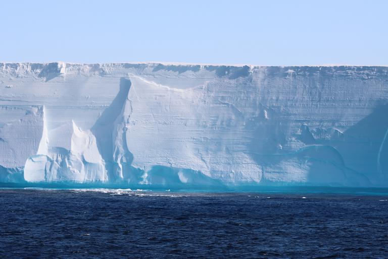
The Dotson Ice Shelf in the Antarctic.
(Photo: Anna Wåhlin)
(Photo: Anna Wåhlin)

(A and B) Reference Elevation Model of Antarctica mosaic of DIS with the regions and features discussed in the text labeled: basal channel features (dashed lines), ~2000 Landsat-derived grounding line [thick black lines; ], and 1992–2020 Interferometric Synthetic Aperture Radar–derived grounding lines [pink lines; ].
Thin black lines show the AUV mission paths, and red squares in (B) show the location of the zoomed-in areas in (C) to (F).
Blue shades show bathymetry [color bar in (A)]. [(C) to (F)] Zoomed-in areas showing the ice surface elevation at the survey areas, referenced to the WGS84 ellipsoid.
The yellow star in (E) shows the location of the hot water drilling site. (G) Study area location.

Upward-looking multibeam sonar maps of the underside of DIS.
(A and B) One-meter multibeam grids showing ice base topography in the East region (E1 and C2). Color bars show the depth of the ice base.
(A and B) One-meter multibeam grids showing ice base topography in the East region (E1 and C2). Color bars show the depth of the ice base.
In (B), red crosses depict locations of channel-like features, and yellow star shows the location of the hot water drilling site.
Profiles of the ice shelf base illustrate (C) channels and (D) terraces, with distance and depth in meters, which are also highlighted by slope derivations of the (E to G) ice base surface.
Black bars in (A) and (B) are 1 km.
Maps are projected in Universal Transverse Mercator zone 13S (WGS84 Datum).
The vehicle’s map revealed previously unseen tear drop-like patterns on the base of the ice shelf, which contrasted with the predicted smooth surface.
Unexpectedly, the glacier’s base displayed a complex terrain of peaks, valleys, plateau-like structures, and sand-dune-like formations.
As per Live Science, the longest of these shapes measures 1,300 feet (400 m).
These enigmatic shapes are believed to be the result of a water flow influenced by Earth’s rotation (Coriolis effect).
As water flows across the ice, it creates swirling currents that carve out these unique formations.
“The mapping has given us a lot of new data that we need to look at more closely.
It is clear that many previous assumptions about melting of glacier undersides are falling short.
Current models cannot explain the complex patterns we see.
But with this method, we have a better chance of finding the answers,” explained Wåhlin in the press release.
Glacier melt
The Dotson Ice Shelf is a large 50-kilometer-wide section of floating ice in West Antarctica. This region is experiencing significant glacial instability, with icebergs calving at an alarming rate.
Experts predict that the potential collapse of the entire ice sheet could lead to a devastating global sea level increase of approximately 3.4 meters or 11 feet.
Earlier studies have demonstrated that the ice shelf is undergoing a steady process of erosion at its edges.
This erosion is driven by warm ocean waters penetrating its underside, which causes the ice shelf to become detached from the land, and ultimately collapse.
As anticipated, the survey confirmed that the glacier melts most rapidly where underwater currents erode its base and fractures accelerate melting.
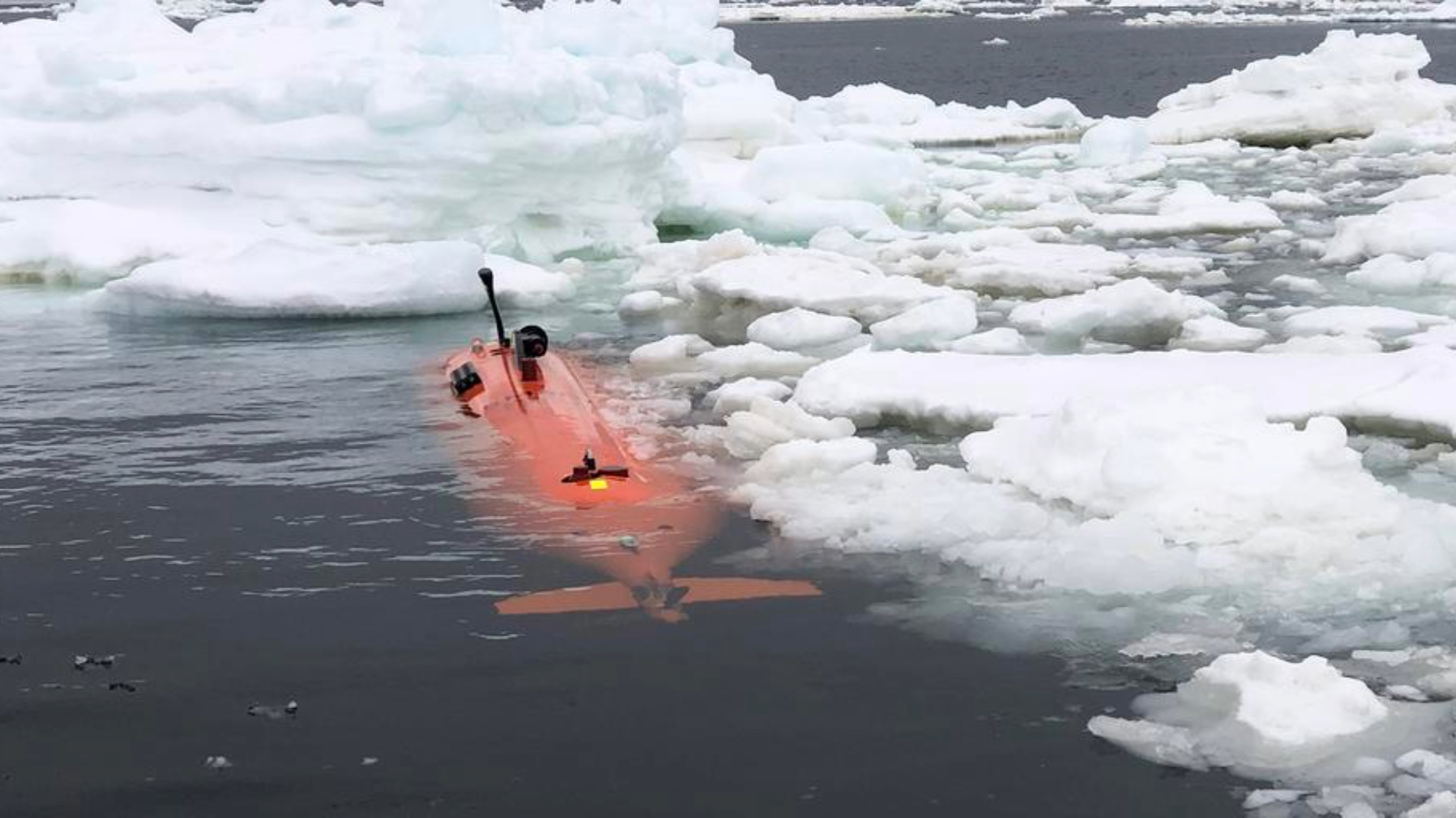
The expedition was carried out in regions of drifting ice in West Antarctica in 2022.
On the return visit in 2024, Ran disappeared without a trace under the ice.
(Filip Stedt)
On the return visit in 2024, Ran disappeared without a trace under the ice.
(Filip Stedt)

Sketch showing the processes discussed in the paper.
Note that the vertical scale is exaggerated.
Note that the vertical scale is exaggerated.
We’ve had hints of how complex ice-shelf bases are but Ran uncovered a more extensive and complete picture than ever before.
The imagery from the base of Dotson Ice shelf helps us interpret and calibrate what we see from the satellites,” said Karen Alley, a glaciologist from the University of Manitoba and co-author of this multidisciplinary study.
Unfortunately, Ran disappeared after diving beneath the Dotson Ice Shelf, but the gathered data proved to be highly significant.
The team plans to return with a new submarine to further explore the unknown depths beneath the ice shelf.
Links :
No comments:
Post a Comment