
From BNF

The Bibliothèque nationale de France holds such treasures as scientific documents that take us back to the time of great discoveries

Reconstitution du planisphère de la géographie d'al-Idrîsî
Sicile, 1154. Copie du XIIIe siècle, Maghreb.
Sicile, 1154. Copie du XIIIe siècle, Maghreb.
Arabs take up the work of the Greeks and revive the scientific tradition of cartography.
In the 12th century, the Arab geographer al-Idrîsî draws up a map of the world, bringing together most of the geographic knowledge of his time.
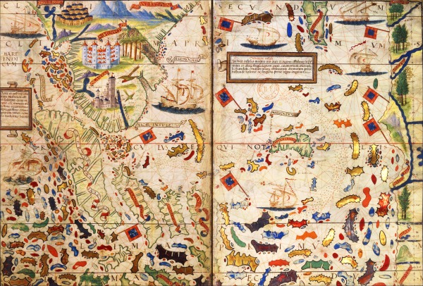
As the most extraordinary pieces, one can find the parchment and often enriched with gold illuminated nautical charts, called ‘portulans charts’ (from the Italian term ‘portolano’, book of nautical instructions).
These maps show the succession of harbours along the coasts; the rhumb lines dotted on the maps correspond to bearings as measured to relative north.
Thanks to this graphic system, navigators could find their way by writing down on the chart the distance they thought they had covered.
Atlas Miller
Carte de l'Insulinde et des Moluques
Carte de l'Insulinde et des Moluques
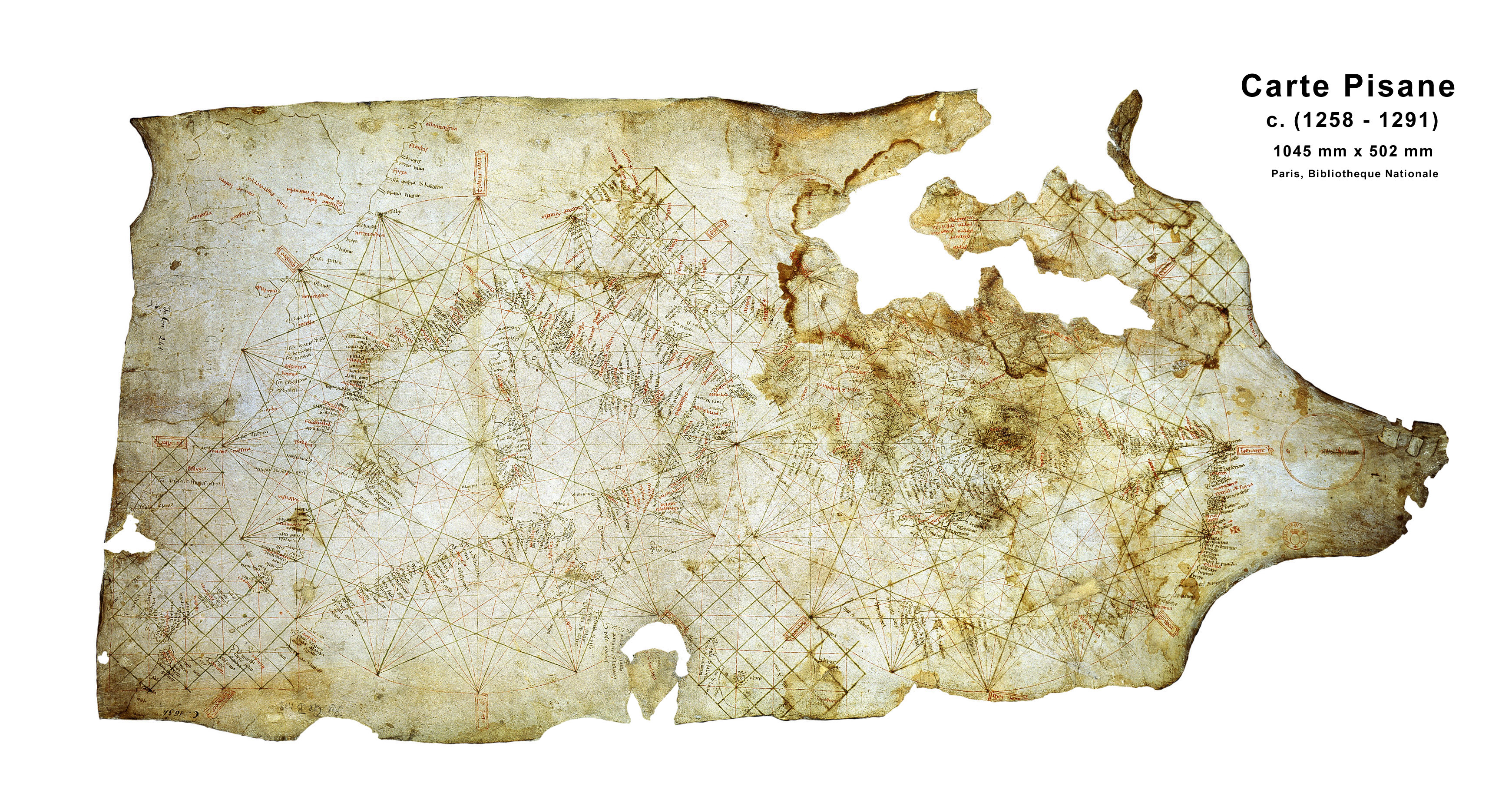
In contrast to the theological image of the world that the globe or map of the world provided, a new cartographic representation, developed as of the 13th century n the context of the expansion of maritime trade.
The oldest portulan chart would date from the late 13th century: it is the famous ‘Carta pisana’, housed at the Department of maps and plans.
Only a few portulans charts among the oldest ones have survived to this day. (ex.: Portolan chart of Guillem Soler (c.1380) / Portolan chart of Gabriel de Vallseca (1447)) : see BNF Gallica catalogue
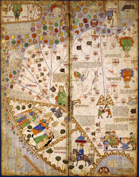
These are the "portulans" which, just as the Catalan Atlas, describe coast and harbour.
Both technical innovations and scientific objects, ‘portulans charts’ also represent the quest for faraway lands
These often impressive polychrome works of art are spectacular; furthermore, they conjure up some sort of exotic universe.
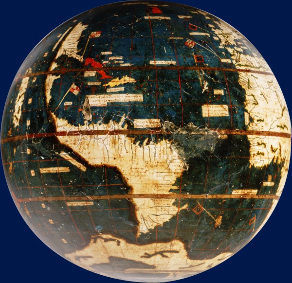
Globe terrestre, dit "Globe vert"
Martin Waldseemüller (1507)
Martin Waldseemüller (1507)
The exhibition presents a selection of 200 main pieces: charts, globes, astronomy tools, objets d’art and ethnographic objects, stuffed animals, drawings, prints, paintings and manuscripts.
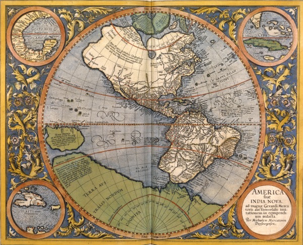
Atlantis pars Altera. Geographia nova totius mundi
Gérard Mercator (1595)
Gérard Mercator (1595)
Research on projection, which allows representing the entire globe on a flat map, increases.
In particular, Mercator’s research, very useful for the sailors, comes to mind.
This Flemish geographer is one of the leading figures of the golden age of Dutch cartography.
These items belong to the BnF’s collections or are exceptional loans from the musée du Quai Branly, musée Guimet, musée du Louvre, Arts et métiers, Mobilier national, musée de la marine, Service historique de la Défense, British Library, Italian and French regional institutions.
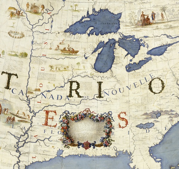
L'Amérique septentrionale
Détail du globe terrestre (1681-1683)
Of both economic and political interest, cartography is important to states, particularly for military reasons.
The large globes of Coronelli, which allow contemplating the world such as it was seen in the 1680s by the Sun-King at the height of his glory, bear witness to the links which connect Prince and cartographer.

Battista Agnese, Atlas nautique
At
the end of the 15th and the beginning of the 16th century, the great
Spanish and Portuguese navigators broaden considerably geographic
knowledge.
America appears for the first time on the world map
Links :
- BNF virtual exhibitions : The history of cartography / The Globes of the Sun King
/ The sea, terror and fascination / Press Release (in French but with many photos)
France24 : L'âge d'or des cartes marines: quand l'Europe découvrait le monde
ReplyDeleteFrance National Library portolan maps available on ArcGIS Online - The world as seen by navigators, explorers and kings
ReplyDeleteYouTube : Littoral, l'âge d'or des cartes marines
ReplyDelete