Wednesday, January 25, 2023

Yesterday and Tomorrow islands (Dioméde islands)


June 2, 2017


June 1, 2017

From NASA by Kathryn Hansen
 
Today’s caption is the answer to our January 2018 puzzler.

Here’s a bit of trivia to challenge your geography knowledge: 
Which country is closest to the continental United States without sharing a land border?

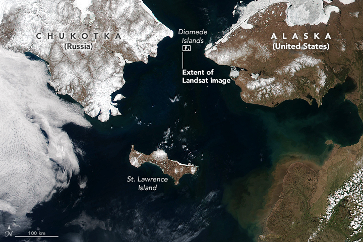
The answer is revealed in the top image, which shows the eastern part of Russia and western part of the United States.
This image was acquired on June 2, 2017, by the Visible Infrared Imaging Radiometer Suite (VIIRS) on the NASA-NOAA Suomi NPP satellite.
At the narrowest part of the Bering Strait, about 82 kilometers (51 miles) is all that separates Cape Dezhnev on the Chukotka Peninsula and Cape Prince of Wales on mainland Alaska.
But Russia’s Big Diomede Island is even closer to mainland Alaska, about 40 kilometers (25 miles) away, making it the closest non-border-sharing country to the continental U.S.
 
Diomede islands with NGA nautical raster charts in the GeoGarage platform
 

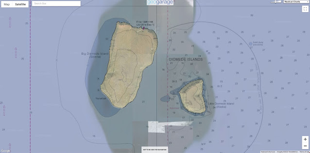
Diomede islands with NOAA nautical raster charts in the GeoGarage platform
 
The distance between the two countries is actually much smaller.

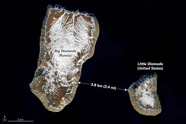
Just 3.8 kilometers (2.4 miles) separate Big Diomede Island (Russia) and Little Diomede Island (U.S.).
The island pair is visible in the detailed image, acquired on June 6, 2017, by the Operational Land Imager (OLI) on Landsat 8.
 
Summer temperatures on the islands average about 40 to 50 degrees Fahrenheit.
Wintertime is even colder, averaging between 6 and 10°F.
Each year, Arctic sea ice extends southward into the strait from the Bering and Chukchi seas.
By June, however, melting usually causes the ice edge to retreat northward, leaving open water that appears black in these images.

The water between the two islands is bisected by the maritime border of the two countries.
The passage was historically nicknamed the “ice curtain,” which had more to do with Cold War tensions than climate.
Today, Little Diomede has a small permanent community—about 115 people according to the 2010 U.S. census.
The town is located on a small beach on the island’s western side, meaning that Russia’s Big Diomede and even the mainland are visible from the homes.
 
RU4OH1S0 ENC Bering Sea- Bering Strait - Diomede Islands - Approaches to Ratmanov Island (1:22,000)
 
US5AK8DM Little Diomede Island
(1:40,000)

Another invisible line runs between the islands and inspired the nicknames “Yesterday” and “Tomorrow” islands.
Big Diomede and Little Diomede sit on opposite sides of the International Date Line.
 
International border and date line
 Big Diomede is almost a day ahead of Little Diomede, but not completely; due to locally defined time zones, Big Diomede is only 21 hours ahead of Little Diomede (20 in summer). 
Diomede Islands: Little Diomede Island or Kruzenstern Island (left) and Big Diomede Island or Ratmanov Island in the Bering Sea. Photo is from the north.
photo : Dave Cohoe

 
As Earth Observatory reader Jim Andersen commented on our blog: “When you look at the Big Diomede Island, you’re looking into the future!”

NASA Earth Observatory images by Joshua Stevens, using Landsat data from the U.S. Geological Survey and VIIRS data from the Suomi National Polar-orbiting Partnership.

Links :

Tuesday, January 24, 2023

After 20 years of service, AIS is about to get a big upgrade


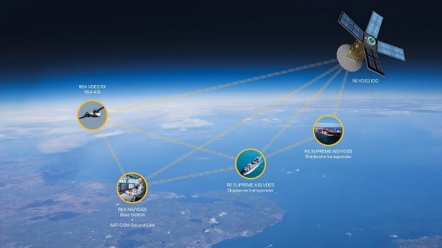
Unlike AIS, VDES has integrated satellite connectivity for effectively unlimited range (Saab)
 

The Automated Identification System (AIS) has served the maritime industry for more than 20 years, and it has revolutionized the way that mariners, regulators and industry stakeholders do business.
AIS makes it easy for watchstanders to identify a target and make passing arrangements, and it gives Vessel Traffic Service (VTS) operators the transparency they need to ensure safety on busy waterways.
Thanks to satellite- and shore-based AIS reception, commodity traders and researchers can study marine traffic patterns for insight into the movements of global commerce.

AIS traffic around Shanghaï (23/01/2023)
 
However, the industry has gotten bigger and busier over the past two decades, and it's time for an update.
In some coastal areas - the Singapore Strait, China's megaports, parts of Japan - there are so many vessels that the performance of AIS has been affected.
As traffic density goes up, the system's range goes down, and the frequency of updates becomes more random.
This has the biggest impact on shoreside observers like VTS operators, according to engineers for leading VDES system developer Saab TransponderTech.

The fix is to update classic AIS with a new digital system, something more robust and capable of handling more bandwidth.
After years of consultation, maritime technology experts and regulators have come up with a solution: VDES (VHF Data Exchange System), a new system which will give operators higher security and reliability.

VDES will operate on additional new frequencies and will use them more efficiently, enabling 32 times as much bandwidth for secure communications and e-navigation.
It will be able to handle higher traffic density and more frequent vessel movement updates, and it is designed to meet the needs of maritime users for the next 20 years.

It also has new features which AIS lacks.
When two ships get close to each other, they will automatically exchange data on their future routes, not just their current positions.
This will increase situational awareness and reduce ambiguity in traffic situations.
Shoreside authorities can use the same data-transfer capabilities to broadcast digital updates, like safety-related text messages and boundary lines for cautionary areas.

VDES is also purpose-built for communication with low earth orbit (LEO) satellite constellations, ensuring genuine over-the-horizon connectivity from the start.
Vessel Traffic Service (VTS) operators will be among the biggest beneficiaries, as satellite functionality will extend the range of reception and enable supervision over a larger area.

Cybersecurity is also enhanced thanks to VDES' ability to send encrypted positions, reducing the chance of spoofing.
Onboard position tampering to disguise the ship's movements - a common technique used by vessel operators for sanctions violations, illegal fishing and smuggling - can be detected and thwarted.
 

Now the next generation of AIS is taking form with VHF Data Exchange System (VDES).
Saab is active in the process of development of the new standard.
VDES greatly enhances the capabilities of AIS, with substantially increased capacity and bandwidth, as well as improved integrity and cyber security.
 
Saab has developed a lineup of dual function AIS and VDES transponders to equip vessels with the next decade's technology, while keeping compatibility with current-generation AIS.
Its R6 Supreme AIS/VDES satellite transponder is already in use with Danish company Sternula, which provides satellite connectivity for VDES and will be trialing the technology with select partners beginning in April.
The Saab R60 base station, intended for stationary VTS applications, exceeds AIS transceiver specifications for sensitivity and can interface directly with Saab's maritime traffic control software platform.

Links :

Monday, January 23, 2023

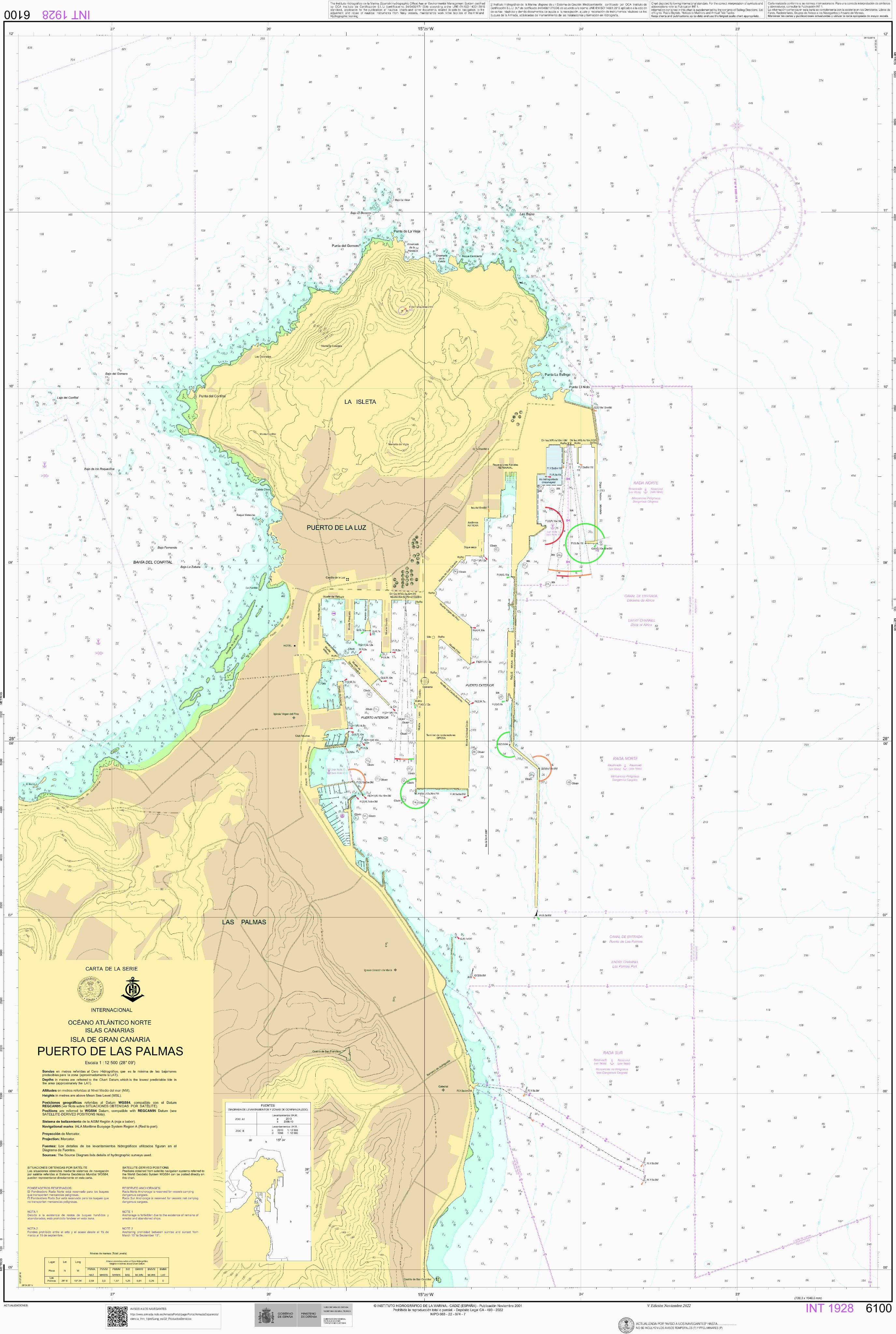
Spain (IHM) layer update in the GeoGarage platform

101 rasterised ENC nautical charts updated
 
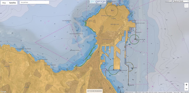
Las Palmas ENC in the GeoGarage platform
 
 Paper map (raster)
El #InstitutoHidrográficoDeLaMarina publica la V edición de la carta 6100 Puerto de LasPalmas, que incluye información de los nuevos canales de acceso y fondeaderos establecidos, así como el nuevo código de los colores de las luces.  
Velamos por la seguridad en la navegación pic.twitter.com/WpjOzDQE54 

Orient Express reveals plans to launch "world's largest sailing ship"


From Dezeen by Tom Ravenscroft

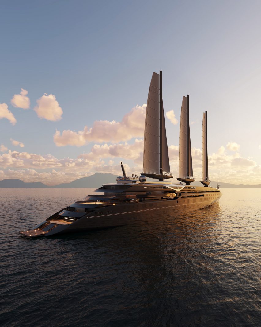
Hotel company Accor has unveiled the 220-meter-long Orient Express Silenseas sailing yacht, which will be designed by architect Maxime d'Angeac and studio Stirling Design International.

Set to be the "world's largest sailing ship", the Orient Express Silenseas will set sail in 2026 as the latest addition to the historic train line's brand.

Designed to be a continuation of the luxury Orient Express trains, the 220-metre-long ship will feature 54 passenger suites that will all be around 70 square metres, along with a large 1,415-square-metre presidential suite.

Facilities will include two swimming pools, a spa, two restaurants and a speakeasy bar.
Orient Express is launching the "world's largest sailing ship"

Built by shipbuilder Chantiers de l'Atlantique, the ship will be propelled by three rigid sails with a surface area of 1,500 metres each, which will power the ship during calm weather.
The sails will be supplemented with an engine powered by liquefied natural gas (LNG).


According to Accor the ship, which will be designed by Stirling Design Internationalwith interiors by D'Angeac, aims to replicate the splendour and comfort of the original Orient Express trains that ran across Europe from 1883 until to 2009.

"The interior design embodies a perfect balance between the past and the future, it is a tribute to the golden age of the French Riviera, with very futuristic lines and great technological innovation," D'Angeac told Dezeen.
"It perfectly embodies the Orient Express brand which with its 140 years of history has always been avant-garde."

The ship marks the latest launch under the Orient Express brand, which was acquired by hotel company Accor in 2017.
According to the brand, the first Orient Express trains in the 19th century were informed by ocean liners of the age, and the ship marks a return to these roots.

"With Orient Express Silenseas, we are beginning a new chapter in our history, taking the experience and excellence of luxury travel and transposing it onto the world’s most beautiful seas," said Accor chairman Sébastien Bazin.

"This exceptional sailing yacht, with roots in Orient Express' history, will offer unparalleled service and refined design spaces, reminiscent of the golden age of mythical cruises."

Along with Orient Express-branded hotels, the Accor group intends on relaunching a redesigned train that will run from Paris to Istanbul and will also have interiors designed by D'Angeac.

Links :

Sunday, January 22, 2023

Japan divers capture rare footage of live giant squid

Rare video captured by divers shows a 2.5-metre giant squid swimming in the waters off Japan's west coast.
Giant squid are known to live in the waters around the country and occasionally wash ashore, but seeing them alive in the wild remains relatively rare.
A couple came face-to-face with a rare giant squid while diving in Japan.
Diving instructor Yosuke Tanaka, 41, and his wife Miki, 34, were on a day trip when locals at a fishing shop told them about sightings of the elusive 8.2ft-long beast lurking off the coast of Toyooka City in Hyogo Prefecture.
The pair went with local instructors and were amazed when the massive marine creature emerged after just 30 minutes on January 6.
Marine experts say it is rare for such large squids to appear close to the shore.
But footage from Yosuke's underwater camera shows how the pink squid flapping as it floats through the ocean, oblivious to the nearby scuba divers.
Miki said: 'We swam together and took pictures. I was so happy that the squid was within my reach but its eyes were so big. It was so big that I started to feel scared.'
An honorary researcher at the National Museum of Nature and Science Tsunemi Kubodera said that it is rare for a giant squid from the deep sea to be swimming along the coast.
The squid is also believed to be between one and two years old.
The researcher said that it is a medium-sized mature squid. 

Saturday, January 21, 2023

Croatia (HHI) layer update in the GeoGarage platform

29 nautical rasterized ENC charts updated


The best islands in Europe for getting away from almost everyone


From CNN by Terry Ward

From legendary nightlife hotspots to volcanic outposts far off the continent's mainland, Europe has islands in spades.
But for every Mykonos, Ibiza or Santorini, there's someplace lesser known and equally lovely to escape to where you can ditch the crowds and get closer to nature.

Here are some of the best islands in Europe for getting away from almost everyone:

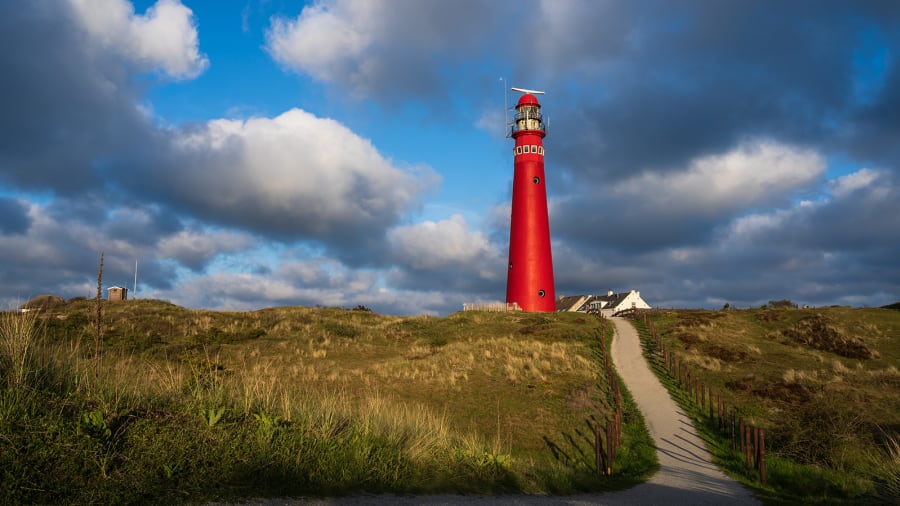
Schiermonnikoog, the Netherlands: Schiermonnikoog in the West Frisian Islands is home to about 950 people -- perfect for a peaceful getaway.
Sander van der Werf/Adobe Stock
 
Schiermonnikoog, the Netherlands

The Netherlands is better known for canals, dikes and tropical Dutch Caribbean Islands like Bonaire and Curaçao than the sandspun isles along the country's North Sea coast.
But one of Europe's most peaceful island escapes awaits on Schiermonnikoog in the West Frisian Islands, located off the Netherlands' northern coast across a shallow inlet of the North Sea called the Wadden Sea.
 

Home to just 950 people and a lone town, Schier, as locals call their island, is primarily national parkland, covered in dunes and forests and with some of Europe's most pristine beaches.

"Besides the beautiful nature and the vastness of it, there is not much to do on the island.
And that is precisely the charm," says Annemarieke Romeijn, who has a holiday home on Schiermonnikoog and has been visiting all her life.
Only residents are allowed to drive cars on the island, which you can get to from the mainland Dutch village of Lauwersoog by hopping a 45-minute ferry.
Once there, visitors can spend their time hunting for pieces of amber washed ashore on the island's wide white sand beaches, take kitesurfing lessons along natural sandbanks and cycle and hike the island's miles of lonely trails.

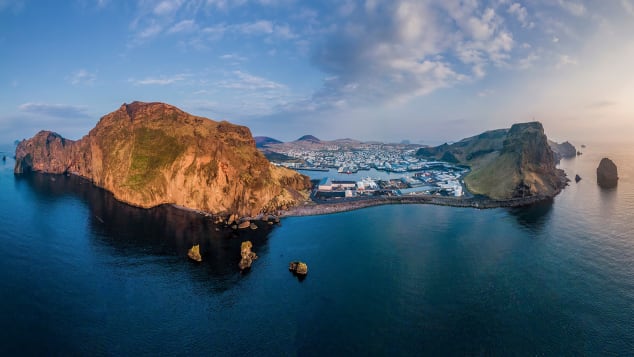
Heimaey, Vestmannaeyjar, Iceland 


There are more puffins than people here, but human visitors are richly rewarded.
Thor/Adobe Stock

Home to more puffins than people, the island of Heimaey in the Vestmannaeyjar (Westman Islands) off Iceland's south coast looks straight from a story book, with emerald green cliffs dotted with sheep, a sweeping black sand beach and sea caves yawning from its rugged coastline.

"The view alone coming into Heimaey takes your breath away," says Eyrún Aníta Gylfadóttir of Hotel Ranga, a hotel on mainland Iceland that regularly sends guests on day trips by ferry to the Westman Islands, a 40-minute crossing.
"The harbor is surrounded by high cliffs and home to seabirds of many kinds such as puffins, northern gannet, northern fulmar and Manx shearwater," she says.
 

A cataclysmic volcanic eruption on Heimaey in 1973 covered the area in 200 millions tons of ash and lava but miraculously just one death was reported.
Today, utter peace reigns, with lonely hiking trails to explore and vast ocean views.

Only about 4,500 people share Vestmannaeyjar with nearly a million puffin pairs that make up the largest Atlantic puffin colony on the planet.
The breeding season, between April and late summer, sees birds careening from the cliffs and carrying fish to their young in cliffside burrows.

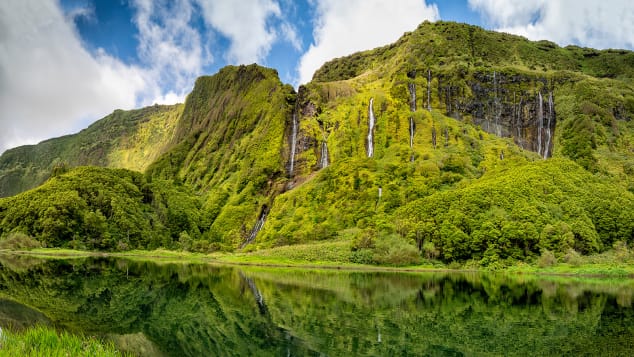
Flores Island, Azores, Portugal


Waterfalls trickle down an imposing rock face on the island Flores in the Azores.
aroxopt/Adobe Stock

One of the most remote islands in an already remote archipelago, Flores Island in the westernmost stretches of the Azores is a nature lover's dream.

Deep blue crater lakes, vivid green slopes, plunging valleys, waterfalls and boiling hot springs are among the otherworldly sights on the 55-square-mile volcanic island home to roughly 3,400 people, where you can arrive via flights from other Azorean islands
"On this island you have the sensation that you are in another world.
No pollution, no stress, no noise." says Gabriela Silva, 69, who was born on Flores and still lives on the island near an Airbnb she rents to guests.
"The sea all around is very clean, deep blue and you can dive in and feel the sensation of being in the house of gods."
Related contentAmericans are flocking to Europe's hot spots.
Here's where Europeans are going instead

One of the most magical sites on Flores is Rocha dos Bordões, a geological formation of basalt columns draped in vegetation that looks like the backdrop of a dinosaur film.


With just 26 rooms, Hotel das Flores is Flores' largest hotel, located in the island's main harbor town, Santa Cruz das Flores.
Vacation rentals are scattered throughout the island.

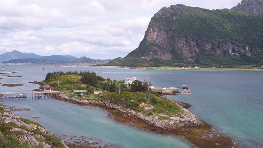
Naustholmen, Norway 

Naustholmen, Norway: This private island, owned by a Norwegian adventurer, hosts visitors for a range of outdoor experiences.
Alamy Stock Photo

Visitors must fly into Bodø in Northern Norway then continue north by boat to reach this private island owned by Norwegian adventurer Randi Skaug, the first Norwegian woman to scale Mount Everest.
Naustholmen guests stay in rooms spread across three houses on the island and spend their days kayaking to white sandy beaches lapped by deep blue waters or hiking nearby peaks for views of the Lofoten Islands to the north.
They can also simply swing in a hammock (or even sleep overnight outside in one) and do nothing at all, surrounded by the silence and beauty of this remote place.


"Have lunch over the fire on a beach, go hiking across the spectacular Nordskot Traverse or hear a mini concert in a local cave," says Torunn Tronsvang, CEO of travel company Up Norway.
"This is a place which will give energy and inspiration."

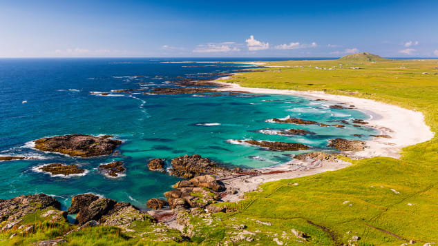
Isle of Tiree, Scotland 


This turquoise paradise is off the western coast of Scotland.
Richard Kellett/Adobe Stock

One look at the turquoise and deep sapphire waters and perfect surf waves rolling onto its shores and it's clear why the Isle of Tiree is sometimes referred to as the Hawaii of the North.

The most westerly island in the Inner Hebrides archipelago, off mainland Scotland's west coast, 12-mile-long Tiree is known for its mild climate, clean air and beautiful white sand beaches that could easily be mistaken for the Caribbean in photos if not in person (August water temperatures are in the brisk upper 50s Fahrenheit, or about 14 Celsius).
 

Intrepid surfers know Tiree for its uncrowded beach breaks, and the eight-room Reef Inn caters to the board-riding crowd.
The annual Tiree Music Festival draws up to 2,000 attendees every July for a Scottish folk music extravaganza, but you'll most often have the island's mostly flat walking and cycling trails and 46 miles of gorgeous beaches to yourself.
Visitors arrive on Tiree via four-hour ferry rides from Oban or flights from Oban or Glasgow on Loganair.

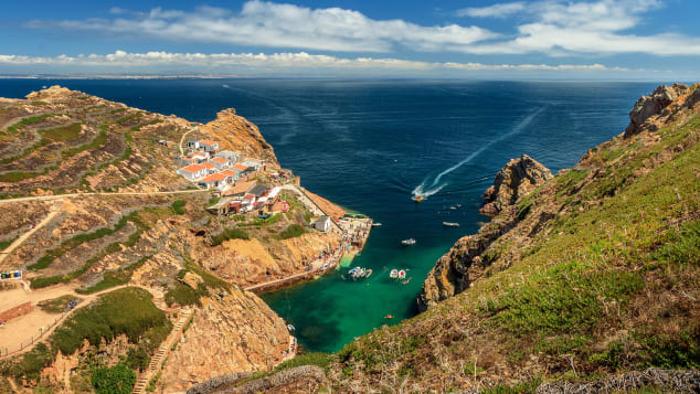
Berlengas archipelago, Portugal 


About six miles off the coast from Peniche, the Berlengas archipelago is an excellent scuba diving destination.
Luis Fonseca/iStockphoto/Getty Images

One of Portugal's most surprising island destinations awaits visitors arriving by boat for day trips or to camp overnight in the Berlengas archipelago, three groups of mostly uninhabited islands within the UNESCO-listed Berlengas Biosphere Reserve.
Roughly six miles offshore from the mainland Portugal town of Peniche, the archipelago is best known for the Fort of São João Baptista, a fortress dating back to the 1600s that commands an imposing presence atop a rocky outcropping on Berlengas Grande, the largest island in the chain.
Rooms can be booked at the fort's inn during the summer for overnight stays.


Berlengas Grande has campsites open during the summer where visitors can sleep overnight and feel all alone under the Milky Way.
"The landscape is arid but beautiful, and the sight of the Atlantic Ocean crashing around the islands is impressive," says Arlindo Serrao of Portugal Dive.
Serrao says the archipelago is one of the best places for scuba diving in Portugal, thanks to unique currents and a climate influenced by the Atlantic Ocean and the Mediterranean.

Mola mola (ocean sunfish) can sometimes be seen in the waters, and the islands are one of the most important places along mainland Portugal's coast for breeding seabirds.
 
Alicudi, Sicily, Italy

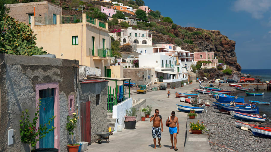
Alicudi, Sicily, Italy: Wild and rugged, Aliduci is the least inhabited of the seven islands in the Aeolian chain off Sicily's northern coast.
Dallas Stribley/The Image Bank Unreleased/Getty Images
 
Leave the "White Lotus"-inspired crowds to Taormina and make for the westernmost and most remote of Sicily's volcanic Aeolian Islands for an experience apart.

Wild and rugged, Aliduci is the least inhabited of the seven islands in the chain off Sicily's northern coast that include Stromboli and Lipari, among others.


"It's the most wild island in Sicily.
They still use donkeys to transport goods around on Alicudi," says Sicilian Francesco Curione.
"If you're looking for quiet and a castaway feel, this is the place."
Alicudi's distinctive volcanic cone rises from the Tyrrhenian Sea to dramatic effect, with colorful fishing boats bobbing along the shoreline completing the postcard look.
Buying fish straight from the fishermen in Alicudi is not to be missed.

There are no cars here and only around 100 residents, so finding a quiet spot all to yourself is never an issue.
The higher you walk along lava stone steps leading up the volcanic slopes, the deeper the silence and escapism.

There are no hotels on Alicudi, but villa rentals and Airbnbs make it comfortable to settle in and stay awhile.

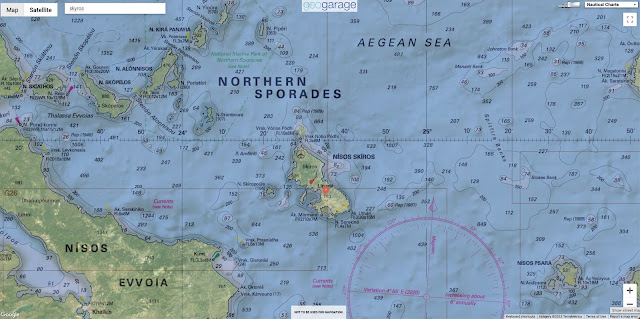
Skyros, Greece 
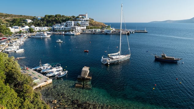

Skyros is one of two dozen islands in Greece's Sporades chain.
dinosmichail/iStockphoto/Getty Images

Greek islands like Santorini and Mykonos in the Cyclades can get so sardined with tourists during the summer months that you might be left wondering what all the hype is about.
For a more isolated experience in the Greek islands, set your sights instead north in the Aegean Sea to the island of Skyros.
One of 24 islands in the largely uninhabited Sporades chain in the northwest Aegean Sea, Skyros is reached via flights from mainland Greece as well as by ferry from the mainland and other nearby Greek islands.
 

Once there, there are secluded beaches to explore, a Byzantine castle towering over the main town and sea and even an ancient breed of miniature horse, the Skyrian horse, that lives in the wild only on this island.

With the exception of the lead up to Lent -- when Skyros' famous carnival puts the island into nonstop party mode with parades and costumed revelry and an inundation of Athenians -- it's a supremely peaceful place. 
 
Rathlin Island, Northern Ireland 

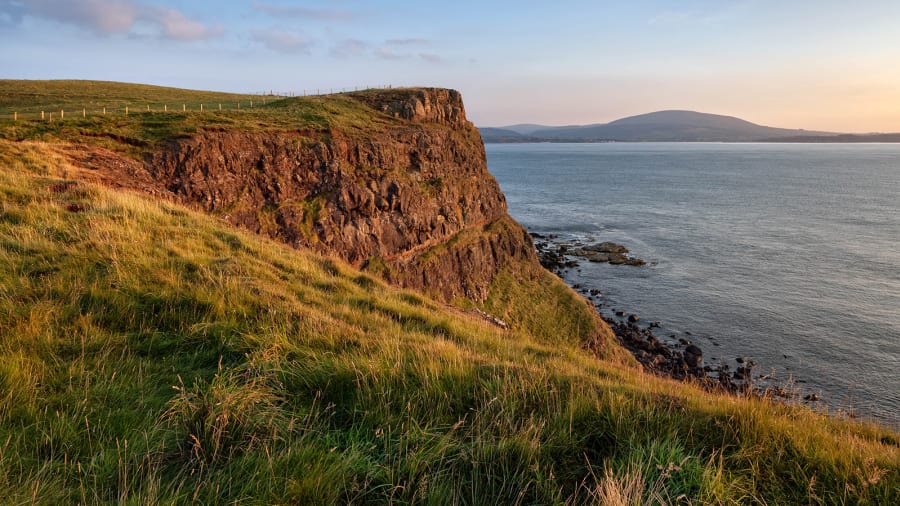
Rathlin Island, Northern Ireland: Rathlin Island off the coast of Northern Ireland is home to only about 150 residents and thousands of nesting birds.
Andrea Ricordi/Moment Open/Getty Images

Stretching six emerald-hued miles long and just one mile wide, Rathlin Island off the coast of Northern Ireland is home to only about 150 permanent residents.
Visitors who arrive via a quick ferry crossing from Ballycastle on the mainland are transported to a wilderness of dramatic sea cliffs home to thousands of nesting birds that include puffins, guillemots, kittiwakes and razorbills.
Colonies of harbor seals and grey seals line Rathlin's remote inlets.
Hiking trails crisscross the ruggedly scenic island and experienced scuba divers are drawn underwater to explore the scores of shipwrecks just offshore that include the HMS Drake, torpedoed by a German U-boat during World War I.


Don't miss a visit to Rathlin West Light, a lighthouse built upside down on the rocks to better cut through the low, dense fog that often descends on the island.
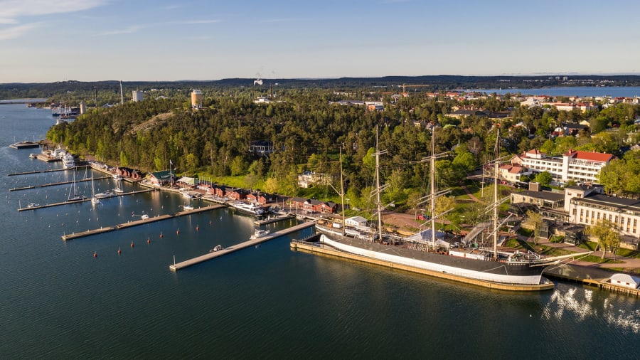

 Fasta Åland, Finland: Fasta Åland is the largest island in this archipelago and home to Mariehamn, the administrative capital of the Åland Islands.
Tuukka/Adobe Stock
 
Fasta Åland, Finland 

In the Gulf of Bothnia between Sweden and Finland, the Åland archipelago has more than 6,500 islands, of which only about 60 are inhabited.
To say there's room to stretch out and breathe on these Baltic Sea islands is an understatement.

An autonomous region, the islands belong to Finland but are only 25 miles from Sweden, with Swedish as the official language.

Fasta Åland is the largest island in the archipelago and a good base for explorations.
Tour by bike to nearby islands linked by ferries and bridges or just settle into a vacation rental or hotel with a sauna and sea views for a relaxing reset.
HavsVidden offers a secluded escape on northern Fasta Åland with villas with their own saunas overlooking the rocky shoreline.
 
Links :
Friday, January 20, 2023

Imray layers update in the GeoGarage platform

8 layers updated

North Atlantic map (1868) published by James Imray & son

Maluku earthquake: why do some ocean earthquakes cause tsunamis while others don’t?


From The Conversation by Martin Van Kranendonk

We live on an active planet, one whose surface is constantly in motion, although imperceptibly to us most of the time.
Until an earthquake occurs.

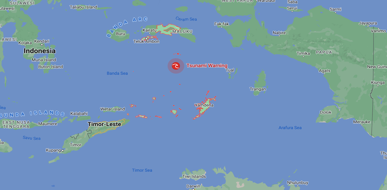
This morning, just such an event happened in the seas north of the Indonesian Archipelago, where a strong (magnitude 7.6 on the Richter scale) earthquake shook the region and was felt as far afield as Darwin in Australia.


The Bureau of Meteorology advises there is no tsunami warning for Australia, while some parts of Indonesia are in watch and wait mode.
But what determines if a tsunami will occur?

Grinding rocks

Only 70 years ago, it was considered our planet was rigid and affected only by slight sagging and raising of landscapes.


However, with the advance of technology in the 1950s we began to map the seafloor using sonar.
We could also measure the magnetic properties of the seafloor.

As a result, we’ve discovered the ocean floors are splitting apart at undersea mountain ranges known as mid-ocean ridges.

Additionally, oceanic crust (the part of Earth’s crust underlying the ocean basins) is being lost around the edges of most continents.
It is being returned deep into Earth’s mantle – the thick layer of semi-molten rock beneath Earth’s surface crust.

This happens at what are known as “subduction zones”.
Subduction zones are deep oceanic trenches where one tectonic plate dives down beneath another, generating earthquakes as the rocks slowly grind past one another.

The source of tsunamis

So why is it some earthquakes generate deadly tsunamis and others don’t?

Earth’s tectonic plates move across the planet’s surface at an average speed of around 10cm per year.
This speed was originally estimated based on changes in the magnetic seafloor properties, but has now been measured by satellites in space.

This movement is not a smooth process, since Earth’s crust is hard and experiences strong friction when the tectonic plates come into contact with one another.

As they move, this friction builds up stress in the rock, which is released every once in a while in the form of earthquakes.
In some places, earthquakes occur only occasionally but are very strong, while in others they happen more frequently and are weaker.

But earthquakes also vary greatly in terms of how deep they are generated below the surface.
This is because subduction zones continue for a long way down into the mantle.
The rocks remain cold and stiff for hundreds of kilometres down before they get hot enough from the internal heat of the planet to become soft.

And this is the main reason some earthquakes generate tsunamis and others do not.
Shallow subduction zone earthquakes actually displace the seafloor – either up or down – and also the ocean above it.

This happened with devastating effect in the 2011 Tohoku earthquake in Japan, located 24km deep and 9.1 magnitude on the Richter scale.
This single earthquake moved the crust 26 metres in seconds and lifted up the ocean, sending the crashing waves of a tsunami right across the Pacific Ocean.

Meanwhile last night’s 7.6 magnitude Maluku earthquake in Indonesian waters was not as strong and occurred at a depth of 105km.
At this depth, the energy and associated movement from the earthquake becomes dissipated into a million small fractures in the overlying rocks.

The energy also has to pass up through a wedge of the semi-molten mantle.
Thus, the surface expression of the earthquake is significantly weakened and we either get no ocean waves, or only small ones.

Because Earth’s plates move at a relatively constant rate and we have a record of earthquake activity for any particular part of Earth’s crust in the form of the geological record, we can predict roughly how often earthquakes should occur in any broad location.

Unfortunately, we do not yet have the technology to be able to predict exactly when or where an earthquake will occur.
But what we can do is identify areas at risk and build earthquake-resistant infrastructure in areas prone to earthquakes to prevent damage and loss of life.

Links :

Thursday, January 19, 2023

How did cartographers create world maps before airplanes and satellites? An introduction


Regular readers of Open Culture know a thing or two about maps if they’ve paid attention to our posts on the history of cartography, the evolution of world maps (and why they are all wrong), and the many digital collections of historical maps from all over the world.
What does the seven and a half-minute video above bring to this compendium of online cartographic knowledge? A very quick survey of world map history, for one thing, with stops at many of the major historical intersections from Greek antiquity to the creation of the Catalan Atlas, an astonishing mapmaking achievement from 1375.

The upshot is an answer to the very reasonable question, “how were (sometimes) accurate world maps created before air travel or satellites?”
The explanation?
A lot of history — meaning, a lot of time.
Unlike innovations today, which we expect to solve problems near-immediately, the innovations in mapping technology took many centuries and required the work of thousands of travelers, geographers, cartographers, mathematicians, historians, and other scholars who built upon the work that came before.
It started with speculation, myth, and pure fantasy, which is what we find in most geographies of the ancient world.

Then came the Greek Anaximander, “the first person to publish a detailed description of the world.”
He knew of three continents, Europe, Asia, and Libya (or North Africa).
They fit together in a circular Earth, surrounded by a ring of ocean.
“Even this,” says Jeremy Shuback, “was an incredible accomplishment, roughed out by who knows how many explorers.”
Sandwiched in-between the continents are some known large bodies of water: the Mediterranean, the Black Sea, the Phasis (modern-day Rioni) and Nile Rivers.
Eventually Eratosthenes discovered the Earth was spherical, but maps of a flat Earth persisted.
Greek and Roman geographers consistently improved their world maps over succeeding centuries as conquerers expanded the boundaries of their empires.

Some key moments in mapping history involve the 2nd century AD geographer and mathematician Marines of Tyre, who pioneered “equirectangular projection and invented latitude and longitude lines and mathematical geography.”
This paved the way for Claudius Ptolemy’s hugely influential Geographia and the Ptolemaic maps that would eventually follow.
Later Islamic cartographers “fact checked” Ptolemy, and reversed his preference for orienting North at the top in their own mappa mundi.
The video quotes historian of science Sonja Brenthes in noting how Muhammad al-Idrisi’s 1154 map “served as a major tool for Italian, Dutch, and French mapmakers from the sixteenth century to the mid-eighteenth century.”

The invention of the compass was another leap forward in mapping technology, and rendered previous maps obsolete for navigation.
Thus cartographers created the portolan, a nautical map mounted horizontally and meant to be viewed from any angle, with wind rose lines extending outward from a center hub.
These developments bring us back to the Catalan Atlas, its extraordinary accuracy, for its time, and its extraordinary level of geographical detail: an artifact that has been called “the most complete picture of geographical knowledge as it stood in the later Middle Ages.”

Created for Charles V of France as both a portolan and mappa mundi, its contours and points of reference were not only compiled from centuries of geographic knowledge, but also from knowledge spread around the world from the diasporic Jewish community to which the creators of the Atlas belonged.
The map was most likely made by Abraham Cresques and his son Jahuda, members of the highly respected Majorcan Cartographic School, who worked under the patronage of the Portuguese.
During this period (before massacres and forced conversions devastated the Jewish community of Majorca in 1391), Jewish doctors, scholars, and scribes bridged the Christian and Islamic worlds and formed networks that disseminated information through both.

In its depiction of North Africa, for example, the Catalan Atlas shows images and descriptions of Malian ruler Mansa Musa, the Berber people, and specific cities and oases rather than the usual dragons and monsters found in other Medieval European maps — despite the cartographers’ use of the works like the Travels of John Mandeville, which contains no shortage of bizarre fiction about the region.
While it might seem miraculous that humans could create increasingly accurate views of the Earth from above without flight, they did so over centuries of trial and error (and thousands of lost ships), building on the work of countless others, correcting the mistakes of the past with superior measurements, and crowdsourcing as much knowledge as they could.

To learn more about the fascinating Catalan Atlas, see the Flash Point History video above and the scholarly description found here.
Find translations of the map’s legends here at The Cresque Project.
 
Links :