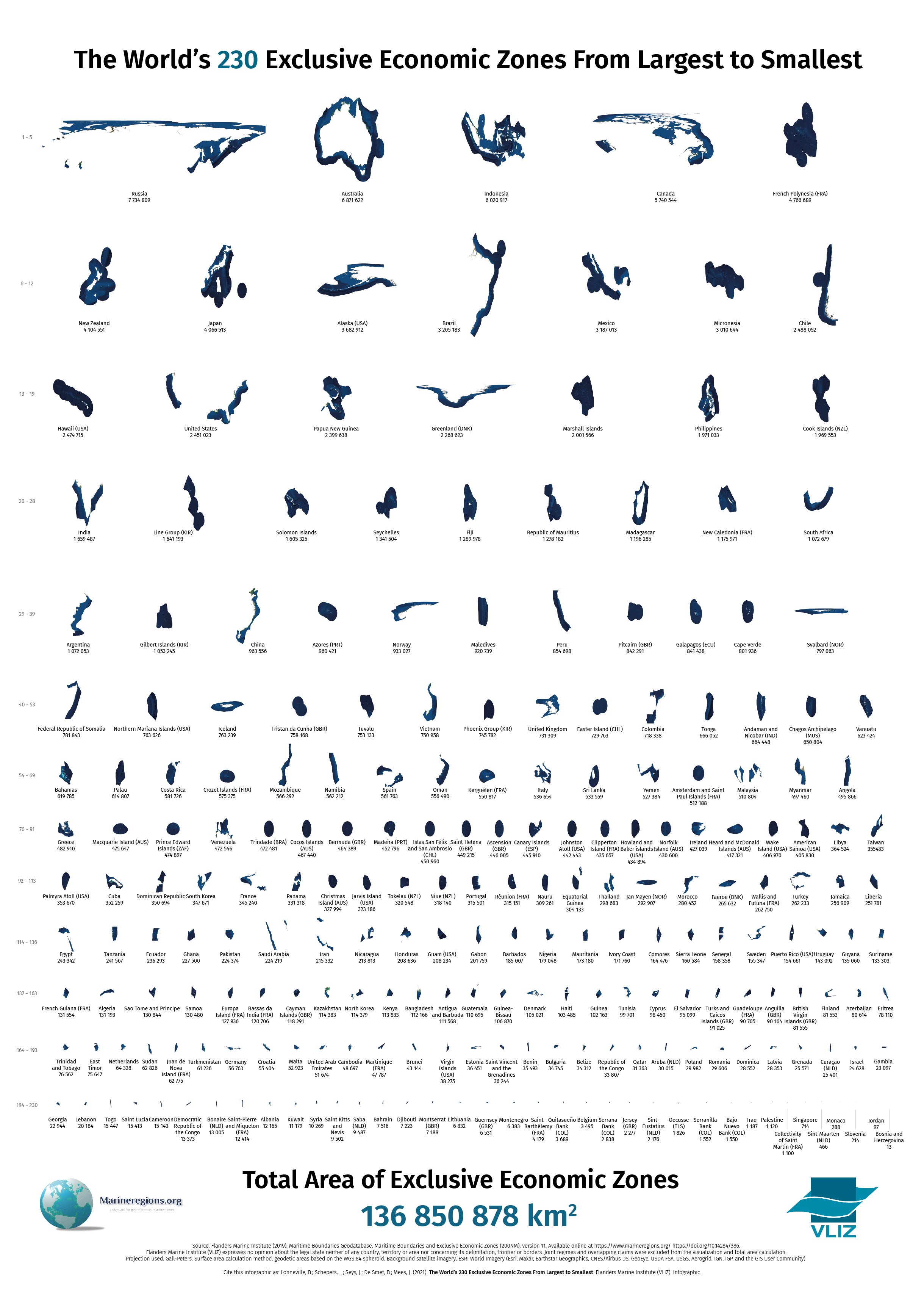
World’s EEZs ordered from Largest to Smallest - a powerful & unique view on sea areas.
Saturday, April 1, 2023
Friday, March 31, 2023
Oil tankers without ice-class protection could soon start shuttling on Northern Sea Route
Russian oil companies are desperately looking for new markets.
Nuclear icebreaker operator Rosatom now offers Lukoil and Gazprom Neft escort across icy Arctic waters to Asia.
From Barnets Observer by Atle Staalesen
The two companies that produce many million tons of oil at Arctic fields might soon start to send shiploads to Asian buyers across the Northern Sea Route.
According to Rosatom, the nuclear power company that manages Russia’s fleet of nuclear icebreakers, there is a significant potential in oil shipments on the Arctic route.
Negotiations with the oil companies are already taking place, Rosatom representative Sergei Chemko confirmed in a meeting in the Federation Council this week.
He believes oil from Lukoil’s Varandei terminal and Gazprom Neft’s Prirazlomnoye project could be sent across the route to the Asia-Pacific region in the period of the year without massive sea-ice, Interfax reports.
In summer and fall, the shipments can be made without ice-class tankers, Chemko argued.
“Unfortunately, we do not yet have large-size tankers with ice-class and therefore we offer our colleagues use of ordinary tankers with a guaranteed level of security, with escort of our icebreakers in the summer- fall season,” he explained.
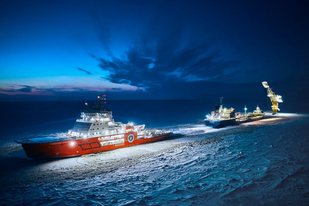
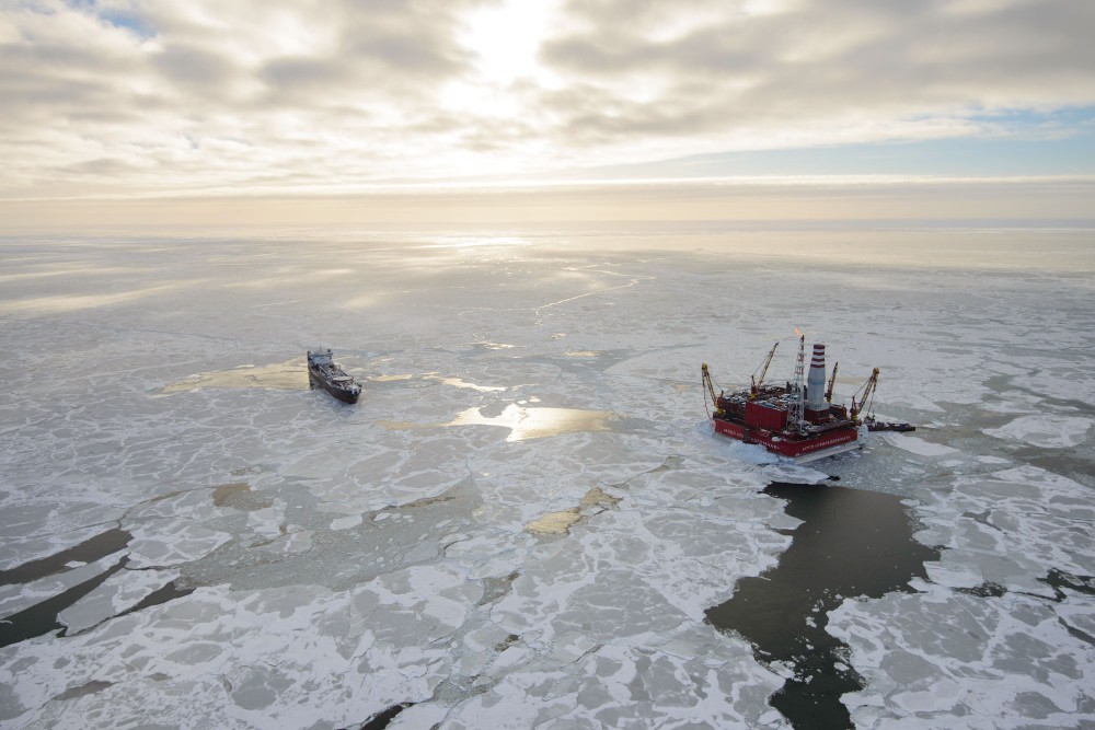
Big logistical operations are surrounding Gazprom Neft’s year-round shipments of oil from the Novy Port field in Yamal. Today, the oil is shipped to a reloading facility in the Kola Bay. Photo: Gazprom Neft
Russia produces a significant share of its oil in far northern regions.
According to Gazprom Neft, Arctic fields today account for more than 30 percent of its total production. In 2020, production at the company’s Novy Port project increased five percent to a total of 14,89 million tons, and the offshore project Prirazlomnoye delivered 3,27 million tons, an increase of three percent year-on-year.
In addition comes oil from Lukoil’s Varandey terminal, expected to reach more than 6 million tons in 2022.
It is far from the first time that oil tankers sail on the Northern Sea Route.
It is far from the first time that oil tankers sail on the Northern Sea Route.
In October last year, the 257 meter long oil tanker Vasily Dinkov made it across the route to the Chinese port of Rizhao.
The voyage tool place shortly before the EU introduced its oil ban on Russia.
The voyage tool place shortly before the EU introduced its oil ban on Russia.
The Commission’s 6th package of sanctions, adopted in June last year, prohibits all purchase, import or transfer of crude oil and certain petroleum products from Russia to the EU.
Russian companies today sell oil to China, India and other so-called “friendly countries” with a great discount.
According to Member of the Federation Council Konstantin Dolgov, Russia is able to overcome the troubles created by the sanctions.
“The current geopolitical situation triggers difficulties in resolving certain issues, but it is not sufficiently critical for a review of our general development plans,” he said during this week’s Council meeting devoted to the Northern Sea Route.
In 2023, shipments on the route is estimated to reach 33,12 million tons, he said.
The sea-ice across the Russian Arctic has over the past decade undergone a dramatic shrink. Nevertheless, ice remains a major challenge for ships operating in the area even during summer and fall.
In November 2021, more than 20 ships got stuck in the remote area following a quick and early freeze of the waters.
Links :
- ABC news : Moscow is betting big on its Arctic shipping route as the costs of invading Ukraine continue to mount
- High North News : Norway Sees Greatest Increase in Arctic Shipping Traffic
- MarineInsight : Russia And India Discuss Development Of Northern Sea Shipping Route
- GeoGarage blog :Map shortcomings could hinder Northern Sea Route growth / The warmest ever winter on the Northern Sea Route / Container ship crosses Arctic route for first time in history ... / The future of the Arctic economy / Arctic shipping passage 'still decades away' / Arctic sea routes open as ice melts / SCF Baltica tanker completed the Northern Sea Route / Ships to sail directly over the north pole by 2050, scientists ... / Russian tanker sails through Arctic without icebreaker for ... / Chinese shipper on path to 'normalize' polar shipping / As Arctic ice vanishes, new shipping routes open / Polar powers: Russia's bid for supremacy in the Arctic Ocean / Why the Arctic is not the next' South China Sea / Oblique icebreaker gives better access to Arctic waters / The world map of the future might be vertical / Polar code agreed to prevent Arctic environmental disasters / These maps show the epic quest for a Northwest Passage / Arctic headache for ship insurers as routes open up / Arctic Ocean: history and now / Arctic satellite image of the week : Russia discovers a new ...
Thursday, March 30, 2023
Seaweed is having its moment in the sun

From NYT by Somini Sengupta
It’s being reimagined as a plastic substitute, even as cattle feed.
But can seaweed thrive in a warming world?
For centuries, it’s been treasured in kitchens in Asia and neglected almost everywhere else: Those glistening ribbons of seaweed that bend and bloom in cold ocean waves.
Today, seaweed is suddenly a hot global commodity.
It’s attracting new money and new purpose in all kinds of new places because of its potential to help tame some of the hazards of the modern age, not least climate change.
In London, a start-up is making a plastic substitute out of seaweed.
In Australia and Hawaii, others are racing to grow seaweed that, when fed to livestock, can cut methane from cow burps.
Researchers are studying just how much carbon dioxide can be sequestered by seaweed farms, as investors eye them as a new source of carbon credits for polluters to offset their greenhouse gas emissions.
And in South Korea, one of the most established seaweed growing countries in the world, farmers are struggling to keep up with growing export demand.

Chang W.Lee/The New York Times

What was mainly a relatively small Asian industry is now coveted by the West.
Far beyond South Korea, new farms have cropped up in Maine, the Faroe Islands, Australia, even the North Sea.
Globally, seaweed production has grown by nearly 75 percent in the past decade.
The focus is moving far beyond its traditional use in cuisine.
But even as its champions see it as a miracle crop for a hotter planet, others worry that the zeal to farm the ocean could replicate some of the same damages of farming on land.
Much is unknown about how seaweed farms, particularly those far offshore, can affect marine ecosystems.
“Seaweed protagonists believe seaweed is a cure to everything, that seaweed is a magical panacea for climate problems,” said David Koweek, chief scientist for Ocean Visions, a consortium of research organizations studying ocean-based interventions for the climate crisis.
“Seaweed antagonists think seaweed is completely overhyped.”
There’s another problem.
Seaweed is itself feeling the impact of climate change, particularly in Asia.
“The water is way too hot,” said Sung-kil Shin, a third-generation seaweed farmer, as he pulled his boat into harbor one morning on Soando Island, just south of the South Korean mainland, where seaweed has long been foraged and farmed.
‘Plastic’ from seaweed
Pierre Paslier once made a living by designing plastic packages for cosmetics.
It felt to him like “leasing out my brain to a big plastic polluter.”
He wanted out.
He wanted to create packaging that would come from nature and disappear into nature, quickly.
With a friend from graduate school, Rodrigo García González, he created a company called NotPla, short for “not plastic.”
A biodegradable “plastic” membrane at NotPla’s operation in Hackney, London.
Ellie Smith for The New York Times
Ellie Smith for The New York Times
From an East London warehouse, they designed an edible sachet of water, made of seaweed and other plant extracts: To drink the water you simply pop the sachet in your mouth.
They designed another one that can hold ketchup and a third for cosmetics.
They also began making a seaweed-based coating for takeout cardboard boxes.
Just Eat, a food delivery app in Britain, began using it for some of its orders, including at the European women’s soccer finals in July at Wembley Stadium.
It’s still niche.
The seaweed coating, designed for home composting bins, is considerably more expensive than the plastic coating now used on most takeout boxes made of paper.
But Mr. Paslier is looking to the future.
The European Union has a new law restricting single-use plastic.
A global plastics treaty is under negotiation.
“Seaweed is not going to replace all plastic, but seaweed combined with other things can tackle single use plastic,” he said.
“We are barely scratching the surface.”
Foragers from the past
In the gray light of dawn, Soon-ok Goh, a slight 71-year-old, swam soundlessly in the shallow waters of Gijang, on the southern coast of South Korea.
Her feet were sheathed in yellow flippers, her thin, small frame in a wetsuit.
She surfaced above water for a few seconds, took a long breath that sounded almost like a whistle in the quiet of the morning, then dived down again, yellow flippers upturned.
Ms. Goh is among the last practitioners of a vanishing trade.
Since the end of the 7th century, women like her have foraged for wild seaweed, along with other seafood, in the chilly waters around the Korean Peninsula.
This morning, a tiny pink-handled knife in hand, she snipped shiny green-brown ribbons of kelp called miyeok.
She plucked sea snails clinging to rocks, two kinds of sea cucumbers, a handful of kelp-devouring sea urchins.
All went into her sack.

She has been diving since she was 9 years old.


With demand rising, old practices are getting pushed in the past
Chang W. Lee/The New York Times
Her grandmother taught her the trade, Ms. Goh said, which is known as haenyeo, or the “sea women.”
She has been diving since she was 9 years old.
“People who do this kind of work are disappearing,” she said.
“When I’m done, no one will do it.”
With demand rising, old practices are getting pushed into the past.
What role seaweed plays in your life depends on where you’re from.
For Alaska’s Indigenous people, seaweed has been a source of sustenance for generations.
The Irish and Welsh have used it to make pudding.
Japanese soup stock is made of kelp.
Seaweed extracts also help millions of people worldwide keep their teeth clean; it’s been used to make toothpaste for years.
In Korea, bordered by water on three sides, 20 different species of seaweed have been recorded.
It is central to cuisine and culture.
In a Seoul restaurant, many varieties on the menu.
After childbirth, mothers are served a soup made of miyeok, iron-rich and brown, and children are served it on their birthdays to honor mothers.
Dried, salted sheets of gim are eaten as snacks or dusted over cookies.
Wispy tendrils of maesaengi are tucked into a steamy breakfast porridge that’s believed to be a hangover cure.
In decades past, when there was no money to buy rice, you could go to the sea and find seaweed, said Hye Kyung Jeong, a food historian at Hoseo University in Seoul.
“Seaweed helped people survive during famines,” she said.
This is not the first time seaweed has helped avert a crisis.
Slimy arms race
The new frontier for seaweed production lies beyond Asia.
Steve Meller, an Australian-American businessman in Australia, grows seaweed in giant glass tanks on land.
Specifically, a red seaweed native to the waters around Australia called asparagopsis, which beef and dairy companies are eyeing as a way to meet their climate goals.
A sprinkle of asparagopsis in cattle feed can cut methane from their burps by between 82 and 98 percent, according to several independent studies.
“The race is on, I suppose, to get the world’s first commercial supply,” Mr. Meller said.
“The demand is off-the-roof scale.”

Chang W. Lee/The New York Times

Chang W.Lee/The New York Times
His company, named CH4 Global, after methane’s chemical formula, is competing to bring asparagopsis to the mouths of cows.
A manager examined the crop recently.
Cattle burps are a major source of methane, a potent greenhouse gas.
A farmer at an Australian feedlot with a handful of seaweed supplement.
At least two other Australian start-ups, Sea Forest and Rumin8, are in the seaweed-for-cattle race.
So are Symbrosia and Blue Ocean Barns, both in Hawaii.
Fonterra, a New Zealand dairy producer, has begun commercial trials of the seaweed supplement, and Ben and Jerry’s is planning its own trials soon.
The global dairy giant Danone has invested in an asparagopsis start-up.
Whether seaweed can make a dent in cattle methane remains unclear.
In the United States, there’s another hurdle to overcome: regulatory approval.
Nevertheless, it could be key to the beef and dairy industry's ability to meet climate goals.
Emissions from food systems alone, mainly meat and dairy, could raise the global average temperature by 1 degree Celsius by the end of the century, blowing past the threshold of relatively safe global warming, researchers have said.
Climate pressures
Seabirds dive and squawk around the fishing port in Soando, an island off the southern tip of South Korea, as Mr.Shin’s boat pulls in with the morning’s harvest.
Mr. Shin, 44, has plied these waters for 20 years and has seen climate change upend his trade.
He grows a red kelp species called pyropia, which favors cold water during its growing season.
So he has been going further and further from shore in search of chilly waves.
Mr. Shin’s crew harvesting seaweed recently.
By mid-April, Mr. Shin says, the water isn’t as cold as Pyropia likes.
His yield has suffered.
“People want more seaweed these days,” he said.
“But there’s no more seaweed.”
Since 1968, the waters where Mr. Shin farms have warmed by 1.4 degrees Celsius, slightly higher than the global average.
That’s why South Korean scientists are racing to breed strains that can thrive in warmer waters.
Seaweed farms are a far cry from the rows of corn and wheat that make up monoculture farming on land.
But even as they signify new opportunities, they present ecological risks, many of them unknown.
They could block sunlight to creatures who need it below.
They could scatter plastic buoys in the sea, which already suffers from too much plastic.
They could leave their plant detritus on the seafloor, altering the marine ecosystem.
“It needs to be carried out with a great deal of care,” said Scott Spillias, a doctoral student in economics who studies marine systems at the University of Queensland.
“We shouldn’t expect seaweed to save us.”
Links :
- GeoGarage blog :The plans for giant seaweed farms in European waters / Seaweed: The food and fuel of the future? / Climate change: Can an enormous seaweed farm help curb it? / By cultivating seaweed, indigenous communities restore ... / Why waves of seaweed have been smothering Caribbean ... / Ever heard of ocean forests? They're larger than the Amazon ...
Wednesday, March 29, 2023
China to up its deep-sea mining efforts
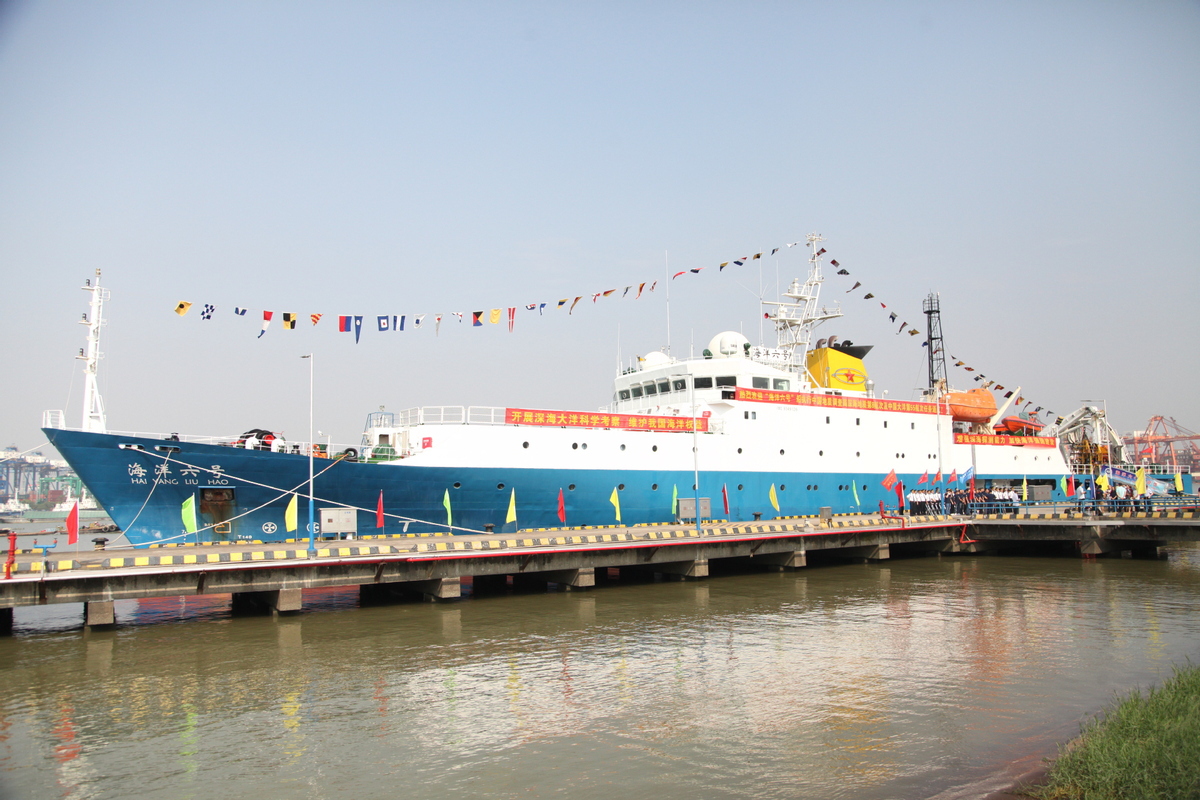 Chinese scientific research ship Haiyang 6 returns to Guangzhou, Guangdong province, after completing its deep sea exploration on Oct 23, 2019.
[Photo/Xinhua]
China will pay more attention to the research and development of techniques and equipment used for deep-sea mining, according to a senior researcher in the country's shipbuilding industry.
"Deep-sea mining has become a new frontier of international competition on science, technology, resources and industries, because there are a lot of polymetallic nodules on ocean floors that contain rich concentrations of nickel, copper, manganese and cobalt that are essential to the renewable energy industry," said Ye Cong, deputy director of the China Ship Scientific Research Center in Jiangsu province's Wuxi.
"A large proportion of the metals I mentioned, which are extensively used at Chinese factories, needs to be imported.
Mining them from seabed will help us reduce the heavy reliance on foreign suppliers," said Ye, who is a member of the 14th National Committee of the Chinese People's Political Consultative Conference.
Internationally, some Western nations have owned key technologies and the capability of manufacturing major hardware required in deep-sea mining and at least one company has launched experimental commercial mining operations expected to retrieve thousands of metric tons of ores each day.
However, China lags behind in terms of knowledge, technology and hardware, which highlights the importance of government attention and investment.
"We are facing several difficulties and challenges.
First, it is hard to bring the ores from a depth of several thousands of meters.
We need a reliable, powerful system consisting of pumps and tubes that can bring the mixture of seawater and extracted ores to ships" he explained.
"Second, we must thoroughly study the possible impact on deep-sea ecosystems and make sure that our solution can protect the marine environment and biodiversity.
Also we need to figure out an economical, sustainable approach to mine from ocean floors otherwise we will not be able to afford it."
Ye's center is a subsidiary of the State-owned conglomerate China State Shipbuilding Corp and is known for its deep-sea submersibles like the Jiaolong, or Sea Dragon, and Shenhai Yongshi, or Deep-Sea Warrior.
According to him, previous scientific dives by the Jiaolong and Shenhai Yongshi have enabled researchers to carry out some preparatory work for deep-sea mining.
Hu Zhen, a senior researcher at the Wuxi center and also a 14th CPPCC National Committee member, said that exploration and development of oceans have become a significant topic of science and technology, and are closely related to safeguarding a nation's marine interests and its international status.
He urged the government to speed up its review and approval procedures for major deep-sea hardware's research and development and also accelerate the implementation of the deep-sea station project.
Ye and Hu were speaking on the sidelines of the first session of the 14th CPPCC National Committee, which closed in Beijing on Saturday.
Links :
- EJFoundation : How the rush to deep-sea mining threatens people and our planet
- The Guardian : Deep-sea mining for rare metals will destroy ecosystems, say scientists / Row erupts over deep-sea mining as world races to finalise vital regulations
- The Verge : The race for more battery materials could cause ‘irreversible’ damage under the sea
- Greenpeace : Greenpeace confronts deep sea mining expedition in the Pacific Ocean
- NYTimes : A Rush to Mine the Deep Sea Is Underway. It Must Be Stopped
- BBC : The looming threat of deep-sea mining
- Climate Home News : High Seas Treaty exempts deep-sea mining from stricter environmental rules
- Wired : The Mining Industry’s Next Frontier Is Deep, Deep Under the Sea
- Mining : China to step up deep sea mining efforts / Diving for Metals: Visualizing Deep Sea Mining
- Politico : The uncharted waters of deep-sea mining
- The Hill : China’s maritime strategy: To own the oceans by adverse possession
- GeoGarage blog : Is deep-sea mining a cure for the climate crisis or a curse? / Deep-sea mining to turn oceans into 'new industrial frontier' / Deep-sea mining could start in two years after Pacific ... / Race to the bottom: the disastrous blindfolded rush to mine ... / Mining the deep ocean will soon begin / The secret on the ocean floor : deep-sea mining / Renewables' deep-sea mining conundrum / Electric car future may depend on deep sea mining / Will ocean seabed mining delay the discovery of potential ... / How will China's submersibles help us explore the ocean ... / Deep sea mining licences issued
Tuesday, March 28, 2023
The science of sailing: inside the race across the world’s most remote ocean
‘It’s win-win’: how a dangerous sailing race could reveal the ocean’s secrets
From The Guardian by Yvonne Gordon
After a long hiatus, the epic Ocean Race is back – but this year, as well as dodging icebergs, cracking masts and suffering the occasional ‘hull sandwich failure’, the teams are gathering crucial data from places even research vessels rarely reach
The Southern Ocean is not somewhere most people choose to spend an hour, let alone a month.
Circling the icy continent of Antarctica, it is the planet’s wildest and most remote ocean.
Point Nemo – just to the north in the South Pacific – is the farthest location from land on Earth, 1,670 miles (2,688km) away from the closest shore.
The nearest humans are generally those in the International Space Station when it passes overhead.
But on 21 March, four sailing teams came through here – part of a marathon race round the bottom of the Earth, from Cape Town in South Africa to Itajaí in Brazil.
By the time these 18-metre (60ft) Imoca monohull sailing yachts neared Point Nemo, the five sailors on each boat had already been at sea for 23 days, with another two weeks to go before they reach port in early April.
And this is just leg three, the longest portion of the even longer Ocean Race, a 32,000-nautical-mile dash around the world that started in January and finishes in July.
Competition is fierce and racing is close, even after three weeks at sea.
Boat speeds on leg three so far have been up to 40.5 knots – the equivalent of gale force winds – and the vessels have, subject to ratification, broken the 24-hour distance record multiple times.
The crews survive on freeze-dried food (rehydrated with hot water from a kettle – there’s no kitchen), and operate a four-hour alternating watch system.
Nobody gets much sleep.
The toilet is a bucket.
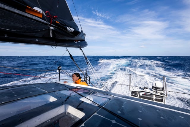
Malama, the 11th Hour Racing yacht, cruises in abnormally calm Southern Ocean conditions.
All photographs courtesy Amory Ross/11th Hour Racing.
Video by Antoine Auriol
All photographs courtesy Amory Ross/11th Hour Racing.
Video by Antoine Auriol
The dangers are unpredictable.
Winds in the Southern Ocean can reach up to 70 knots and hitting an iceberg at speed would be catastrophic, so the boats have to steer clear of an ice exclusion zone around Antarctica.
On 1 March, the Team Malizia crew discovered a crack at the top of the mast, requiring one of them to climb up 28 metres in rough seas to patch it over in the middle of the night.
Guyot Environnement – Team Europe had to abandon leg three completely after suffering a “hull sandwich failure”, spending three nervous days sailing 600 nautical miles back to Cape Town for repairs.
The last time Team Holcim-PRB’s skipper Kevin Escoffier raced here, his boat broke in half and sank and he was rescued from his life raft.
But while the Ocean Race is sometimes known as the toughest, and certainly the longest, professional sporting event in the world – an event that began in 1973 as the Whitbread Round the World Race then became the Volvo OceanRace, and which attracts professional sailors of the highest level who join mixed crews every few years on sponsored teams to vie for an overall trophy (there is no cash prize) – this year scientists have smelled an opportunity for them to benefit as well.
Because the boats visit the most remote part of the ocean, which even scientific vessels struggle to access, this year the crews will seed scientific instruments all around Antarctica, aiming to measure 15 different types of environmental data – from ocean temperature and atmospheric indicators to concentrations of microplastic.
Information from the devices will help with everything from weather forecasting to insights into the climate emergency.
The Southern Ocean is one of the planet’s largest carbon dioxide sinks, for example, but its inaccessibility has meant that there is relatively little CO2 data available.
Justine Mettraux of the 11th Hour Racing team takes a final look at the sail setup before ducking back into the cockpit
“The Southern Ocean is a very important driver of climate on a global scale [but] there is very little data,” says Toste Tanhua, chemical oceanographer at Geomar Helmholtz Centre for Ocean Research in Kiel, Germany.
“Data from the sailing races in the Southern Ocean is very important for us to understand the uptake of carbon dioxide by the ocean.”
Each boat is equipped with weather sensors on board that measure wind speed and direction, barometric pressure and air temperature.
Each team will drop two surface drifter buoys provided by organisations such as Météo-France and the US National Oceanic and Atmospheric Administration, which capture data to help the World Meteorological Organization study ocean currents and forecast extreme weather events such as hurricanes.
Course waypoints and the ice exclusion zone circles most of the world’s southern pole
A second type of buoy, the Argo profiler, deployed by Team Malizia in leg two, operates below the surface at depths of up to 2km, moving slowly with deep currents and transmitting information every 10 days.
The data is used for climate analysis as well as for long-range weather forecasts.
Meanwhile, 11th Hour Racing Team and Team Malizia are using OceanPacks to take regular water samples to measure the levels of carbon dioxide, oxygen, salinity and temperature, to be analysed in Germany and fed to Socat, the Surface Ocean CO2 Atlas.
Live dashboards give snapshots of the data as it is collected out at sea.
Tanhua says the fresh data reveals new patterns.
For example, it shows how carbon dioxide varies over a year – higher when the water warms up in summer, lower during a phytoplankton bloom.
It also shows how the ocean takes carbon from the surface and transports it into the depths.
“In the Southern Ocean, you have three major frontal systems where water is either going down vertically (sinking) or coming up,” Toste says.
“That has very different carbon levels.
Eddies also transport carbon up and down.” Scientists will now be able to observe these fronts and eddies up close, compare with satellite data and fill in the gaps.
11th Hour Racing team’s Charlie Enright and Jack Bouttell assess a tear in the mainsail
The boats are also sampling trace elements such as iron, zinc, copper, cadmium, nickel and manganese, which are essential for the growth of plankton.
Not only is plankton the base of the food chain, but phytoplanktonare responsible for most of the transfer of CO2 from the atmosphere to the ocean.
“This data is extremely important,” says Dr Arne Bratkič, environmental biogeochemist at the University of Lleida, Spain, who analyses the trace element results.
“It is important to know how much food is available for animals that will feed on phytoplankton eventually, and how much CO2 the phytoplankton is going to absorb from the atmosphere.”
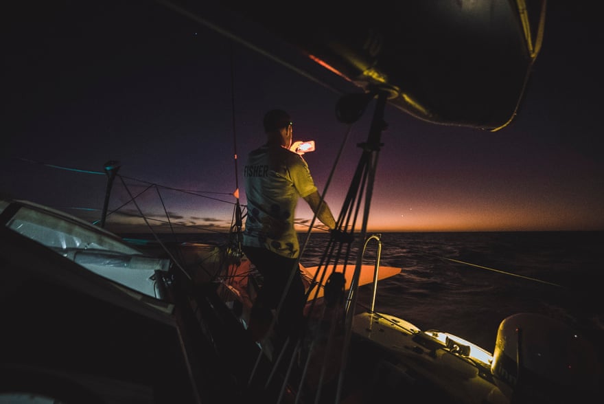
Simon Fisher of 11th Hour Racing team tries to capture the last rays of sunset
Bratkič says that sampling such as this normally requires dedicated scientific voyages, on which places are limited and expensive.
The Ocean Race is a way of testing investigations on non-scientific platforms at sea.
“We are paying attention to the design of the samplers – what works and what does not,” says Bratkič.
“It’s really exciting.”
To add to the plankton study, Team Biotherm is working with the Tara Ocean Foundation to study ocean biodiversity, and the sailors have an automated onboard microscope to record images and provide insights into the diversity of phytoplankton species.
They are also studying oxygen.
Dr Véronique Garçon, senior scientist for France’s National Centre for Scientific Research at the Observatoire Midi-Pyrénées at the University of Toulouse, France, wants to better understand ocean deoxygenation, which is being caused by global heating.
Skipper Charlie Enright catching up on some rest in the Southern Ocean
“Boats sail through remote parts of the world ocean where observations are really scarce,” she says.
“Getting more oxygen data is invaluable to yield a better estimate of the ocean oxygen inventory and thus of the oceanic oxygen loss.
“The more data we have, the more accurately we can understand the ocean’s capacity to cope with climate change and predict what will happen to the climate in future.”
The 2017-18 race made headlines after samples taken near Point Nemo showed that even these remote waters are polluted with microplastics.
This year, two teams, Holcim-PRB and Guyot Environnement, are again taking water samples to test for microplastics but can now also analyse them to determine their product source (for example, a bottle or plastic bag).
We still have a very poor understanding of the abundance and distribution of very small microplastics in the ocean, and it’s quite difficult to collect them, according to Dr Katsiaryna Pabortsava, a biogeochemist at the National Oceanography Centre in Southampton who is helping analyse the samples.
“The Ocean Race will be delivering samples from places that otherwise we’d have difficulty getting samples from,” Pabortsava says.
“The other thing is the ease of collection of those samples.
You don’t need trained personnel, as you would have with research vessels.” The hope is that this type of sampling could eventually be employed on other non-scientific ships, such as cruises or ferries.
The sailors benefit, too: in such a close and dangerous race (Team Holcim-PRB had a lead of 600 nautical miles at one stage, but light winds brought the pack together again and by 20 March just 5.1 nautical miles separated the four boats), every piece of information is vital.
“It’s a win-win situation, because six hours [after dropping the buoys], the sailors will download a new weather bulletin,” using data from the buoys, says Martin Kramp, ship coordinator at OceanOPS, the monitoring, coordination and implementation support centre of the Global Ocean Observing System.
“In such data-sparse areas as the Southern Ocean, [that] can make a significant difference – the forecast will be much better.”
The albatross begin their flight patterns across the boat’s wake – a sign that the Southern Ocean is near
Links :
Monday, March 27, 2023
The mighty quest to unveil our blue planet
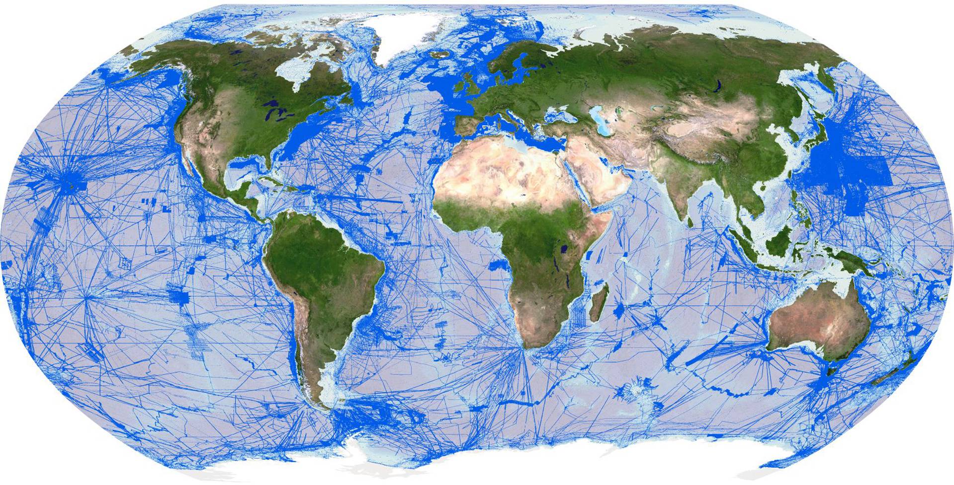
Areas mapped to date
Image courtesy Seabed 2030
From Maritime Magazines by Kira Coley
Mars is more than 137 million km from Earth.
And yet, even with this colossal distance between us and the Red Planet, by 2013, nearly 90 percent of its surface had been mapped to some scale by the stereo camera on the European Space Agency's Mars Express.
Back on Earth, only around six percent of the ocean (and therefore only 33 percent of our own planet) had been mapped.
Fast forward ten years to 2023, and the majority of our planet’s surface still remains a complete mystery.
Of the 71 percent of Earth that is underwater, less than a quarter has been mapped to an adequate resolution.
And so as we continue to launch telescopes to view the furthest reaches of our galaxy and send tourists into space, more than half of our planet's topography remains hidden beneath the waves.
The recent words of Bill Gates come to mind:
‘Space? We have a lot to do here on earth.’
That said, we have not been idle in this regard.
Seafloor mapping activities have been occurring for more than a century through the General Bathymetric Chart of the Oceans (GEBCO).
Initiated in 1903 by Prince Albert I of Monaco and Professor Julien Thoulet of The University of Nancy, GEBCO has the vision of providing authoritative, publicly available ocean depth data (also known as bathymetry data) for the planet.
The GEBCO community, mostly made from a dedicated group of international volunteers, is celebrating its 120th anniversary in May at the International Hydrographic Organization (IHO) Assembly in Monaco.
Yet, despite many years of mapping efforts, only a tiny fraction of the ocean’s depth has been recorded, significantly limiting humankind’s ability to explore and understand the critical processes that support all life on Earth.
The importance of an ocean map goes far beyond the need to survey underwater foundations for the development of coastal infrastructure.
Knowing the seafloor's shape is fundamental for understanding ocean circulation, tsunami forecasting, fishing resources, sediment transportation, the safety of navigation, environmental change, underwater geo-hazards, cable and pipeline routing, and much more.
It is also vital information which will enable the realization of the UN Decade of Ocean Science for Sustainable Development's outcomes, including, among others, a healthy and resilient ocean.
A complete ocean map will lead to a boundless number of discoveries, some of which will be important enough to reshape what we think we know today about Earth and oceanic processes.
An apt example was demonstrated when Bruce Heezen and Marie Tharpe used early echo-sounding profiles across the Atlantic Ocean, enabling them, and subsequently others, to understand the relationship between mid-ocean ridges and earthquake seismicity.
As a result, they played an essential part in formulating one of the most significant paradigm shifts in science—developing the hypothesis of seafloor spreading and plate tectonics.
The lack of a complete world map and the critical role such knowledge plays in understanding and maintaining our planet brought together several individuals in pursuit of a radical solution.
Yohei Sasakawa and Mitsuyuki Unno of The Nippon Foundation, Robin Falconer of Robin Falconer Associates Ltd, Martin Jakobsson of Stockholm University, and Graham Allen of the British Oceanographic Data Centre conceived a global initiative which would act as an accelerator for GEBCO's long-standing endeavor.
And in 2017, Japan's largest philanthropic organization formally joined forces with GEBCO to launch The Nippon Foundation-GEBCO Seabed 2030 Project (Seabed 2030) at the first-ever United Nations Ocean conference in New York.
Six years later, Seabed 2030, together with its fast-growing list of partners, is an impressive global collective relentlessly pursuing a complete ocean floor map by 2030.
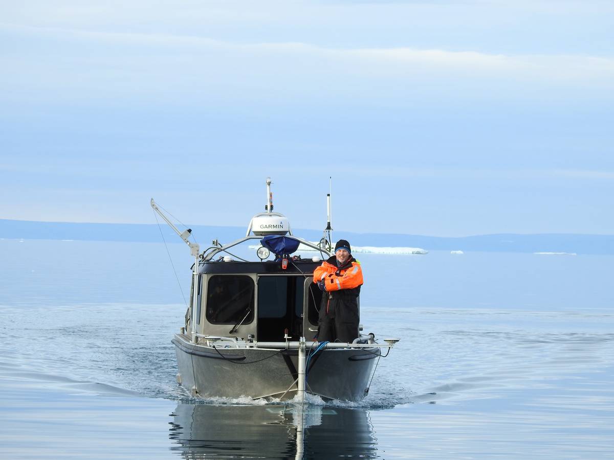
Martin Jakobsson onboard RV Skidbladner.
IMAGE COURTESY LARRY MAYER
From Ripples to Waves: Creating a Mapping Movement
‘It is entirely achievable if we can further mobilize governments and industries to increase their support for seabed mapping,’ says Jamie McMichael-Phillips, director of Seabed 2030.
‘But it must be a global effort.’
Seabed 2030 is undoubtedly a heroic and ambitious call to action.
The project actively seeks partnerships to collate all existing data into the GEBCO map and to identify areas where there is no data to inform future mapping expeditions.
Today, the project has over 220 partners, data contributors, and supporters in more than 50 countries.
But there is still room, and a need, for growth.
Almost anyone in the private sector, industry, governments, NGOs, research institutes, as well as boat-owning individuals, can join Seabed 2030 and contribute towards achieving its critical mission in several capacities, from supporting outreach and advocacy efforts to solving the many technological or regulatory challenges limiting progress.
Of course, for a project of this grand scale, there are many challenges.
Beyond the technical issues of mapping a vast ocean from its coastal waters to its deepest depths, crowdsourcing has occasionally been difficult, with some nations hesitant to share seabed data within their exclusive economic zones.
The severe restrictions on human movement brought about during the height of the COVID-19 pandemic had a significant impact on academic scheduling of seabed mapping expeditions, in some cases delaying data collection efforts by years.
The need to map the ocean floor also competes for funding and resources against other pressing issues, such as tackling plastic pollution or marine biodiversity loss.
But with all its challenges, progress is being made.
In the last two years alone, the project has realized several important achievements.
In 2021, Seabed 2030 celebrated a major milestone by welcoming New Zealand as the first country to sign up for the ocean mapping initiative.
This was followed by the United Kingdom, the United States, the Philippines, and Kiribati, as well as over 20 additional MOU partners across academic and private sectors.
These partnerships are essential to the success of the mission.
In December 2021, the project marked a further milestone with partner Fugro: more than 2 million square km of high-resolution, in-transit bathymetry collected by Fugro vessels were delivered to the Seabed 2030 project.
Combined, this data coverage is roughly equivalent to the size of Mexico.
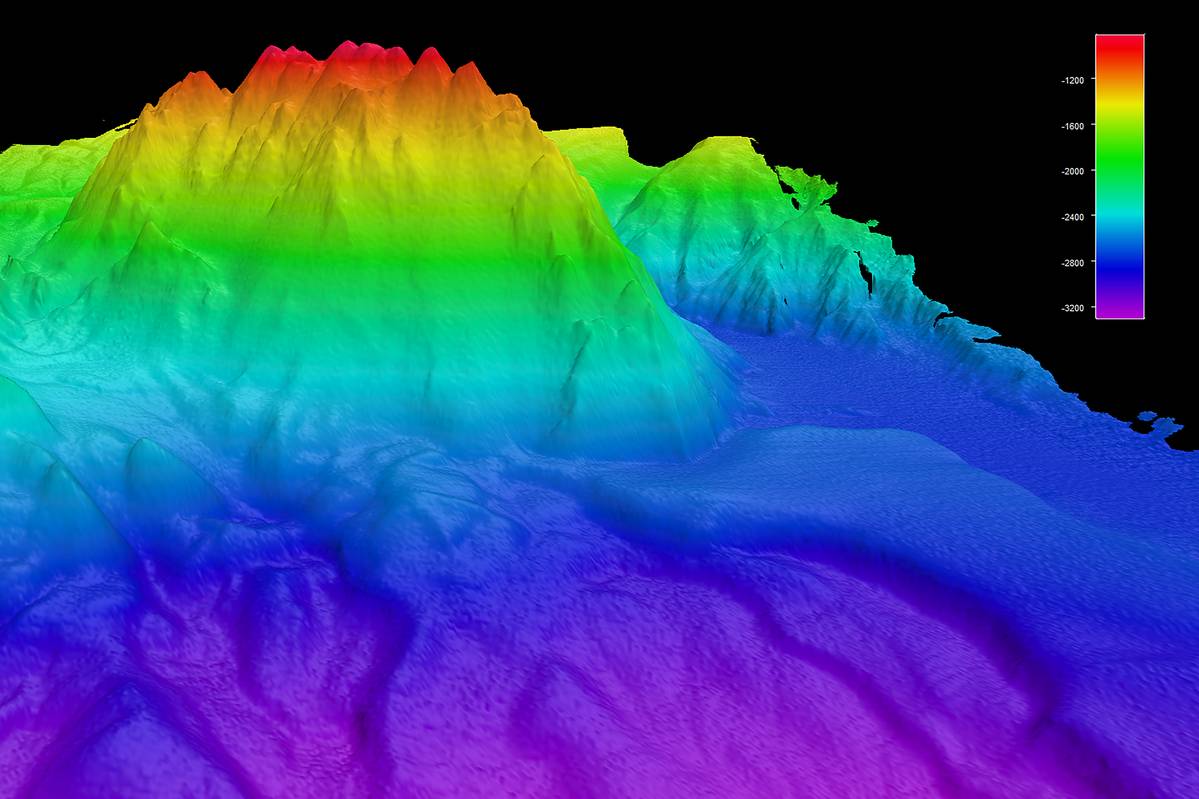
Clarity of data collected with the Saildrone.
IMAGE COURTESY SAILDRONE
The latest GEBCO figure was announced by Mitsuyuki Unno, Executive Director of The Nippon Foundation, at the second UN Ocean Conference held in Lisbon last year.
As of June 2022, ocean mapping coverage had increased to 23.4 percent following an increase of 10.1 million square km of new bathymetric data in just 12 months, equivalent to an area around the size of Europe and slightly larger than the Sahara ¬desert.
Seabed 2030 estimates that an additional 20 percent of the ocean map is gathering dust in long-forgotten or restricted archives.
‘A big part of achieving our mission is encouraging everyone to check past survey missions for shareable data that can be added to the GEBCO map, at a resolution of their choice, and help further our knowledge of our planet,’ says McMichael-Phillips.
And there are plenty of old archives yet to be discovered.
In October 2021, the results of an influential survey were released.
Out of 800 respondents, 154 potential sources of new data have been found.
As we make headway with a new year, Seabed 2030 comes one step closer to the end of the decade, and 2023 is already shaping up to be another significant year for the project.
Crowdsourced data is paramount to Seabed 2030’s endeavor and it, therefore, hopes to further mobilize communities across the world to play a part in advancing our ocean knowledge, by humanity, for humanity.
In February last year, the International SeaKeepers Society - an organization which promotes oceanographic research through direct involvement with the yachting community, officially joined the project.
This was a welcome boost for crowdsourcing activities.
By enabling vessel owners to get directly involved in research initiatives, opportunities for ocean mapping are not only multiplied, but also expanded to uncharted areas as yachts often explore areas of the world’s ocean where data is sparse.
Such contributions can therefore have a significant impact on the global seafloor mapping effort.
But citizen science is not exclusive to yacht-owners.
Seafarers, including small boat owners, also have the potential to advance marine sciences.
To support this, Seabed 2030 makes uncomplicated data loggers available to ocean-going vessels as part of a wider IHO-led initiative at its Data Centre for Digital Bathymetry (IHO DCDB).
Established in 1990, the center supports worldwide data collection by mariners, which it archives and shares freely.
The center is currently hosted by the National Oceanographic and Atmospheric Administration (NOAA), a US government agency and, as of last year, official Seabed 2030 partner.
In addition to continuing this ongoing field of ocean research and science, Seabed 2030 is also committed to capacity building, particularly in Small Island Developing States (SIDS).
A priority for 2023 is supporting SIDs which, as island countries, are integral to the global collective Seabed 2030 hopes to inspire, as well as being key beneficiaries of the sustainable outcomes which a complete ocean map will help achieve.
Also worth mentioning is the launch of Empowering Women in Hydrography last year - an IHO project aimed at enabling more women to participate in the field of hydrography and to reach more leadership roles.
Currently less than ten percent of national hydrographers are women.
The project will, amongst other things, coordinate training opportunities and oversee the establishment of a mentoring network, and it has already received support from countries including the UK, Canada and Norway.
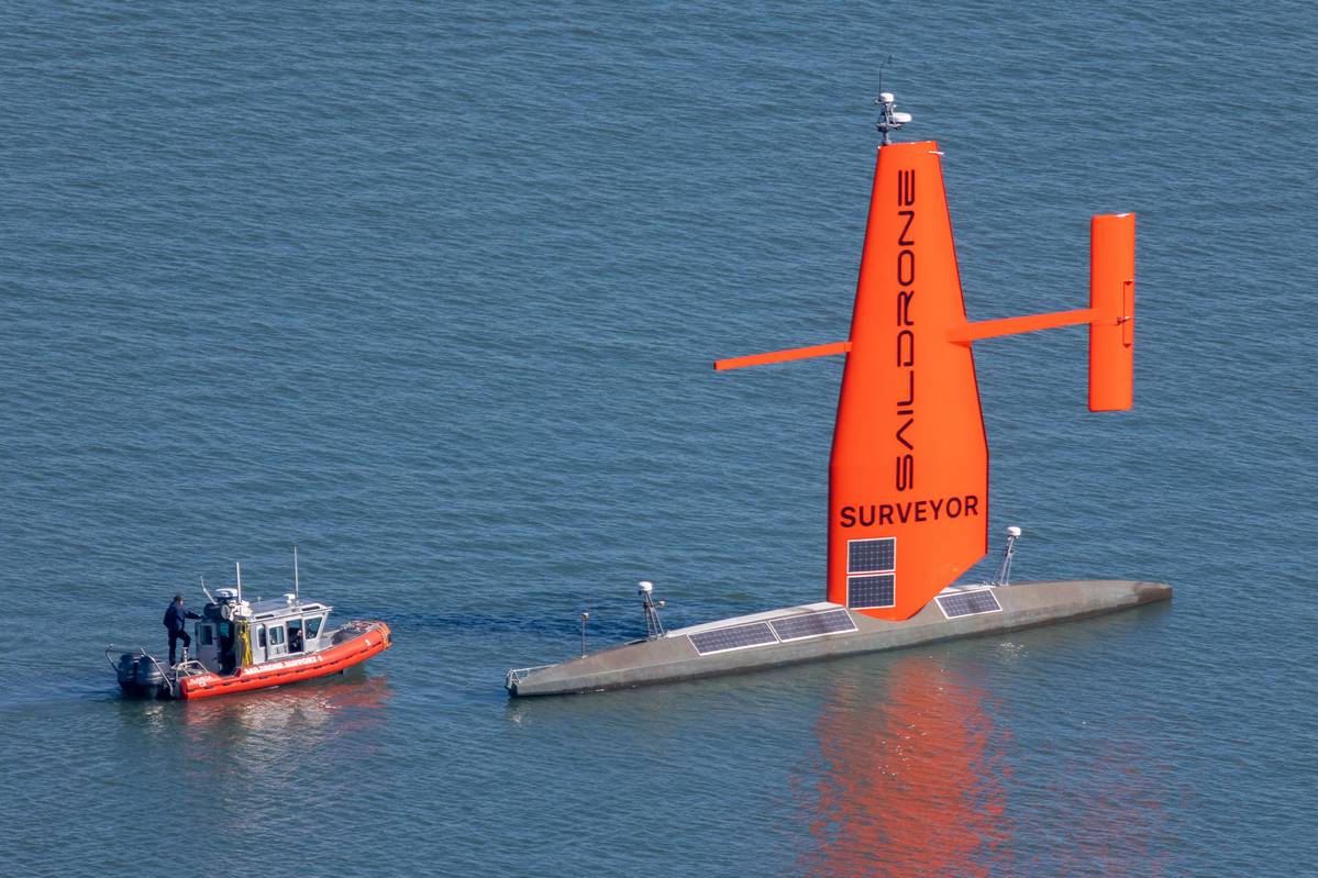
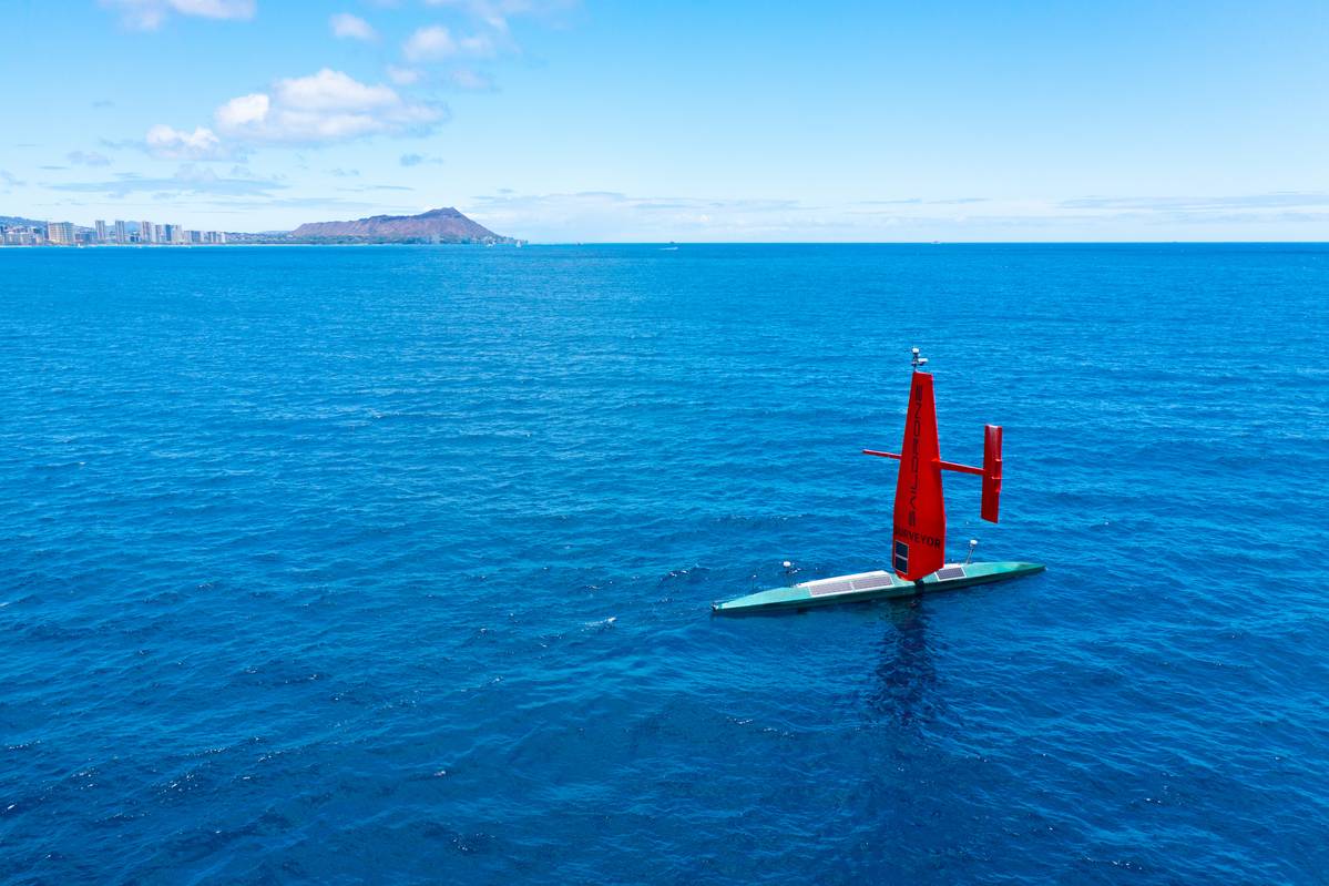
Image courtesy SAILDRONE
A Catalyst for Technological Innovation
Scientists have told us that we have less than ten years to prevent irreversible damage from climate change.
To succeed in this global ‘duty of care’ we need a complete map of the seabed – from the inshore drying line to the deepest regions and below the floating extensions of ice sheets.
Thus, we are at a critical point in history where we no longer have the luxury of measuring progress in decades, but years.
Although the space sector is making enormous strides toward mapping the planets and moons in our solar system, the ocean adds a layer of complexity to mapping efforts here on Earth.
In the ocean, light does not penetrate very far through the water column - particularly in the deep sea, where we mostly rely on power-hungry, ship-based echo sounder systems for data gathering, which is a slow and expensive process.
In order to meet Seabed 2030’s ambitious but critical goal, ocean innovation and capacity building within our sector will need to be augmented beyond anything we have ever seen before.
Seabed 2030 offers a new vision and audacious goals for the ocean technology community.
Alongside the Ocean Decade, the drive towards a complete ocean map could be the catalyst we need to propel innovation forward.
‘The primary challenge is capacity,’ says Guy Noll, department manager for Mapping Systems Products at Esri.
‘There are simply not enough observational tools available to meet high-resolution requirements for Seabed 2030.
The Southern Ocean, and southern oceanic areas in general, are most at-risk of not meeting the objective due to long distances and cost of mobilization of resources.
That said, there are multiple new platforms, such as our partner and co-supporter of Seabed 2030, Saildrone, who are making rapid progress in building new capacity.’
Saildrone’s Surveyor is an uncrewed surface vehicle (USV) propelled by the wind but primarily powered by solar energy.
It has a small diesel engine on board, primarily to charge sensor batteries but can provide propulsion, reducing the need to regularly return to port.
As a result, Saildrone’s Surveyor has long endurance and can collect high-resolution shallow and deep-water ocean mapping data that meets - or even exceeds - standards set by the IHO.
Over the last few years, the USV has collected ocean mapping data in the US Exclusive Economic Zone mapping, including areas in Hawaii, Alaska, and California.
Future efforts will support storm surge modeling efforts and emergency response, as well as coastal resiliency and hazard studies, resource management, restoration projects, habitat mapping, and infrastructure for renewable energy generation.
‘We can produce these vehicles a lot faster than you can build a new survey ship, and there aren't many new survey ships being built,’ says Brian Connon, vice president of Ocean Mapping at Saildrone.
‘And so, what the USV market brings is that ability to scale up and meet the demand very quickly.
And what we get as a Seabed 2030 partner is a goal to strive for and the opportunity to demonstrate our technology’s capability through joint projects.
We're starting construction of five new Surveyors equipped with new deep water multibeam mapping systems, which will be brought to bear against the challenge of Seabed 2030.
In the near future, we envision building ten, 20, or 30 of these surveyor platforms, having them in every ocean around the world, and collecting bathymetry for our customers.
For Seabed 2030, data discovery was the big first piece, and the next step has to be getting more assets, such as USVs, Autonomous Underwater Vehicles, Gliders and Profilers, in the ocean for mapping.’
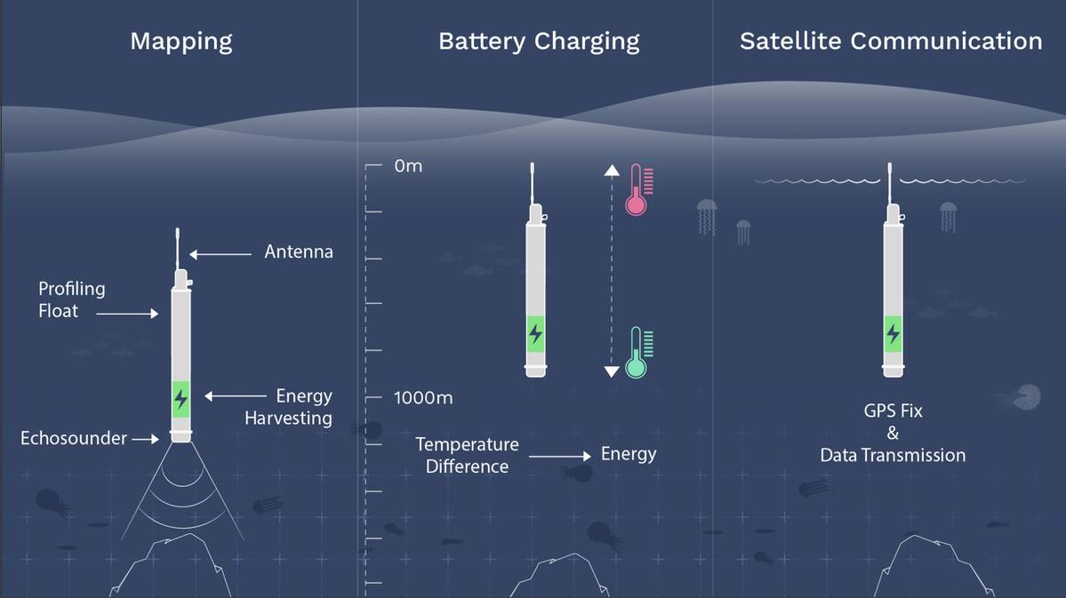
Seatrec’s InfiniTE Float platform is powered by a pioneering energy harvesting system that generates electricity from the ocean’s temperature differences.
Echosounders - previously impossible to mount on a float because of power limitations - are now able to conduct bathymetry surveys at depth, autonomously, and without expensive ship support.PHOTO CREDIT: SEATREC
Echosounders - previously impossible to mount on a float because of power limitations - are now able to conduct bathymetry surveys at depth, autonomously, and without expensive ship support.PHOTO CREDIT: SEATREC
With seven years remaining, achieving the project’s goal in the relatively short time frame will be a momentous challenge for the ocean sector.
‘The ocean is a very challenging place to work, especially when developing hardware,’ says Yi Chao, founder and CEO of Seatrec.
‘Because of this, the development cycle takes much longer than for systems used on land or in the air.
As a result, one of the biggest challenges put forward by Seabed 2030 for the ocean technology community is how can we speed up the innovation process? It takes a long time for new technology to hit the market and to scale up on the global level, and time is not on our side.
Clearly, we need all hands on deck.
It will take the whole community to reach that objective.
At Seatrec, we want to be part of this international effort and make our unique contribution.’
Chao pioneered the ocean thermal energy harvesting project at NASA JPL in collaboration with his co-inventors, Jack Jones and Thomas Valdez.
Now he supports Seabed 2030 by developing his technology to power micro echosounders on thousands of profiling floats.
He adds, ‘There are currently 4,000 Argo floats in the ocean measuring temperature and salinity.
If we can harvest energy from the ocean to power additional sensors such as echosounders, then we can mobilize all these existing platforms to measure not only oceanography but also map the bathymetry.
Imagine if we suddenly had 4,000 echo sounders moving around the globe; we’d automatically have global coverage.
Seabed 2030 has this incredible data management system distribution network, in the form of its regional and global centers, which we can leverage so we can just focus on data collection.’
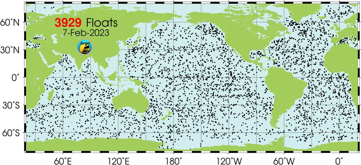
There are currently 4,000 Argo floats in the ocean measuring temperature and salinity.
IMAGE COURTESY SEABED 2030
With funding secured from the Eric and Wendy Schmidt Family Foundation, Seatrec is in the final stages of getting the first two prototypes ready for demonstration.
The systems are being built in collaboration with Larry Mayer from the University of New Hampshire and David Sandwell from Scripps Institute of Oceanography.
Mayer is also the co-head of Seabed 2030’s Arctic and North Pacific Regional Center, along with Martin Jakobsson.
‘Through Seabed 2030’s regional centers and global network, we can get access to bathymetric experts to help validate and further develop our technology,’ says Chao.
‘We're going to verify our technology this summer and expand the floats’ capabilities beyond oceanography to bathymetric mapping.
Then, by working with people within Seabed 2030’s community, we will get ready for the next step, which is scaling up for global distribution.’
Saildrone has also been working closely with Mayer.
Connon added, ‘It's great to have Professor Mayer on board.
His program is particularly helpful when giving us a route from A to B and guiding us over unmapped areas.
The entire Seabed 2030 community is a fantastic asset.
And that's how we will get things done, by these relationships and working together to map the ocean.
I'm excited because I now think that in my lifetime, we could do this.’
Seabed 2030 has also supported a number of ground-breaking ocean mapping expeditions.
A recent example is the Tonga Eruption Seabed Mapping Project (TESMaP), formed in response to the eruption of the Hunga Tonga-Hunga Haʻapai (HT-HH) volcano in January 2022.
The eruption of the underwater volcano caused a tsunami that devastated the island and spread throughout the Pacific.
The shape of the seabed greatly influenced the speed and size of the tsunami.
Waves hit Australia, New Zealand and Japan and even touched the shores of California, Alaska, and Chile.
New Zealand's National Institute of Water and Atmospheric Research (NIWA) and The Nippon Foundation - supported by Seabed 2030 - came together to examine the undersea impacts of the eruption, which was subsequently confirmed to be the largest ever recorded.
SEA-KIT International also played a critical data-gathering role.
Remotely operated from the UK, a SEA-KIT USV surveyed the site of the Tonga volcano eruption.
The uncrewed vessel was able to survey across areas considered too dangerous for NIWA’s scientists, gathering further evidence from the caldera that the HT-HH was still erupting.
‘This mission was a great example of international coordination.
When we have the opportunity to test equipment in such dangerous locations, we learn a huge amount about how to overcome technical challenges in remote regions and it allows us to demonstrate the capabilities of the vessel’, says Peter Walker, SEA-KIT’s Director of Technology.
‘The biggest challenge we're finding now is the more remote the technology is, the more difficult it is to obtain good quality data, especially at deeper depths.
Satellites are one of the key things here.
Connectivity is important for the quality control of data acquisition, navigation, and safety of navigation.
Connectivity also helps with regulation.
The classification societies don't want a robot in the ocean doing its own thing without some kind of control or a higher level of supervision.’
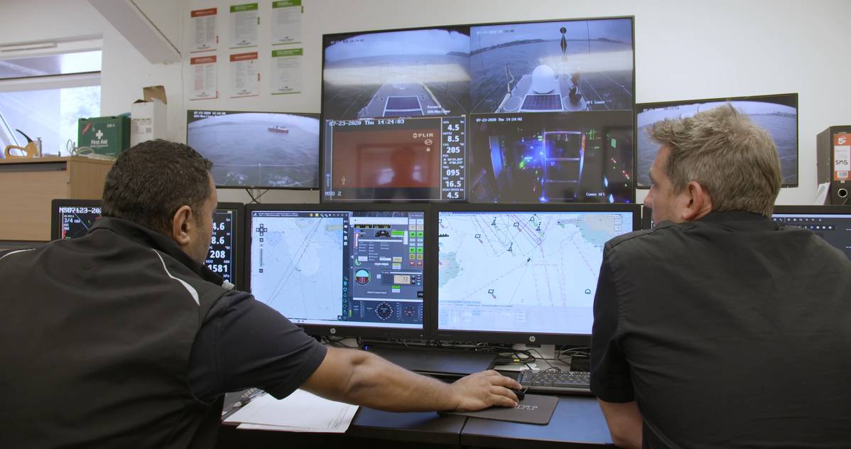
SEA-KIT control panel: Members of the SEA-KIT International team controlling the ship from their office in Essex.
IMAGE COURTESY SEA-KIT
‘As an industry, we need to change how we work together so we can benefit from each other's strengths to accelerate the process,’ adds Walker.
‘At SEA-KIT, we’ve always been focused on changing the way we do things offshore and becoming better stewards of the ocean.
That’s why the fit with Seabed 2030 is so snug because as well as being a commercial business, there is also a mutual drive to want to develop that understanding and try to meet the ultimate goal of Seabed 2030.
And that can only come with continued collaboration and involvement from countries all around the world.’
A partnership with Seabed 2030 is a good measure of the commitment we all have to mapping our ocean, says Connon.
‘Saildrone believes that the ocean is the key to everything, and we want to make sure it's healthy and secure.
But we've got to understand it first.
And the basis of understanding is knowing what's at the bottom of the seafloor.
We also need to help Seabed 2030 tell the story about why ocean mapping is important so we can help convince funders to actually invest in our technology.
Or is there a new avenue we’ve yet to explore? How do we make vehicles like ours available for carbon credits, for example? There's currently no mechanism for that.
If there's an advantage to using low carbon surveying platforms, then more companies might be willing to invest.’
Chao adds, ‘If we want to reach the goal by 2030, we cannot duplicate efforts and waste resources.
I'm optimistic we can do it.
It just needs a community, the whole sector to work together and to coordinate.
And it's not about my technology, about your technology, it's about how we are leveraging all the existing technology and developing new ones in synergy so they complement these efforts.
‘By 2030, I hope we can no longer say that we know more about the surface of the moon and Mars than we do our own planet.
It would be nice if we could finally retire that statement.’
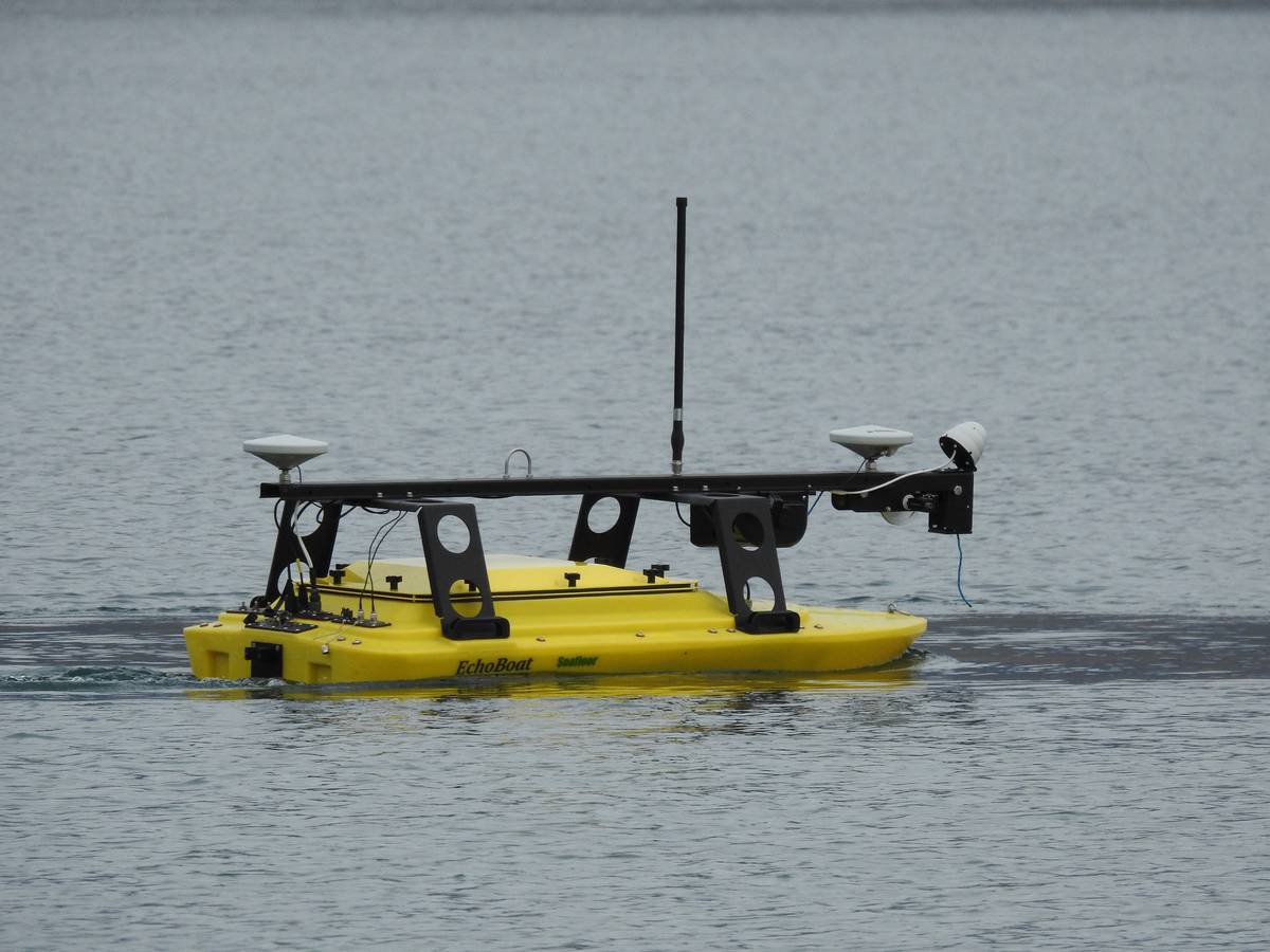
The EchoBoat is a remote-control scanning device used by scientific expeditions capable of housing a variety of scanners.
Here it is scanning one of the shallower inland lakes in Greenland: Pink Foot Lake.
Here it is scanning one of the shallower inland lakes in Greenland: Pink Foot Lake.
IMAGE COURTESY LARRY MAYER
Links :
- GeoGarage blog : Closing ocean exploration gaps in remote waters
Sunday, March 26, 2023
Explore detailed logbook information for individual sailing ships as they navigated the globe on G&M’s new web mapping application for the Climatological Database of the World’s Oceans (1750-1850)
Climatological Database for the World's Oceans, 1750-1850 (CLIWOC)
Application created by: Tim St. Onge and Meagan Snow,
Application created by: Tim St. Onge and Meagan Snow,
Geography and Map Division, Library of Congress
The Climatological Database for the World's Oceans, 1750-1850 (CLIWOC) (LCCN: 2020449236) was a 2001-2003 European Union-funded research project involving a large international team of researchers and organizations.
The resulting database, containing comprehensive weather observations and voyage details, is an invaluable resource for the study of climate and maritime history.
The Library of Congress digitally acquired a copy of CLIWOC in 2018.
The Climatological Database for the World's Oceans (CLIWOC) represents the culmination of a major project funded by the European Union, and pursued by a large team of researchers in organizations and universities around the world.
The database consists of 287,114 logbooks written aboard Dutch, English, French, and Spanish sailing ships.
The vast majority of these logbooks date from between 1750 and 1850, yet four ship logbooks were incorporated that predate 1750.
These were centuries of European imperial expansion, and so the logbooks record the activities of sailors - both civilian and military - in oceans that span the entire globe."
Links :
- GeoGarage blog : Visualizing ocean shipping / Britain's Royal Navy in the First World War - animated / Reading digital sources: a case study in ship's logs
- GoogleMapsMania : The Climatological Map of the World's Oceans
- Wooden ships, European maritime activity between 1750 to 1850
