Saturday, September 12, 2026
Friday, September 11, 2026
Hello Equal Earth: what the UN’s new world map will change
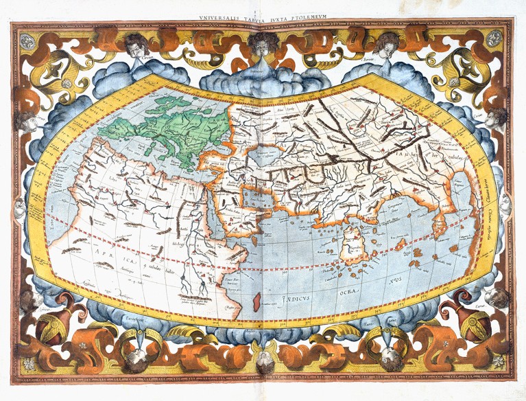
People have long projected their known worlds on maps.
This depiction, from Gerardus Mercator’s copy of Geography by Claudius Ptolemy, dates back to second-century Alexandria, Egypt.
Credit: Royal Geographical Society via Getty
From Nature By Dhruv Shenai
What the UN vote to ditch the Mercator projection means for education, navigation and public perception.
What the UN vote to ditch the Mercator projection means for education, navigation and public perception.
A view of the world that has prevailed for around 450 years has been challenged.
On 4 September, the United Nations General Assembly voted to phase out use of the Mercator map, a sixteenth-century projection that is widely used but has been criticized for not representing countries’ sizes accurately.
The UN resolution instead endorses use of the Equal Earth projection, which better shows the relative sizes of land masses.
That’s an important step towards correcting biases in the Mercator map, researchers say, even though that projection will still be useful in some scientific applications.
“Changing the projection used for global representation has geographic, educational and symbolic significance,” says Melinda Laituri, a geographer at Colorado State University in Fort Collins.
On 4 September, the United Nations General Assembly voted to phase out use of the Mercator map, a sixteenth-century projection that is widely used but has been criticized for not representing countries’ sizes accurately.
The UN resolution instead endorses use of the Equal Earth projection, which better shows the relative sizes of land masses.
That’s an important step towards correcting biases in the Mercator map, researchers say, even though that projection will still be useful in some scientific applications.
“Changing the projection used for global representation has geographic, educational and symbolic significance,” says Melinda Laituri, a geographer at Colorado State University in Fort Collins.
Projection preferences
The Mercator projection, presented by Flemish cartographer Gerardus Mercator in 1569, shows the meridians as straight lines — allowing for easy navigation with compasses.
It gained popularity from the eighteenth century, at a time of increased European maritime expansion and became the go-to map for governments and classrooms the world over.
Most web-based map services, including Google Maps and MapQuest, adopted it.
But critics point out that it shows the Northern Hemisphere as disproportionately large, because it increasingly stretches land masses — nearly 70% of which are north of the Equator — the closer they get to the poles.
For example, Canada and Russia seem much larger than they really are.
And Greenland and Africa seem to be similar sizes even though Africa’s area is about 14 times larger than Greenland’s.
That’s problematic, say researchers, because people are inclined to conflate size and importance.
“Maps don’t simply identify the location of places.
They also exist as social texts which influence how we imagine the importance, centrality or peripheral position of places,” says Derek Alderman, a geographer at the University of Tennessee in Knoxville.
“The effect of the Mercator projection on people’s mental map of the world is difficult to quantify.
It was a common assumption among cartographers that the Mercator projection has strong cultural influence and may be doing irreparable damage to our ability to think accurately about the world,” says Bernhard Jenny, a cartographer at Monash University in Melbourne, Australia, and co-creator of the Equal Earth projection.
Jenny cites a research article from 2009 showing that map readers don’t tend to compensate for distortions even when they know they exist 1.
Because all maps are projections from the 3D globe onto a 2D surface, they inevitably distort shapes, distances, areas and directions.
The Equal Earth projection, developed in 2018, shows the relative sizes of land masses more accurately than its Mercator counterpart does by curving the meridians (see ‘Bent into shape’).
However, this affects some shapes and angles, notably in New Zealand, which is stretched diagonally and sits on the edge of the map.

What will this change?
How widely used the Equal Earth projection will be remains to be seen.
The resolution was proposed by Togo with the backing of the African Union and the geography research community.
They say that shrinking Africa affects how the continent is perceived in media, education and policy.
Six nations abstained from the vote and only one, the United States, voted against, saying that the resolution "mocks the work and purpose" of the United Nations.
In the same week, after US President Donald Trump signed an executive order to rename Lake Ontario as Lake America, Google Maps and Apple Maps made this change for US-based users.
“The resolution is non-binding.
No country is compelled to remove a Mercator map tomorrow and Google is not suddenly required to redesign every digital map,” says Ashley Gunther, a geographer at the University of South Africa in Pretoria.
“If the vote does not eventually change geography education and the default world maps encountered on digital platforms, then its impact will remain primarily symbolic.”
On the technological side, geographic information systems — software that store, manage, analyse and map spatial data — will continue to use the Mercator projection, says Dawn Wright, an oceanographer and chief scientist of the Environmental Systems Research Institute (Esri) in Redlands, California.
“The Mercator projection is not going away, as it is still appropriate for marine navigation.
This is because mariners can measure their compass bearings most effectively on a Mercator map,” she says.

Japan demanding that new UN map, which places Kuril Islands under russian jurisdiction, be revised
Wright adds that the Equal Earth projection is already being used for scholarly research “such as population density studies, land use and climate vulnerability mapping, especially when representing these characteristics at a global scale”.
Geographers and other researchers around the world are excited by the UN resolution and keen to see how its adoption will progress over time.
But Gunther says that “publishers, international organizations, universities and companies should be engaged, and geography teachers should use this moment not merely to introduce Equal Earth but to teach a generation of students to be critical readers of maps”.
Links :
Geographers and other researchers around the world are excited by the UN resolution and keen to see how its adoption will progress over time.
But Gunther says that “publishers, international organizations, universities and companies should be engaged, and geography teachers should use this moment not merely to introduce Equal Earth but to teach a generation of students to be critical readers of maps”.
Links :
- doi: https://doi.org/10.1038/d41586-026-02820-x References :Battersby, S. E. Cartographica 44, 33–44 (2009)
- EarthSky : What is an Equal Earth projection map? See comparisons here
- The Guardian : UN votes to adopt new world map that shows Africa’s true scale / Japan seeks change to new UN world map over Russia 'misconception'
- BBC : UN votes to adopt new world map to reflect Africa's true size / What different world maps get right - and what they get wrong
- UN : UN tells the world: Stop making Africa look small
- CNN : UN votes to adopt new map that makes our world look very different
- Diplomacy&Law : UN New World Map: Legal Effect of the Equal Earth Resolution
- Newsweek : U.N. Votes on Major Change to World Map: How Different Versions Compare
- The Economist : In search of the least wrong map
- MoneyControl : A map is political, and it always was
- Scroll in : Size matters: Why India has a stake in the Africa-led campaign to decolonise world maps
- SaveMind : Who Owns the World Map?
- Equal Earth : political wall map
- https://freethemap.org/
- Chatham House : ‘We need messier maps’
Thursday, September 10, 2026
How do you navigate a drying channel when the charts disagree?
From YachtingMonthly by Rachel Sprot
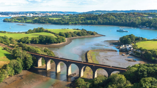
Tim and Josh have found a space for their Bowman 40, Artemis, which has a 1.5m draught, at Treluggan Boatyard which is five miles off the Tamar up the River Lynher.
The difficulty is that the river completely dries for the last three miles and doesn’t appear to have any formal buoyage (there is mention of some withies and posts).
The lift-out has been scheduled for 1630, an hour and a half before HW Springs.

Localization with the GeoGarage platform (UKHO raster nautical chart)

The yard manager assures them they’ll be able to negotiate the river at this time and has sent them some pilotage instructions, but they’ve checked the charts and aren’t so sure.
Navionics shows a relatively wide channel with drying heights of around 2m.


Navionics chart & zoom at the level of Treluggan Boatyard
The Imray chart uses a single line to depict the deepest part of the river (which corresponds with the yard’s instructions), but crosses a drying height of 3.3m.

Localization with the GeoGarage platform (Imray raster nautical chart)
They’d be making their passage with a height of tide of 4m so if the Navionics chart is correct, they’ll make it up but according to the Imray chart, they won’t.
What should they do?
Navigating a drying channel when the charts disagree
This question is really about how to navigate in areas with limited navigational data.
Tom and Josh have identified a discrepancy between three sources of information – the Navionics and Imray charts, and the yard manager – which is a good indicator that the charts here are a guide, not gospel.
When they visited the yard there were plenty of boats with similar draughts ashore, albeit most of them were smaller than a Bowman 40.
Tim and Josh need as much information as they can get to try and identify the run of the channel.
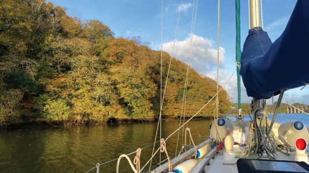
I would be suspicious of the wide channel shown by Navionics – usually the top of a muddy river has a narrow deep-water channel surrounded by steep mud banks, which corresponds more closely with the Imray chart and the advice from the yard manager.

Google Maps imagery
In the upper reaches of rivers, extra information might include Google Maps (with any luck, satellite view may show the river at low water), drone footage from YouTube, and even OS maps, which can be a good indicator of the baseline of the riverbed.
Owing to the lack of reliable chart data, they need to be prepared for a minor grounding.
Occasionally touching the edge of a mudbank at slow speed in a heavy, long-keeled yacht like a Bowman 40, would, in my mind, carry low risk of damage.
If they were doing this trip frequently in a lightweight yacht with a fin keel this would be different.
They need to monitor the echosounder constantly and keep speed to a minimum.
Less likely, but worth considering, would be a full stranding.
This is best avoided by approaching with plenty of flood tide remaining to float off.
An hour and a half before high water means there’s over a metre of tide left to rise, which should be plenty to get them out of a tricky situation.
However, I wouldn’t de-rig the deck in readiness for the haul out – the anchor needs to be ready to go and dinghy available, plus a headsail rigged which could be partially unfurled (and even backed) to induce a heel if necessary.
Carrying warm clothes and a few basic stores on board is always sensible; you never know quite how things might turn out.
Finally, I would set a snail trail with a high-resolution track on the plotter or a navigation app (Navionics does this very well), to help with getting out again when they relaunch.
If they note the height of tide at the time of the minimum reading on the echosounder, they’ll be able to calculate how much height of tide they need for the departure.
Sometimes a low water dinghy expedition can be useful, but with over 2 miles of drying approach channel they’d need to time this well and to have a reliable outboard.
If they do go ahead with a dinghy, a navigation app recording their track will be their best guide when they come in by yacht, though planting a withy or two would be the traditional way.
Although they have a modest draught, in my opinion a Bowman 40 is on the limits for this sort of creek-crawling venture.
It’s a heavy boat to manage if they do go aground, and backing sails, rowing out anchors and inducing heel all become more arduous.
However, with careful pilotage this is unlikely, and once they’re in, the yard is supremely sheltered so it’s a good place to overwinter.
Wednesday, September 9, 2026
Arteries of empires: Geopolitical siege and the new strategic map of maritime chokepoints

Illustration: TBS
From The Business Standard by Nasif Tanjim
Until global powers establish stronger, cooperative enforcement
mechanisms to protect maritime routes, the global economy will remain
deeply vulnerable to recurring disruptions, the costs of which are
ultimately borne by everyday consumers across the globe
The global economy is anchored to a remarkably fragile geometry of maritime trade routes increasingly vulnerable to geopolitical conflict.
Nearly 90% of global trade is transported by sea, representing 80% of international commerce by volume and more than 70% by value.
Squeezed through a handful of narrow natural straits and man-made canals, these maritime chokepoints serve as primary arteries for raw materials and finished goods.
However, when these channels become congested or closed due to wars, shipping accidents, or regional security threats, the global economy experiences immediate distress through soaring freight rates, delayed transits, and extreme market volatility.
In an era of escalating great-power rivalry and active warfare, these vital passages have increasingly been weaponised, exposing the severe limitations of international maritime law and forcing a fundamental reorganisation of global supply chain networks.
Battlefields on the water: The siege of Hormuz, Bab el-Mandeb and Suez
The ongoing military escalations in the Middle East demonstrate the terrifying vulnerability of the world's most critical energy and transit corridors.
The Strait of Hormuz, wedged between Iran and Oman, connects the Persian Gulf to the Arabian Sea.
Measuring 39 kilometres at its narrowest point, this strait handles 20–21 million barrels of crude oil daily — representing roughly a quarter of all seaborne oil — and 20% of global liquefied natural gas exports.
Yet, this pivot was shattered when the United States-Israeli war on Iran erupted on 28 February, 2026, prompting Tehran to effectively close the strait to almost all tankers.
This blockade has triggered severe disruptions, particularly penalising Asian energy importers.
For developing countries like Bangladesh, the crisis is acutely felt as domestic industries depend on the Hormuz and Bab el-Mandeb straits to ship vital energy and fertilizer supplies.
While Oman has proposed regional management and voluntary fees, Washington insists that unilateral closures violate transit passage rights guaranteed under the United Nations Convention on the Law of the Sea (UNCLOS).
Further south, the 32-kilometre-wide Bab el-Mandeb Strait, which connects the Indian Ocean to the Red Sea and Suez Canal, carries 12% of global trade.
Recent Houthi missile strikes on Saudi-affiliated and Western vessels have turned this transit into an active combat zone, forcing over 70% of Suez Canal traffic to detour.
Bypassing the 193-kilometre Egyptian canal via South Africa's Cape of Good Hope adds up to 4,000 nautical miles and 10 to 14 days of travel.
This structural detour inflicts a heavy economic toll, costing global trade $10.7 billion annually in delays and $3.4 billion in elevated freight costs, delaying vital energy and fertiliser deliveries by up to a month.
The Malacca bottleneck: Overcrowding at the throat of asia
The Strait of Malacca, running 500 miles between the Malay Peninsula and Sumatra, connects the Indian Ocean with the Pacific and South China Sea.
As East Asia's primary maritime highway, it carries 60% of global maritime trade and handles over 94,000 ship crossings annually.
It handles 23 million barrels of oil daily, making it the world's busiest oil transit chokepoint, even exceeding Hormuz.
Nearing its capacity limits, the corridor is expected to exceed safe operational thresholds by the end of the decade.
To mitigate this bottleneck, Thailand has proposed an ambitious 100-kilometre landbridge railway/road bypass to offload cargo and completely avoid the Malacca Strait.
Continental gatekeepers: Bosporus, Danish Straits and Gibraltar
In Europe, continental gatekeepers wield immense strategic leverage.
The Turkish Straits – the Bosporus and Dardanelles — are the sole link between the Black Sea and Mediterranean.
Measuring only 700 metres wide at its narrowest point, the Bosporus sees 55,000 transits annually.
Turkey regulates military passage through these waters under the 1936 Montreux Convention, a power actively invoked following Russia's 2022 invasion of Ukraine.
The Black Sea's vulnerability was underscored when blockaded ports severely disrupted global wheat and fertilizer supplies, driving food prices to historic highs.
Similarly, the narrow Danish Straits are the primary, highly contested gateway for Russian seaborne oil exports.
On Europe's western edge, the Strait of Gibraltar, ceded to Britain under the 1713 Treaty of Utrecht, remains a contested 13-kilometre borderland with Spain.

The Polar Silk Road: Hopes and hazards of the new Arctic shipping route
As climate change accelerates polar ice melting, the Arctic Ocean is transitioning from an impenetrable frozen wilderness into a highly contested commercial and military corridor.
Between 2024 and 2025, the extent of Arctic sea ice during its winter peak phase fell by 5.8%, marking the largest recorded drop in history and offering longer windows of summer navigability.
This ecological transformation has allowed China and Russia to deepen their strategic partnership by actively commercialising the Northern Sea Route (NSR) along Russia's Arctic coast.
Promoted by Chinese President Xi Jinping as the "Ice Silk Road", this polar corridor represents an appealing alternative to traditional southern routes.
Recently, the Chinese private shipping firm Sea Legend officially launched the first regularly scheduled seasonal container service connecting eastern China to Europe.
A test voyage demonstrated that a transit from Ningbo to the port of Felixstowe in eastern England takes just 20 days — slashing the 40 days required via the Suez Canal and avoiding the geopolitical disruptions plaguing the Middle East.
Logistically, the Arctic route is highly suitable for low-temperature, heat-sensitive and time-critical cargoes such as lithium-ion batteries and photovoltaic panels.
For Russia, the NSR is a vital economic lifeline to bypass Western sanctions.
Moscow has increasingly used the route to transport liquefied gas and crude oil from heavily sanctioned projects like Arctic LNG-2 and Yamal LNG directly to China.
Blacklisted Russian tankers frequently carry out ship-to-ship cargo transfers in secluded bays off the Kamchatka Peninsula to transport sanctioned gas directly to dedicated terminals in southern Chinese ports.
However, the Polar Silk Road is fraught with severe operational, environmental, and political hazards.
The route remains unpredictable and seasonal, as ice-free navigation is only possible during summer, and ships risk getting trapped in sudden ice formations, requiring expensive nuclear icebreaker escorts managed by Russia's state nuclear agency, Rosatom.
Furthermore, environmental organisations warn that increased shipping in the fragile Arctic ecosystem by older, poorly maintained vessels operating as part of Russia's shadow fleet significantly increases the risk of catastrophic oil spills and soot deposition, which accelerates localised melting.
Sovereignty and geopolitical control remain major friction points.
Permits to navigate the NSR are strictly controlled by Russia, meaning that transits are highly dependent on Moscow's political goodwill.
This expanding corridor has triggered deep military alarm among Western nations and Nato allies, who launched a specialised military mission named Arctic Sentry in February 2026 to curb Sino-Russian military projection.
Furthermore, the United States has signed a shipbuilding pact with Finland to rapidly expand its own icebreaker fleet to counter China's polar presence.
Private Chinese operators have had to establish new, small corporate entities to navigate the route to shield their larger parent companies from secondary Western sanctions associated with dealing with blacklisted Russian energy firms.
Ultimately, the Polar Silk Road remains a valuable strategic hedge for Beijing, rather than a year-round replacement for traditional shipping lanes.
The erosion of maritime law and the path to supply chain resilience
The systemic crises across the world's maritime corridors have exposed the fundamental limitations of international law in safeguarding global commerce.
The United Nations Convention on the Law of the Sea was designed on the optimistic assumption that strategic straits would remain open to free transit even during times of heightened political tension.
However, the weak enforcement mechanisms of international law have proven entirely insufficient when confronted with the immediate security interests of regional and global powers.
As coastal nations and militant groups continue to weaponise these chokepoints as leverage in geopolitical disputes, global supply chains must adapt to a more volatile and fragmented reality.
For international businesses and importing nations, the path forward requires a transition from just-in-time supply chains to highly resilient logistics strategies.
This transition involves maintaining larger emergency inventories, partnering with multiple transportation providers, and actively diversifying shipping routes to hedge against localised disruptions.
Until global powers establish stronger, cooperative enforcement mechanisms to protect these maritime commons, the global economy will remain deeply vulnerable to recurring disruptions, the costs of which are ultimately borne by everyday consumers across the globe.
Tuesday, September 8, 2026
Explainer: the Northwest Passage’s shipping potential, legal status, and what’s at stake
.png.webp)
Photo Credit Toggle
Alison J. Cook, Jackie Dawson, Stephen E. L. Howell, Jean E. Holloway & Mike Brady, Communications Earth & EnvironmentThe map shows all ship tracks 1990–2018 (grey lines), and shipping routes (four different line colors) along the Northwest Passage. Map republished under CC By 4.0 license from Cook, A.J., Dawson, J., Howell, S.E.L. et al. Sea ice choke points reduce the length of the shipping season in the Northwest Passage. Commun Earth Environ 5, 362 (2024). https://doi.org/10.1038/s43247-024-01477-6. Ship tracks from Pizzolato et al.; updated. Land relief from the International Bathymetric Chart of the Arctic Ocean V3 (IBCAO).
From Harvard Kennedy School by Justin Barnes
With climate change accelerating and global interest in transiting the Passage rising, the unresolved debate over the Northwest Passage's legal status could have geopolitical implications for North America and maritime claims elsewhere in the world.
Arctic Initiative Predoctoral Research Fellow Justin Barnes produced this explainer ahead of participating in the course Arctic Future Pathfinders, a part of the One Ocean Expedition. Justin sailed aboard the S/S Statsraad Lehmkuhl from Nuuk, Greenland, into Baffin Bay, until ice conditions forced the expedition to cancel its planned voyage through the Northwest Passage. We are grateful to UiT the Arctic University of Norway for supporting Justin's participation in the course. Learn more about Arctic Future Pathfinders.
The Northwest Passage (NWP or Passage) is a series of maritime routes that run through Canada’s Arctic Archipelago. European explorers began to seek the Passage in the 16th century as part of a shortcut between the Atlantic and Pacific Oceans to enhance trade with Asia, but a navigable route eluded them until the early 20th century due to thick sea ice and challenging conditions. Meanwhile, Inuit have lived and successfully navigated the land, waters, and ice of the NWP for time immemorial.
In recent decades, technological advances paired with the impacts of climate change on sea ice have made transiting the NWP more feasible under certain conditions, renewing interest in the Passage for shipping, tourism, and access to Arctic resources. The NWP is often hailed as a potentially valuable shortcut between East Asia and Western Europe – shaving upwards of 7,000km (~3,480 nautical miles) off the route through the Panama Canal – but unreliable conditions, sparse infrastructure, and high risks make its real-world value far less certain.
With climate trends accelerating and global interest in the Arctic rising, interest in transiting the NWP for shipping or military purposes could reignite an unresolved – yet peacefully managed – debate between Canada and the United States on the legal status of the NWP.
As strategic interests converge in the Arctic, important questions about the future of the NWP could arise: Who controls - or should control - these waters? How will Indigenous rights and voices shape the rules of transit through Inuit homelands, including areas previously frozen for centuries? Can navigation of the Passage be made safe without sacrificing fragile ecosystems? The answers to these questions could have geopolitical implications for North America, as well as the maritime claims of the United States, Russia, and China elsewhere in the world.
Is it possible to navigate the Northwest Passage?
The NWP is a network of possible routes passing through Canada’s Arctic Archipelago. It is possible to navigate through the NWP during certain parts of the year, but all routes are relatively narrow, shallow in places, and seasonally choked with shifting sea ice and icebergs flowing from higher latitude areas. Uncharted sea lanes along with limited marine support or response infrastructure pose significant hazards for regular shipping through the Passage. Although the NWP has seen an overall increase in vessel traffic in its various sections, the challenging geography and conditions mean that even in summer, navigation requires caution, ice-capable vessels, and often icebreaker escort.
Historically Impassable: For most of history, multi-year sea ice made the Passage effectively non-navigable year-round to European vessels. Norwegian explorer Roald Amundsen took three years to make the first complete journey through the Passage, finishing in 1906. From 1906 to 2006, only 69 complete voyages transited the NWP. It was not until 1944 that the NWP was transited during a single navigation season. However, in recent decades, global warming has dramatically reduced sea ice coverage; in summer 2007, the NWP experienced a record retreat in sea ice that marked the first full opening of the Passage in recorded history.
Experts Are Divided: Scientific projections strongly support the idea that the NWP will be open for shipping every summer for a window of time by mid-century. More recent studies have pushed back on this claim, however, suggesting that reductions in sea ice do not necessarily equate to increased ship navigability. A key 2024 study indicates that, despite recent changes along individual sections of the NWP, the overall shipping season along the route has instead been shortening since 2007. According to this study, multi-year ice is flushed southward from high-latitude regions, maintaining “choke points” along certain route sections and adding to the difficulty of routine shipping through the NWP. Nonetheless, transits are increasing as ice conditions become more navigable: it took 100 years to accumulate 69 transits, then just the next 5 years (2006–2010) to log another 69 transits.
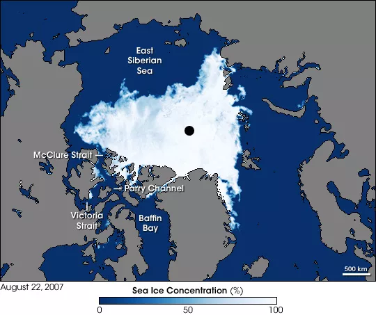
Photo Credit Toggle
NASA image created by Jesse Allen, using data obtained courtesy of the National Snow and Ice Data Center.This image shows sea ice around the Northwest Passage as observed by the Advanced Microwave Scanning Radiometer for EOS (AMSR-E) aboard NASA’s Aqua satellite on August 22, 2007. McClure Strait, Parry Channel, Victoria Strait, and McClintock Channel (north of Victoria Strait), all appear nearly ice-free. North of McClure Strait, an area of sea ice remains, but it is fragmented.
Who's Using It? Destination vs. Trans-Arctic Navigation: An Arctic Council report found that the number of unique ships entering the NWP area increased by 44% from 2013 – 2019 and the distance sailed by vessels increased by 107%. Most vessels operating in the NWP are re-supply cargo ships servicing communities and mines, local and commercial fishing vessels, tankers, tourist vessels (including pleasure craft), and military/research vessels, with pleasure crafts being the fastest growing sector by far. The majority of commercial ships operating in the NWP during this period were Canadian. The Scott Polar Research Institute’s record of “complete” transits by vessels that used the NWP to travel between the Atlantic and Pacific Oceans also shows a steady increase, with all-time highs reached in 2023 (41 transits) and 2024 (38 transits). Between 2020 – 2024, 117 “complete” transits took place, made up of 48 (41%) yachts or other private vessels, 39 (30%) commercial vessels, 28 (23%) passenger ships, and 2 (1.7%) research or survey vessels. Although the NWP has experienced an increase in both destination and trans-Arctic passages, both pale in comparison to the 36-38 ships that pass through the Panama Canal per day under normal operation.
Risky Business: The Passage is still a risky and uncertain corridor for regular commercial shipping due to unpredictable ice conditions, a lack of deep sea ports, poor charting relative to other passages, and high insurance costs. Comparisons to the Northern Sea Route, another passage along the Arctic coast of Russia, have made the case that the NWP is much more constrained and unpredictable. Shipping companies have been cautious, and few commercial ships (47) and passenger vessels (91) have ever attempted full transits. The overall increase in vessel traffic in the NWP could lead to an increase in accidents requiring an environmental and rescue response. A lack of support infrastructure and an overall decrease in highly strengthened ships operating in the Canadian Arctic more broadly exacerbates these risks.
Captain Wayne Duffet, Commander Corey Gleason, and Commander Michele Tessier of the Royal Canadian Navy explain the difficulties of operating in the harsh ice conditions of the Canadian Arctic.
The legal status of the Northwest Passage: International strait or internal waters of Canada and Inuit Nunangat?
The international legal status of the Northwest Passage remains unresolved. Canada maintains that the Passage lies within its internal waters, under full Canadian sovereignty. Whereas the United States has taken the position that it is an international strait, through which foreign vessels can transit freely without Canadian consent.
The U.S. Argument for an International Strait: The United States asserts that the NWP qualifies as an international strait under Article 37 of the United Nations Convention on the Law of the Sea (UNCLOS), arguing that the NWP connects the Atlantic and Pacific Oceans and thus must be treated as a strait with a right of transit passage for all nations. The U.S. position on international straits is that they do not depend on a waterway being ice-free or frequently used historically – if a passage connects two high seas/exclusive economic zone (EEZ) areas, it can be considered an international strait subject to transit rights. The United States has never accepted Canada’s historic waters claim and regularly reasserts that the Passage is an international waterway.
The Canadian Argument for Internal Waters: Canada’s position is that the NWP lies entirely within Canada’s territorial waters. In 1985, Canada drew baselines around its Arctic Archipelago that define the outer limit of Canada’s historic internal waters. Canada asserts that it has full sovereignty over the “historic internal waters” winding through the islands of the Arctic Archipelago that is based on historical exploration and effective governance of these waters. As part of this assertion, Canadian officials have emphasized that from time immemorial Inuit have used and occupied the waters and sea ice between these islands “as they have used and occupied the land,” which for Canada, strengthens its historic title.
Inuit – Historic Use and Indigenous Rights: Inuit in Canada emphasize that the NWP is inseparable from their homeland, Inuit Nunangat, and must not be regarded purely as an external or strategic waterway, necessitating legal recognition of Indigenous rights and Inuit-led co management in any governance or policy framework. Inuit assert that their continuous presence for millennia and relationship with the local environment establishes both ancestral rights and stewardship responsibilities. The Inuit Circumpolar Council (ICC) Canada has argued that the U.S. position is inconsistent with the United Nations Declaration on the Rights of Indigenous Peoples (UNDRIP), noting that Inuit have rights to the lands, waters, and ice they have “traditionally owned, occupied or otherwise used or acquired.” This position is based on treaties and constructive agreements between Inuit and the Government of Canada, including the Nunavut Land Claims Agreement among others, that “recognize both Inuit sovereignty and Canadian sovereignty over the Arctic, including the Northwest Passage.” The Inuit Tapiriit Kanatami’s (the national representation organization for Inuit in Canada) Nilliajut 2 report asserts that Inuit voices are essential in defining the Passage’s future, stating that “we must be consulted before any decisions are made and any research is done.”
Perspectives from Russia and China: Russia’s interpretation mirrors Canada's, which is central to its sovereign control over the Northern Sea Route. Parallels have also been made between the NWP debate and China’s claim that the Qiongzhou Strait in the South China Sea is part of China’s internal waters, an assertion that the United States formally rejects. However, the Chinese government has never explicitly recognized the Canadian position. China, as a self-proclaimed “near-Arctic state,” has been more cautious and ambiguous, formally respecting Arctic states’ jurisdiction but emphasizing international law and freedom of navigation as it pursues its “Polar Silk Road” across the Arctic.
Agree to Disagree? The U.S.-Canada 1988 Arctic Cooperation Agreement: Two diplomatic incidents - the transiting of the NWP by the U.S. tanker SS Manhattan in 1969 and the U.S. Coast Guard icebreaker Polar Sea in 1985 - sparked strong public and political reactions in Canada. In both instances, despite important contexts unique to each case, the United States did not formally request permission but coordinated with Canada throughout the passage.
To manage tensions, the two countries signed the 1988 Arctic Cooperation Agreement: the United States would notify Canada of voyages of American icebreakers conducting research while transiting the NWP without officially asking for permission, and Canada would grant consent routinely without the United States officially asking for it. The deal preserved both sides’ legal positions while serving as a model for Ottawa and Washington to manage the NWP disagreement. This has been described as a pragmatic “agree-to-disagree” framework that eased tensions but left the underlying legal debate unresolved.
For now, the official line on both sides remains unchanged. Some observers have proposed that the two nations find a mutually beneficial resolution (for instance, a joint management regime that acknowledges Canadian legal control while assuring innocent passage to foreign ships). Other experts feel that any negotiation could risk one side’s core interests, and that the existing compromise, ambiguous as it is, has worked without major incident. This longstanding debate has been generally well-managed, and so far, poses “no acute sovereignty or security concerns to Canada.”
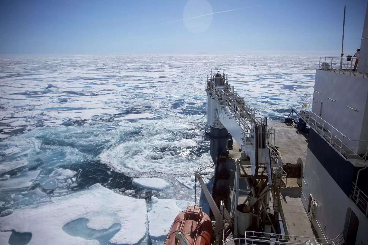
Photo Credit Toggle
AP Photo/David GoldmanThe Finnish icebreaker MSV Nordica, pushes through floating sea ice on the Victoria Strait while traversing the Northwest Passage in the Canadian Arctic Archipelago, Friday, July 21, 2017. The voyage was registered with Canadian authorities.
AP Photo/David GoldmanThe Finnish icebreaker MSV Nordica, pushes through floating sea ice on the Victoria Strait while traversing the Northwest Passage in the Canadian Arctic Archipelago, Friday, July 21, 2017. The voyage was registered with Canadian authorities.
Why does the legal status of the Northwest Passage matter?
Geopolitical Implications: Both the United States and Canada want to avoid creating unwanted precedents. For example, a concession by the United States in the NWP could undermine the U.S. stance against excessive maritime claims elsewhere in the world, as well as its own freedom of navigation in other strategically important regions. The United States maintains an active Freedom of Navigation Operations (FONOPs) program to contest such claims and preserve global maritime access.
North American Security: Some analysts note that unregulated access by potentially any nation’s vessels (including strategic rivals) could harm North American security. If the Passage is considered an international strait, there would also be an international air corridor above each of its routes. Foreign military or criminal vessels and/or aircraft might attempt to use it to transit through North America’s northern flank – a scenario that would be a major concern for both the United States and Canada. If Canada’s internal-waters claim were accepted, Canada could legally bar or strictly control foreign vessels and aircraft, preventing, for example, Russian or Chinese naval use of the Passage – a result the United States might quietly appreciate.
Environmental Protection: The possibility for increased shipping raises concerns over the impacts of oil spills and pollution on Arctic ecosystems. If the NWP is recognized as Canadian internal waters, Canada could continue to enforce its domestic laws and environmental standards. However, if it is instead treated as an international strait, Canada could only impose internationally approved environmental standards under UNCLOS, which are less strict than Canadian rules in certain areas. This distinction carries consequences for managing oil spill risks, protecting Arctic ecosystems, and safeguarding the food security of Indigenous communities that rely on marine resources.
Respect for Indigenous Rights: Deeming the NWP an international strait would have deep implications for Inuit, who hold legal agreements with the Government of Canada regarding co-management and self-government. It is unclear in this case how the respect for these rights could be negotiated into a multilateral agreement about the NWP, but a legal outcome that bypasses Indigenous input would undermine modern land claims agreements and UNDRIP.
Search and Rescue (SAR): SAR challenges in the NWP, like the North American Arctic broadly, result from minimal infrastructure, limited communication coverage, and harsh weather conditions. Long distances between communities, unpredictable sea ice conditions, and a lack of nearby ports or airfields mean that emergency response times can be dangerously slow. Currently, cooperative frameworks like the 2011 Arctic Search and Rescue Agreement mitigate these concerns, with Canada’s zone of responsibility covering the passages through its Archipelago while stipulating that these boundaries do not affect sovereignty claims. This arrangement ensures that regardless of the NWP’s legal status, Canada and its Arctic partners can effectively cooperate on SAR operations in the region. However, if the NWP is deemed an international strait, Canada could not deny vessels that do not meet its domestic standards, potentially straining Canada’s already limited capacity to respond to incidents.
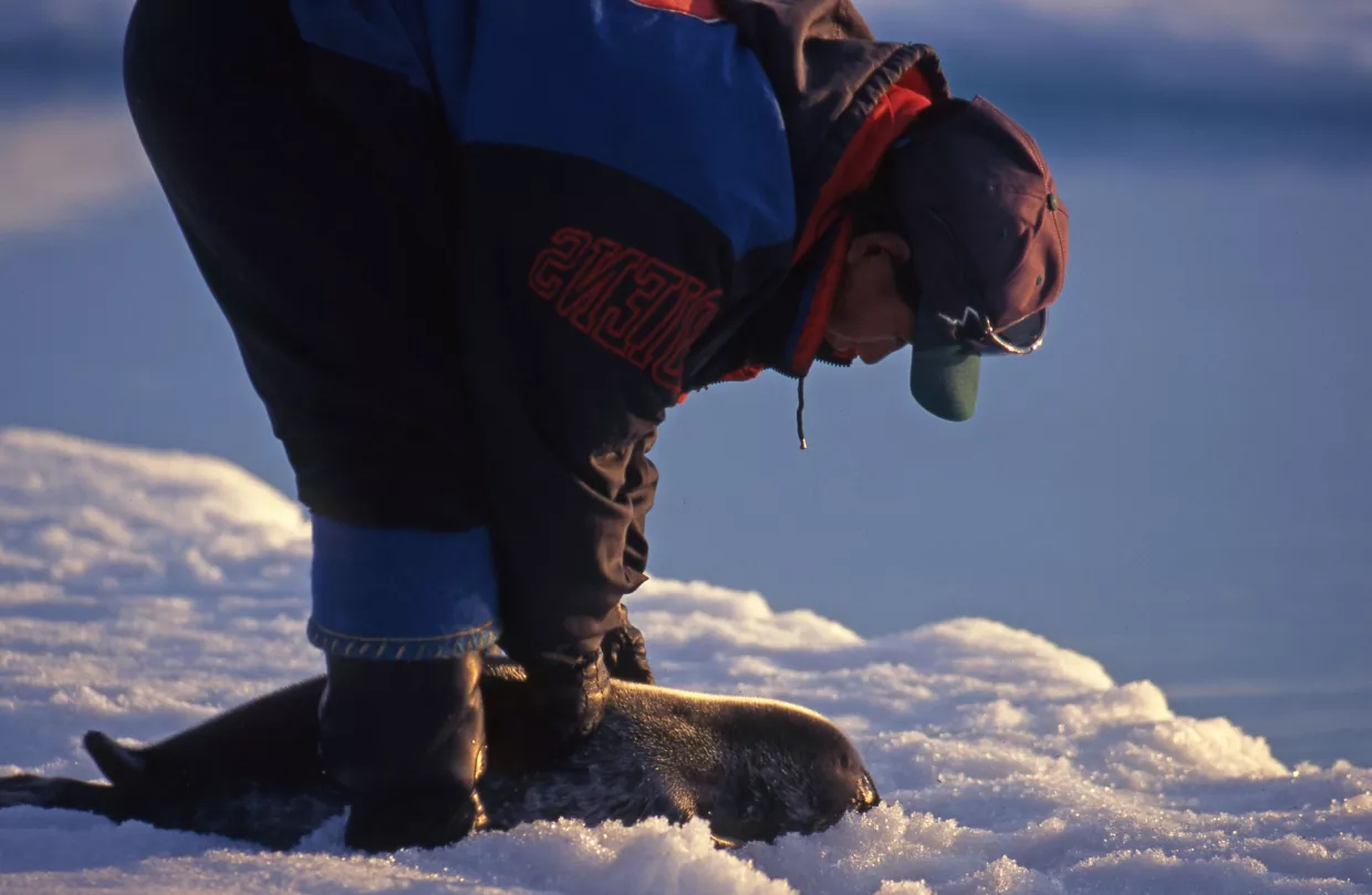
Photo Credit Toggle
Peter Prokosch via GRID-ArendalAn Inuit hunter captures a ring seal in Mittimatalik (Pond Inlet), Nunavut, Canada, where seal hunting on the sea ice is an important part of life. Inuit in Canada emphasize that the Northwest Passage is inseparable from their homeland. Increased ship traffic through the Northwest Passage could raise the risk of pollution and endanger the marine resources on which Indigenous communities rely.
Peter Prokosch via GRID-ArendalAn Inuit hunter captures a ring seal in Mittimatalik (Pond Inlet), Nunavut, Canada, where seal hunting on the sea ice is an important part of life. Inuit in Canada emphasize that the Northwest Passage is inseparable from their homeland. Increased ship traffic through the Northwest Passage could raise the risk of pollution and endanger the marine resources on which Indigenous communities rely.
Conclusion
At this time, both the United States and Canada “agree to disagree” on the status of the NWP. Looking forward, how the Passage is managed in the future will depend on the rate of change and whether collaborative frameworks continue to exist to manage different perspectives. Whether the NWP becomes a space of peaceful governance or contested access will depend on proactive diplomacy, and would benefit from a commitment to Indigenous co-management and continued investment in environmental protection and maritime safety.
Monday, September 7, 2026
Introducing WeatherNext 3, our most advanced and accurate global weather AI model
Our flagship AI weather forecasting model now includes real-time satellite data, hourly refreshes, higher resolution, precise precipitation forecasting, and clean energy variables.
It’s now integrated across Search, Gemini, Maps, Google Maps Platform, and Cloud.
Every day, the weather influences billions of decisions.
Some are as simple as grabbing an umbrella before heading out the door, but others are far more consequential.
Wind, rain, and extreme weather events, like heatwaves and droughts, have cascading impacts across agriculture, global supply chains, clean energy production, and national economies.
In recent years, AI has revolutionized weather forecasting, using historical records to make faster and more accurate predictions than traditional methods.
Yet predicting highly local and rapidly changing weather has remained a challenge.
Previous models often lacked sufficient spatial resolution, and struggled to incorporate real-time weather data from sources like satellites.
Today, Google DeepMind and Google Research are introducing WeatherNext 3, the most advanced and accurate global weather model to date, according to independent live evaluations by Brightband.
Our model learns directly from real-time observations, enabling it to provide timely and more localized predictions for the weather events that impact people the most.
By using raw satellite data to produce a forecast every hour in high resolution, our model makes reliable forecasts accessible across Google products worldwide.
Predicting the weather is one of the oldest, most complex challenges we face.
Traditional numerical weather prediction models are powerful, but they can be slow to run and costly at a global scale.
WeatherNext 3 takes a different approach.
Built on a fundamentally different architecture, WeatherNext 3 learns directly from real-world observations, including live satellite feeds and ground-level weather station data.
What makes WeatherNext 3 different?
What makes WeatherNext 3 different?
Hourly refresh: While traditional models typically refresh every six hours, WN3 produces a fresh forecast every single hour.
Hyper-Local resolution: Native 5km resolution for temperature and humidity, enabling better detail for coastal regions, mountains, and urban areas.
Actionable data: Includes variables like 100m wind speeds for wind energy management and detailed cloud/radiation metrics for solar energy planning.
Global reach: Delivering high-resolution insights everywhere.
You can now use WeatherNext 3 through Google Search, Gemini, Google Maps and more.
Rapid weather prediction at unprecedented resolution
A forecast's utility often comes down to detail and how finely it resolves both time and space.
WeatherNext 3 generates hourly forecasts at multiple spatial resolutions, maintaining physical consistency from broad global wind patterns all the way down to local topography.
With WeatherNext 3, we can visualize key surface variables — like temperature and moisture — at a 5-kilometer resolution, other surface variables at 10 kilometers, and atmospheric variables, like wind speed, at 25 kilometers.
Overall, this provides a global weather picture roughly five times sharper than our previous model, WeatherNext 2, which produced forecasts on a 25-kilometer grid in 6-hour increments.
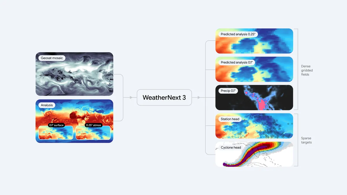
Figure 1: The end-to-end WeatherNext 3 system architecture.
The model ingests live 1-hour geostationary satellite mosaics alongside traditional historical analysis to feed a single, flexible Functional Generative Network (FGN) mesh transformer.
It outputs dense gridded fields, discrete cyclone tracks, and predicts station-level sparse coordinates natively.
Figure 2: Comparison of 2-meter temperature forecasts over the UK.
WeatherNext 2 (left) at 25-kilometer (0.25°) resolution vs.
WeatherNext 3 (right) at a native 5-kilometer (0.05°) resolution.
WeatherNext 3 resolves the intricate local topography, preventing the pixelated, over-smoothed thermal representations seen in older models.
WeatherNext 2 (left) at 25-kilometer (0.25°) resolution vs.
WeatherNext 3 (right) at a native 5-kilometer (0.05°) resolution.
WeatherNext 3 resolves the intricate local topography, preventing the pixelated, over-smoothed thermal representations seen in older models.
Real-world data at continuous global scale
WeatherNext 3's biggest leap forward is what it learns from.
Most AI weather models, including WeatherNext 2, are trained on data from numerical weather prediction (NWP) models.
Although useful, NWP models are complex, supercomputer-driven physics simulations that carry a six-hour data lag.
This lag can lead to biases for fast-changing variables like rain or surface temperature.
By ingesting a mosaic of live, global geostationary satellite data, our new model gains a rich, continuously updating view of the atmosphere.
This allows the model to generate a new forecast every hour, each one grounded in the most recent satellite observations available, at up to 5-kilometer resolution.
This is important because critical weather develops fast.
When storms, fronts, or precipitation systems materialize suddenly, our rapid update cycle and higher resolution provides earlier, more detailed insights needed to help drive an effective response.
Some variables, like temperature and humidity, can fluctuate dramatically over just a few kilometers, which is particularly relevant for communities near coastlines, valleys, or mountain ranges.
Traditional models struggle here because they train on representations of the atmosphere that lack detail and miss extreme local variations.
To address this, WeatherNext 3 instead trains directly on sparse weather station observation data.
This allows us to make global forecasts on a 5-kilometer grid that account for regional details like topography.
This breakthrough is particularly vital for regions across Latin America, Africa, and Asia-Pacific that have historically been underserved by high-resolution forecasting due to the immense supercomputing costs of traditional regional models.
It brings localized, high-fidelity forecasting to billions of people and local businesses in these areas.
Beyond improved resolution and forecast frequency, our model introduces predictions specifically engineered for renewable energy production.
The model forecasts 100-meter wind speeds (roughly at turbine-height) for precise wind-energy output, alongside high-resolution cloud cover and sun radiation levels to help solar farms estimate how much light they will receive on the ground.
This data is crucial for global clean energy planning, allowing grid operators and renewables developers to accurately predict how much power their clean energy assets will generate and match it with consumer demand.
Precipitation forecasting at breakthrough accuracy
Global weather models notoriously struggle to accurately predict precipitation.
Rain and snow systems are driven by fast-moving cloud processes on tiny scales that are hard to model accurately using traditional physics-based simulations.
Consequently, AI forecasts often produce blurry estimates or miss the boundaries of severe storms entirely.
To solve this, we train our model on two exceptionally high-quality sources of precipitation data: NASA’s satellite-based Integrated Multi-satellite Retrievals for GPM (IMERG) and our own global precipitation reanalysis based on satellite radar.
The result is a significant leap in precipitation forecasting accuracy.
In medium-range global forecasts, evaluations against baselines show a Continuous Ranked Probability Score (CRPS) improvement of up to 60% against IMERG, 30% for MRMS, and 10% against rain gauge measurements for early lead times.
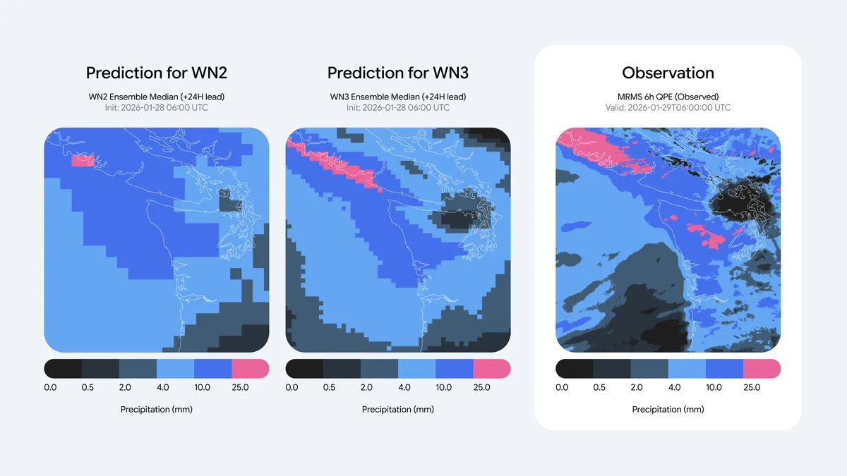
Figure 3: Medium-range probability of precipitation (PoP > 1mm) forecast comparison.
WeatherNext 2 (left) at 25-kilometer resolution shows a highly diffused and pixelated precipitation footprint.
WeatherNext 3 (middle) at 11-kilometer resolution closely mirrors the actual satellite ground truth (right), accurately capturing the sharp, convective bands of the weather systems.
Research applied across the ecosystem
Our primary goal is to advance weather intelligence to make it universally useful — whether for an emergency responder tracking sudden wind shifts, an air traffic controller planning flight paths, or a farmer managing crops.
To bring these breakthroughs out of the lab and into the real world, we’re integrating WeatherNext 3 across Google’s core ecosystem and beyond:High-resolution forecast data: We’re making global weather predictions, updated hourly and ready to integrate into your workflows with no model setup required.
This enables researchers, developers and businesses to query the data in BigQuery and Earth Engine, or bulk-download from Google Cloud Storage.
Available globally: WeatherNext 3 will begin powering weather experiences within Google Search, Gemini app, Google Maps, Google Maps Platform Weather API, and Google Earth Engine starting today.
The update dramatically improves longer term forecasts.
When planning a day or more ahead, people will see up to 50% more accurate precipitation forecasts — with the greatest improvements in regions where forecasts have historically been less reliable.
So if you’re packing for a weekend trip or deciding the best day for an outdoor activity, you’ll now get more accurate predictions to help you plan.
The atmosphere will always retain a degree of unpredictability.
However, by training on real-world observations and bypassing traditional modeling constraints, WeatherNext 3 brings us closer to a future where forecasts truly match what is happening on the ground.
To learn more about geospatial platforms and AI work at Google, check out Google Earth Engine, AlphaEarth Foundations, and Earth AI.
Disclaimer: For official weather forecasts, severe weather warnings, and public safety advisories, please refer to your local meteorological agency or national weather service.
Learn more about WeatherNext 3 Read our paper
Build with WeatherNext 3

Explore Weather Lab to see WeatherNext 3 visualized in real-time
See where WeatherNext 3 ranks on independent live leaderboards from Brightband.
Links :
- Google : WeatherNext 3: Increasing resolution and WeatherNext 3: Increasing resolution and performance of global weather models withraw observations / WeatherNext: AI model achieves breakthrough in forecasting cyclones
- Bloomberg : DeepMind's new AI weather model goes hourly for power markets
- NewsCord : Google DeepMind Unveils WeatherNext 3 With Hourly, Higher-Resolution Satellite Forecasts
Sunday, September 6, 2026
Inside Earth’s most remote island: ‘Almost untouched by humans’
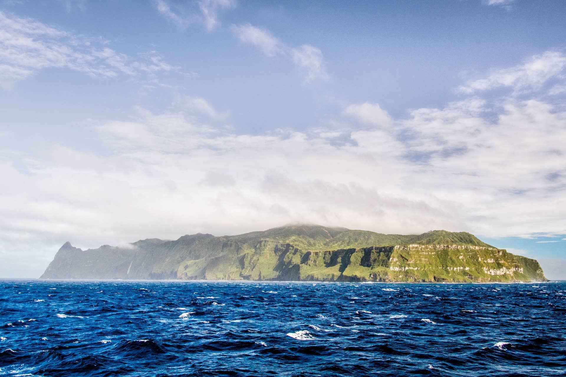
Tristan da Cunha sits thousands of kilometers from anywhere.
Inside the tiny community that shares every job, lives with penguins and whales, and rarely sees visitors
Inside the tiny community that shares every job, lives with penguins and whales, and rarely sees visitors
Tristan da
Cunha, the world’s most remote inhabited island.
Getty Images
From Surfer by Dashel Pierson
Tristan da Cunha is considered the world’s most remote inhabited island.
National Geographic: Tristan da Cunha is 2,700 km from South Africa, 3,700 km from South America.
Isolation shapes daily life; residents share tasks due to limited population and resources.

Looking at a map, just about halfway between the vast South Atlantic Ocean between the African and South American continents, there lies a remote, lonely island.
Actually, there’s a couple.
They’re part of a British overseas territory, but only one of them is inhabited by a small group of people, Tristan da Cunha, and for a long time it’s been dubbed the world’s most remote inhabited island.
They even have a sign.
Actually, there’s a couple.
They’re part of a British overseas territory, but only one of them is inhabited by a small group of people, Tristan da Cunha, and for a long time it’s been dubbed the world’s most remote inhabited island.
They even have a sign.
So, which is it?
While the armchair geographer above posits that the Pitcairn Islands are the world’s most remote, many in the greater geography world still give Tristan da Cunha the title.
While the armchair geographer above posits that the Pitcairn Islands are the world’s most remote, many in the greater geography world still give Tristan da Cunha the title.
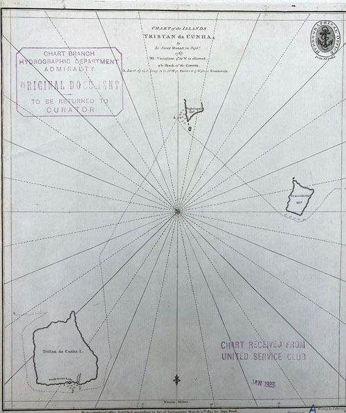
According to National Geographic:
“Tristan da Cunha, the most remote inhabited island in the world, is over 2,700 kilometers from South Africa and 3,700 kilometers from the nearest shores of South America.
Sitting between the South Atlantic Current to the north and the Antarctic Circumpolar Current to the south, the volcanic island and its archipelago are a hotspot of endemic biodiversity both on land and at sea.
“Among the wildlife found here are seven-gill sharks, blue sharks, shortfin mako sharks, southern right whales, fin whales, humpback whales, sperm whales, dolphins, elephant seals, and albatrosses, as well as 200,000 rockhopper penguins, more than five million shearwaters, and 300,000 sub-Antarctic fur seals.”
In addition to the small human community, Tristan da Cunha is also home to roughly 90% of the world’s endangered Norther Rockhopper penguin population.
This species, most likely, were the inspiration for the penguins in the animate movie, Surf’s Up.
See the uncanny resemblance below.
 Rockhopper penguin (Eudyptes chrysocome moseleyi) Gough Island, South Atlantic, Islands in the southern oceans
Getty Images
So, what’s life like on the world’s most remote uninhabited island?
Per NPR:
“Extreme isolation has shaped every part of life on Tristan.
With no airport and only a handful of ships visiting every year, residents say they rely largely on themselves — and each other — to keep life on the island running.
“With so few residents, there are simply too few people for all the jobs that need doing.
When someone is off island or unwell, others have to fill in, whether that means covering shifts, running errands or slaughtering a cow.
The limited labor pool means skills are shared and tasks are stretched across families, making daily life a constant balancing act.”
If you ever need to disappear, and start over in life, now you know where to go.
“Extreme isolation has shaped every part of life on Tristan.
With no airport and only a handful of ships visiting every year, residents say they rely largely on themselves — and each other — to keep life on the island running.
“With so few residents, there are simply too few people for all the jobs that need doing.
When someone is off island or unwell, others have to fill in, whether that means covering shifts, running errands or slaughtering a cow.
The limited labor pool means skills are shared and tasks are stretched across families, making daily life a constant balancing act.”
If you ever need to disappear, and start over in life, now you know where to go.
Links :