
From Ciel&espace


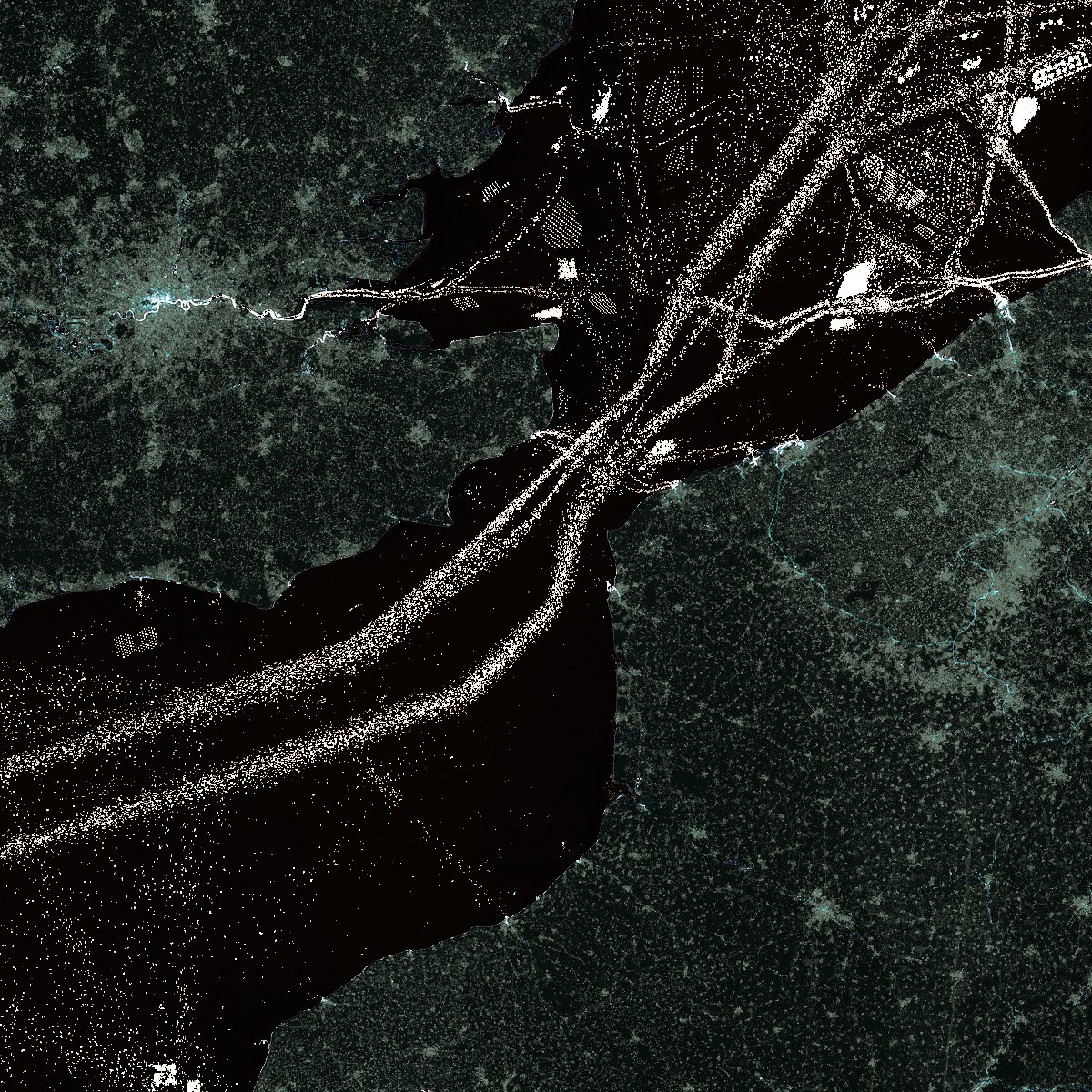 The Channel maritime motorway has two lanes to avoid collisions between the many ships using it.
The North Sea is studded with pre-polar installations and wind farms. Credit: ESA.
Already in 2019, the European Space Agency had published a similar image that accumulated photos taken over three years, between 2016 and 2018.
The English Channel in 2020, as seen by @CopernicusEU's Sentinel-1 imaging radar. This maximum reflectivity composite shows the year in shipping lanes, offshore wind farms, &c. pic.twitter.com/9WjxEkDcB1
— Tim Wallace (@wallacetim) December 31, 2020
In the 2020 image, which was broadcast on 31 December on Twitter by journalist Tim Wallace of the New York Times, in addition to the cargo ships transiting the English Channel, the ferries sailing between Calais and Dover were also shown, as well as the wind farms installed at sea, which drew geometric patterns.
No comments:
Post a Comment