 Nitrogen dioxide emissions over the Mediterranean
From ESA
For the first time, scientists, using data from the Copernicus Sentinel-5P satellite, are now able to detect nitrogen dioxide plumes from individual ships from space.
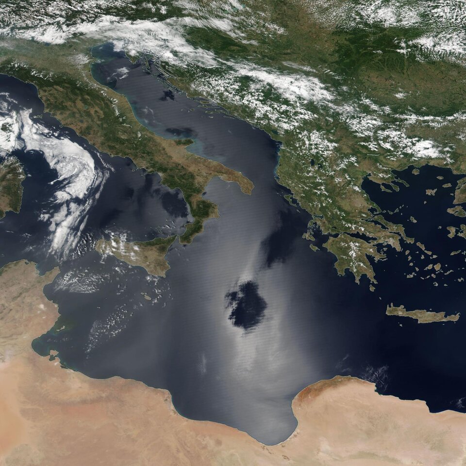
Maritime transport has a direct impact on air quality in many coastal cities. Commercial ships and vessels burn fuel for energy and emit several types of air pollution as a by-product, causing the degradation of air quality.
A past studyestimated that shipping emissions are globally responsible for around 400 000 premature deaths from lung cancer and cardiovascular disease, and 14 million childhood asthma cases each year.
For this reason, during the past decade, efforts to develop international shipping emission regulations have been underway.
For this reason, during the past decade, efforts to develop international shipping emission regulations have been underway.
Since January 2020, the maximum sulphur dioxide content of ship fuels was globally reduced to 0.5% (down from 3.5%) in an effort to reduce air pollution and to protect health and the environment. It is expected that the nitrogen dioxide emissions from shipping will also become restricted during the coming years.
Monitoring ships to comply with these regulations is still an unresolved issue.
Monitoring ships to comply with these regulations is still an unresolved issue.
The open ocean covers vast areas, with limited or no capacity to perform local checks.
This is where satellites, such as the Copernicus Sentinel-5P satellite, come in handy.
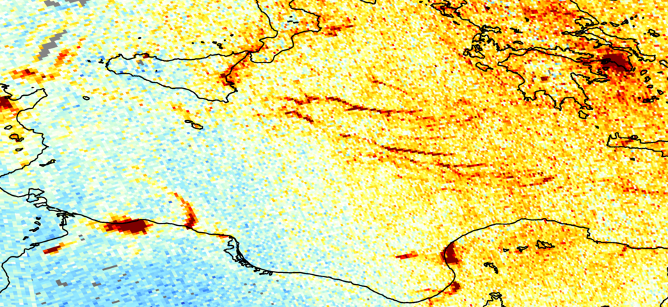
Nitrogen dioxide concentration patterns under sun glint conditions
Until recently, satellite measurements needed to be aggregated and averaged over months or even years to discover shipping lanes, limiting the use of satellite data for regulation control and enforcement.
Only the combined effect of all ships could be seen, and only along the busiest shipping lanes.
In a recent paper, an international team of scientists from the Royal Netherlands Meteorological Institute (KNMI), Wageningen University, the Human Environment and Transport Inspectorate of the Ministry of Infrastructure and Water Management, the University of Thessaloniki and the Nanjing University of Information Science & Technology, have now discovered patterns in previously unused ‘sun glint’ satellite data over the ocean that strongly resemble ship emission plumes.
In a recent paper, an international team of scientists from the Royal Netherlands Meteorological Institute (KNMI), Wageningen University, the Human Environment and Transport Inspectorate of the Ministry of Infrastructure and Water Management, the University of Thessaloniki and the Nanjing University of Information Science & Technology, have now discovered patterns in previously unused ‘sun glint’ satellite data over the ocean that strongly resemble ship emission plumes.
Sun glint occurs when sunlight reflects off the surface of the ocean at the same angle that a satellite sensor views it.
As water surfaces are irregular and uneven, the sunlight is scattered in different directions, leaving blurry streaks of light in the data.
Satellite algorithms tend to mistake such bright surfaces for cloudiness, which is why, for a long time, sun glint was considered a nuisance in satellite measurements.
Differentiating clouds from other bright reflective surfaces such as snow, clouds or even sun glint over the ocean surface has proven difficult – until now.
In a study published last year, scientists were able to differentiate snow and ice from clouds by measuring the height of the cloud and comparing it with the surface elevation.
If the height of the cloud is found to be sufficiently close to the surface, it can be considered either snow or ice, rather than cloud coverage.
When applying the same method for sun glint over oceans, the team were able to easily identify and attribute emissions from individual ships in daily Sentinel-5P measurements.
When applying the same method for sun glint over oceans, the team were able to easily identify and attribute emissions from individual ships in daily Sentinel-5P measurements.
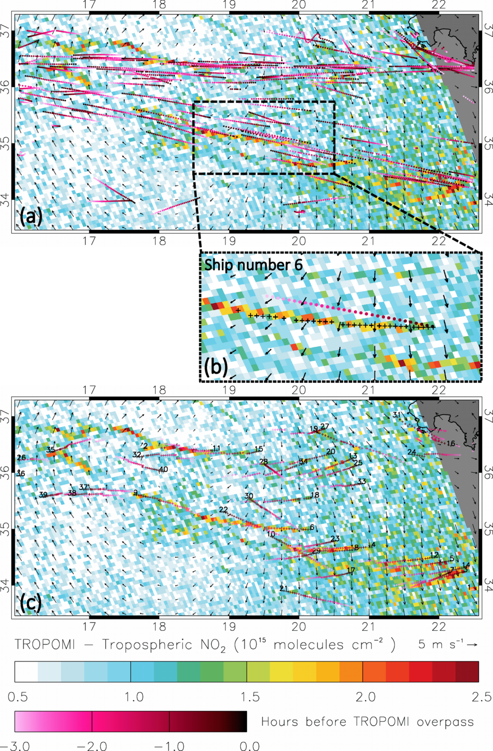
Aris Georgoulias, from the University of Thessaloniki, commented, “By combining these measurements with ship location information, and taking into account the effect of wind blowing emission plumes away from ship smoke stacks, we could show that these structures almost perfectly matched the ship tracks.”
“For now, only the largest ships, or multiple ships travelling in convoy, are visible in the satellite measurements,” added Jos de Laat, from KNMI.
“Ship tracks from small ships never aligned with these emission plume structures, unless their tracks crossed the track of larger ships or large shipping lanes, or a small ship travelled in a busy shipping lane.”
Claus Zehner, ESA’s Sentinel-5P Mission Manager, commented, “We think that these new results demonstrate exciting possibilities for the monitoring of ship emissions in support of environmental regulation from space. Future planned satellite missions with improved spatial resolution, for example the Copernicus Anthropogenic Carbon Dioxide Monitoring satellites, should allow for the better characterisation of nitrogen dioxide ship emission plumes and, possibly, detection of smaller ship plumes.”
No comments:
Post a Comment