Even in the perpetual darkness of the deepest ocean, scientists discover the discarded rubbish of modern life.
Saturday, April 22, 2017
Friday, April 21, 2017
The pristine Arctic has become a garbage trap for 300 billion pieces of plastic
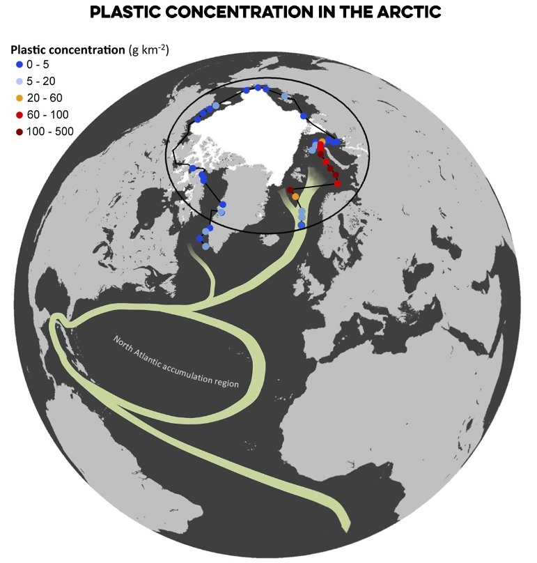
Here’s a map the researchers provided, showing the
ocean circulation in the Atlantic and where that, in turn, has delivered
plastic particles:
Locations and plastic concentrations of the sites sampled.
Locations and plastic concentrations of the sites sampled.
The white area shows the extension of the polar ice cap in August 2013, and green curves represent the North Atlantic Subtropical Ocean Gyres and the Global Thermohaline Circulation poleward branch.
(Andres Cozar)
From The Washington Post by Chris MooneyDrifts of floating plastic that humans have dumped into the world’s oceans are flowing into the pristine waters of the Arctic as a result of a powerful system of currents that deposits waste in the icy seas east of Greenland and north of Scandinavia.
In 2013, as part of a seven-month circumnavigation of the Arctic Ocean, scientists aboard the research vessel Tara documented a profusion of tiny pieces of plastic in the Greenland and Barents seas, where the final limb of the Gulf Stream system delivers Atlantic waters northward.
The researchers dub this region the “dead end for floating plastics” after their long surf of the world’s oceans.
The researchers say this is just the beginning of the plastic migration to Arctic waters.
“It’s only been about 60 years since we started using plastic industrially, and the usage and the production has been increasing ever since,” said Carlos Duarte, one of the study’s co-authors and director of the Red Sea Research Center at the King Abdullah University of Science and Technology in Saudi Arabia.
“So, most of the plastic that we have disposed in the ocean is still now in transit to the Arctic.”
A seal lies on an iceberg in front of the research vessel Tara.
The nonprofit organization Tara Expeditions has been active since 2003, sailing across the world's oceans to study biodiversity, the impacts of climate change and other research topics. In 2013, the schooner sailed around the Arctic Ocean to collect plastic debris floating in the water.
photo : Anna Deniaud / Tara Expeditions Foundation
photo : Anna Deniaud / Tara Expeditions Foundation
The results were published Wednesday in the journal Science Advances.
The study was led by Andrés Cózar of the University of Cádiz in Spain along with 11 other researchers from universities in eight nations: Denmark, France, Japan, the Netherlands, Saudi Arabia, Spain, the United Kingdom and the United States.
The researchers estimated that about 300 billion pieces of tiny plastic are suspended in these Arctic waters right now, although they said the amount could be higher.
And they think there is even more plastic on the seafloor.
Tara Oceans expedition route
Several factors support the idea that the plastic entered these waters via ocean currents rather than local pollution.
First, the Arctic has a very small population that is unlikely to directly contribute so much waste. Also, the aged and weathered state of the plastic, and the tiny size of the pieces found, suggested that it had traveled the seas for decades, breaking down along the way.
“The plastic pieces that may have been initially inches or feet in size, they have been brittled by exposure to the sun and then fragmented into increasingly smaller particles, and eventually led to this millimeter-size plastic that we call microplastic,” Duarte said.
“That process takes years to decades. So the type of material that we’re seeing there has indications that it has entered the ocean decades ago.”
Manta net used to collect microplastics
© Anna Deniaud / Tara Expeditions Foundation
Finally, the study didn’t find much plastic in the rest of the Arctic ocean beyond the Greenland and Barents seas, also suggesting that currents were to blame.
Instead the plastic had accumulated where the northward-flowing Atlantic waters plunge into the Arctic depths. Presumably, the plastic then lingers at the surface.
The Greenland and Barents seas contained 95 percent of the Arctic’s plastic, the research found (the ship sampled 42 sites across the Arctic Ocean).
The Barents Sea happens to be a major fishery for cod, haddock, herring and other species.
A key question will be how the plastic is affecting these animals.
Here’s a collage that the researchers provided showing the types of plastic they found:
Photo collage of plastic fragments found in the
Arctic Ocean.
Although plastic debris was scarce in most of the Arctic
waters, it reached high concentrations in areas of the Greenland and
Barents seas. (Credit: Andres Cozar)
The study’s results sent a troubling message to one researcher who has also focused on the consequences of plastic debris in the oceans and other waterways.
“Isn’t it kind of ironic that days before Earth Day there is more demonstrated proof of widespread contamination of our plastic waste in places that are so far from the human footprint and thus locations we consider to be pristine,” said Chelsea Rochman, a marine ecologist at the University of Toronto who was not involved in the study but praised it as “a great contribution to the field.”
The ocean circulation system in the Atlantic responsible for this plastic transport is part of a far larger “thermohaline” ocean system driven by the temperature and salt content of oceans.
It is also often called an “overturning” circulation because cold, salty waters sink in the North Atlantic and travel back southward at deep ocean depths.
Researchers, including Duarte, previously found that plastic slowly travels the world’s oceans but tends to linger in five “gyres,” or circular ocean currents in the subtropical oceans in both the northern and southern hemispheres.
One of those gyres is located in the Atlantic, which then feeds the Arctic.
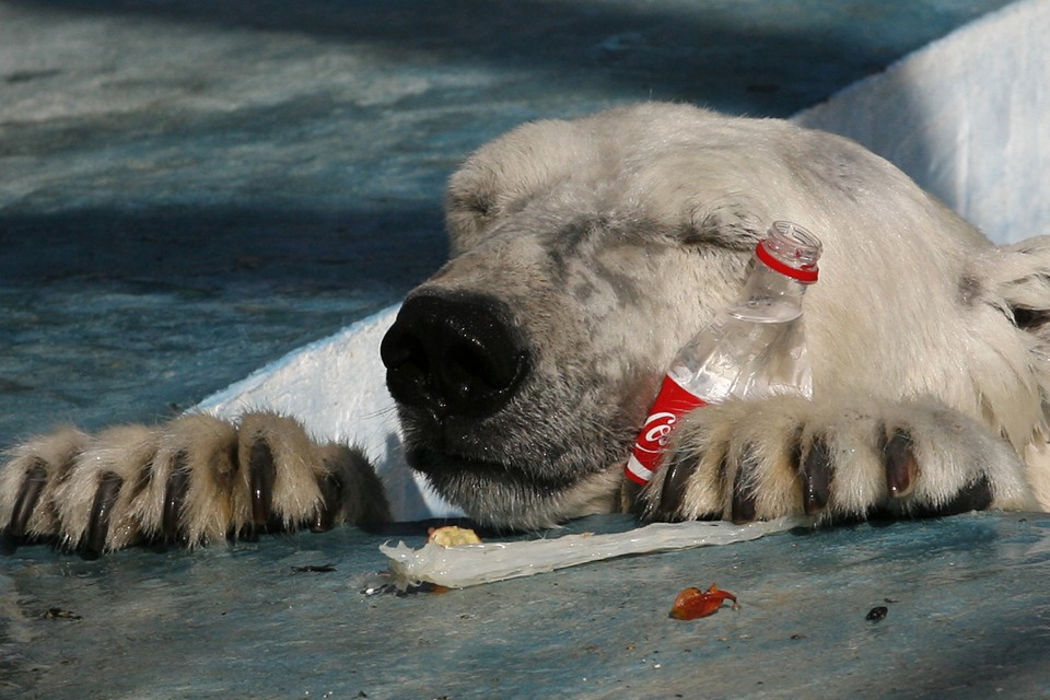
Aurora, a three-year-old polar bear, was found with her sister in the Arctic Ocean in May 2010 and brought to the Royev Ruchey Zoo in Siberia.
photo : Ilya Naymushin / Reuters
Scientists noted that the vast majority of ocean plastic becomes lost before it reaches the Arctic.
They aren’t sure where most of the plastic falls out and are researching to determine those locations.
“The plastic that escapes those traps is the one that actually makes it into the Arctic,” Duarte said.
“But when it enters the Arctic, there is no way out, it just stays there and is stuck there.”
Because it takes such a long time for plastic to travel across the world in ocean currents, the study concludes that the current waste is largely the work of North Americans and Europeans, who dumped it in the Atlantic.
Waste from other parts of the world that dump huge volumes of plastic into the oceans is still in transit.
Rochman said she feared that as the Arctic becomes more accessible because of ice melt linked to climate change, more plastic could wash in.
“As the ice melts, we may see increasing concentrations of plastic in the Arctic due to the opening of passageways for vessels and plastics in surface currents,” she said, “as well as plastics in the ice becoming free to float and interact with marine animals upon melting.”
Links :
Thursday, April 20, 2017
A banned Indian island: Watch video of Sentinelese tribe rejecting attempts at communication
After numerous failed attempts to make
contacts with the Sentinelese tribe since 1964, the Indian government
has finally backed away.
From Indian Express
Surprisingly there has been only one instance when outsiders didn't have to face a hostile reception.
A rare footage of the Sentinelese, one of the last uncontacted tribes in the world, has emerged, showing its members on the beaches of North Sentinel Island in Andaman & Nicobar.
North Sentinel Island with the GeoGarage platform (NGA chart)
Little is known about their exact population and could reportedly have as low as 40 members or as high as 500.
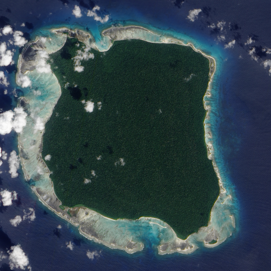
North Sentinel island, NASA
Efforts to reach out to them have been met with hostility and there are several horror stories of how Sentinelese have treated their guests.
People return from the island either injured or not at all. In 2006 two fishermen, aged 48 and 52, were killed after they slept overnight in their boat near the North Sentinel island.
Following the 2004 tsunami, helicopters from the Indian Coast Guard were sent to drop food parcels, but this tribesmen responded by firing an arrow at the rescue team
They were hostile even during emergency rescue missions after Tsunami in 2004 as gifts, food and clothing are of no importance to them.
A photo was captured of one of the tribesmen taking aim at a rescue helicopter with an arrow.
According to a video footage which is a part of a documentary by LoveBite Productions on the Sentinelese tribe, an Indian anthroplogist T N Pandit who conducted several government trips to the island in the late 80’s and the early 90’s in an attempt to reach out confessed, “Sometimes they would turn their backs and sit on their haunches as to defecate. This was meant to insult us as we were not welcomed. It doesn’t matter if you are a friend or an enemy or you arrive at the island’s shores by purpose or by accident, the locals would greet you the same way with spears and arrows.”
Surprisingly there has been only one instance when outsiders didn’t have to face a hostile reception.
On January 4, 1991, 28 people which included men, women and children approached Pandit and his team saying the tribe voluntarily came forward to meet them.
However, after numerous failed attempts to make contacts with them since 1964, the Indian government has finally backed away.
In 2005, the administration of Andaman & Nicobar stated that they have no intention of interfering with the lifestyle of the Sentinelese tribe or pursuing any further contact with them.
Also, the Indian navy enforced a 3 mile buffer zone to keep tourists and explorers away.
Links :
- YouTube : First Out of Africa - The totally isolated Tribe of the Andaman (Sky Vision Documentary)
- DailyMail : The world's last isolated humans: Rare footage captures members of the hostile island tribe who shun aid and KILL visitors on sight / Land of the lost tribe: The Indian Ocean island that is home to a community who have lived there for 60,000 years... but is too dangerous to visit because they try to kill outsiders
Wednesday, April 19, 2017
Climate change to deliver regular flooding to Europe
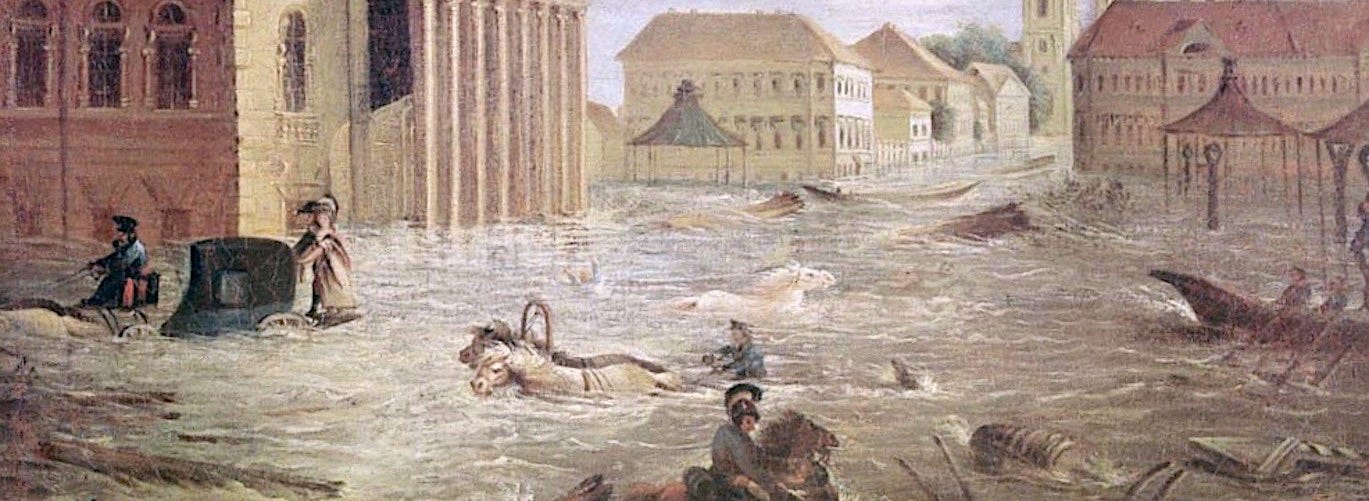
The 1824 flooding for St. Petersburg, Russia.
Once-a-century floods could become commonplace as the planet heats up.
From NexusMedia by Marlene Cimons
Sea-level rise threatens coastal communities.
The
kind of devastating flooding that occurs once every century along
Europe’s northern coastline could become an annual event if greenhouse
gas emissions continue to climb, according to a recent study published in the journal Earth’s Future.
New
analysis takes into account changes in sea-level rise, tides, waves and
storm surge over the 21st century and found that climate change could
prompt extreme sea levels — the maximum levels seen during major storms,
which produce massive flooding — to increase significantly along the
European coastline by 2100.
This
scenario will likely stress coastal protection structures beyond their
capacity, leaving much of the European coastline vulnerable to dangerous
flooding, according to study authors.
“Unless
we take different protection measures, five million people will be
exposed to coastal flooding on an annual basis,” said Michalis
Vousdoukas, a coastal oceanographer at the Joint Research Centre of the
European Commission and lead author of the study.
The
study described the projected rise in extreme sea levels as “a serious
threat” to coastal communities, noting, “their safety and resilience
depends on the effectiveness of natural and man-made coastal flood
protection.”
Kevin
Trenberth, a scientist with the climate analysis section of the
National Center for Atmospheric Research, who was not involved in this
research, said the signs of extreme sea levels are already worrisome,
not just in Europe, but in the United States as well.
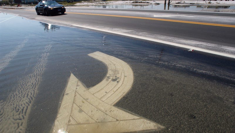
“Witness the sunshine flooding
in Florida already, the flooding that shows up even with no storm on
many streets any time there is a slightly high tide,” he said.
A Florida road flooded by tropical storm Arlene in 2005.
Florida is especially susceptible to rising seas.
Source: FEMA
“Sea
level is going up because the ocean is warming and hence expanding, and
because land ice — glaciers, etc. — are melting and putting more water
into the ocean. But it is not the gradual rise that matters,” Trenberth
said. “Rather, it is the storm surge on top of a high tide riding on top
of the increase in sea level that crosses thresholds and causes things
to break.”
Richard
Alley, professor of geosciences at Pennsylvania State University, who
also did not take part in this study, noted that the study didn’t
consider the possible collapse of the West Antarctic ice sheet. “If that
happens, then sea-level rise and impacts to coasts could be much higher
than in this paper,” Alley said. “Rapid West Antarctic collapse could
cause enough rise to make many of these other factors of secondary
importance. So, the ‘worst case’ in this paper isn’t really the worst
case.”
The
new paper predicted that some regions could experience an even higher
increase in the frequency of these extreme flooding events, specifically
along the Mediterranean and the Black Sea, where the present day
100-year extreme sea level could occur as often as several times a year.
Information
about the number of people at risk from flooding can be used to
determine how large the social and economic impact of these events will
be, said Marta Marcos, a researcher at the Mediterranean Institute for
Advanced Studies in Spain, who was not involved in the new study. “In
terms of adaptation strategies and policy-making, it is very relevant,”
she said.
The
researchers studied changes in extreme sea levels by 2100 under
different greenhouse gas scenarios and considered how all these
components — mean sea level, tides, waves and storm surge — will be
affected by climate change.
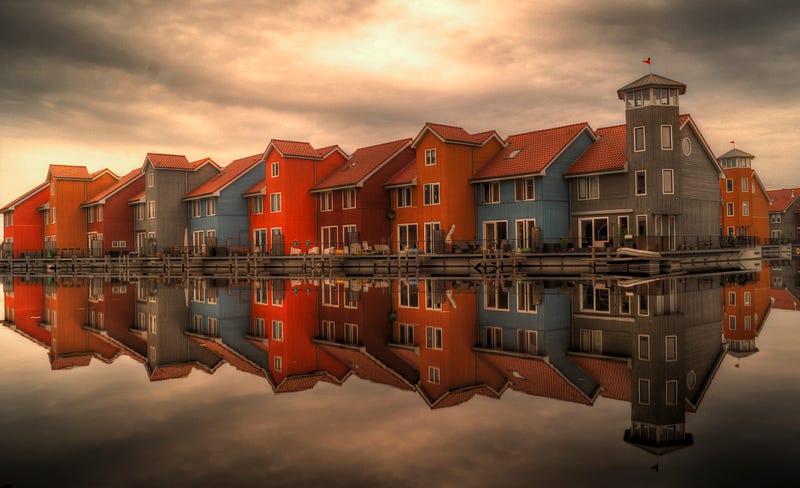
The Netherlands is particularly vulnerable to sea-level rise.
Source: Pexels
If
emissions continue to rise unabated throughout this century, extreme sea
levels along Europe’s coastlines could increase by more than 2.5 feet,
on average, by 2100.
Under a more moderate situation, where greenhouse
gas emissions peak in 2040, 100-year extreme sea levels still could jump
by nearly 2 feet, on average, by the end of the century — with flooding
events occurring every few years — according to study’s authors.
In a related study appearing in Geophysical Research Letters,
scientists found that if greenhouse gases continue to rise, there could
be disturbing changes by the end of the century in the energy that
waves carry to the coast.
In
the southern hemisphere, extreme waves could carry up to 30 percent
more energy by 2100, according to the study, meaning that stronger waves
will become more frequent, and have a greater impact on the coast, said
Lorenzo Mentaschi, a researcher at the Joint Research Centre and lead
author of the study.
The
new study attributed the changes in wave energy to the intensification
of weather patterns, like El Niño.
The new research will be provided to
European Union policymakers.
The data will also be made public so it can
be used by scientists, engineers and coastal managers.
Michael
Mann, professor of atmospheric science at Pennsylvania State
University, said the research once again underscored how climate change,
“which has already increased the threat to our coastlines through a
combination of sea-level rise and intensified coastal storms, will be
catastrophic for coastal communities if we don’t reduce global carbon
emissions.”
Links :
- ScienceDirect : Sea-level rise impacts on the tides of the European Shelf
- The Conversation : How Europe’s coastal cities can cope with rising sea levels
- New Scientist : Internal migration of millions as seas rise will rattle whole US
- Phys : Climate experts release latest science on sea level rise projections
- SFGate : Sea-level rise in California could be catastrophic, study says
- NYTimes : When rising seas transform risk into certainty
- PopScience : As sea levels rise, where will all the people go?
- GeoGarage blog : Five Pacific islands lost to rising seas as climate change ... / The biggest threat to NASA's future is the ocean / New data reveal stunning acceleration of sea level rise / Going Dutch to help conquer the rising seas / New report and maps: Rising seas threaten land home to ... / Map shows where Sea Level rise will drown American cities / 15 facts about sea level rise that should scare the s ... / U.S. cities lag in race against rising seas / Interactive flood map predicts sea level rise / Rising sea levels: Is global warming making the US East ... / Surging seas maps sea level rise in Coastal U.S. / Rising seas will affect major U.S. coastal cities by 2100 / Year after Sandy, rebuilding for storms and rising seas / The old man and the rising sea / Rising seas, vanishing coastlines / Future disasters: 10 lessons from superstorm Sandy / New York at risk from combination of rising seas and ... / Losing paradise: the people displaced by atomic bombs ...
Tuesday, April 18, 2017
Mediterranean rescuers accuse Europe of 'leaving migrants to drown'
From CNN by Barbie Latza Nadeau
Calm seas, desperate migrants and ruthless human traffickers all played a role in a record-breaking weekend of maritime rescues in the Mediterranean Sea between Italy and Libya.
But even as the rescue vessels race against time to save lives, another battle is brewing with accusations from the European Union's border control agency Frontex against nongovernmental organizations like Doctors Without Borders and the Mobile Offshore Aid Station, or MOAS, that run so-called charity rescue ships.
Frontex says the charity rescue vessels create a pull factor for migrants and traffickers; the NGOs say they are out there in the absence of an EU strategy to save lives at sea and a lack of initiative to provide a safe corridor option for migration and asylum.
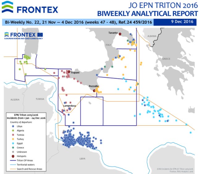
Here is a map of Frontex’s patrol area compared to where the shipwrecks happen.
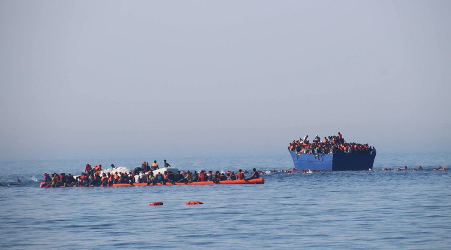
On Sunday evening in Italy, the Italian Coast Guard estimated the number of those rescued since Friday was approaching 7,000, though that number will surely grow as a steady stream of rubber dinghies and rickety wooden fishing vessels were still being spotted off the coast of Libya.
At least 20 cadavers, including that of an 8-year-old boy recovered during rescue operations, were also brought to Sicily and the Italian mainland with the survivors.
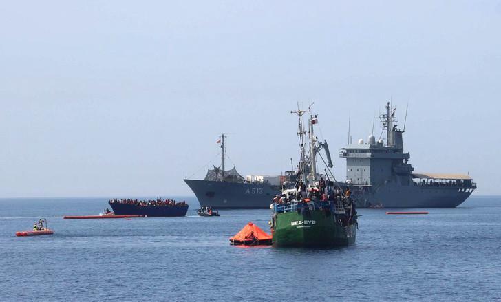
The migrants and refugees were rescued by Italian Coast Guard boats, passing merchant ships and more than a dozen NGO charity ships that have filled the vacuum created when Italy's Mare Nostrum search and rescue program ended in 2014 because of budget concerns.
The Mare Nostrum project cost Italian taxpayers €9 million ($9.5 million) a month, according to the Italian Navy.
The charity ships, which rely on donations, have estimated operating costs of around €11,000 ($11,666) a day, charities say.
Since the beginning of the year, 32,750 migrants and refugees have arrived on European shores, not including those rescued this weekend, according to UNHCR. In 2016, the total number topped 355,000.
Frontex has two programs at sea.
The Sophia program is designed to destroy smuggler's ships after rescues are complete and to train the Libyan Coast Guard to stop boats from leaving.
The Triton program enlists member states to provide assets for search and rescue operations.
Over the busy weekend, Frontex says the Norwegian Siem Pilot, currently on rotation for Frontex's Triton program, rescued more than 500 of the nearly 7,000 people pulled to safety.
In March, Italian prosecutor Carmelo Zuccaro from Catania launched an investigation into the funding of the charity ships, essentially accusing them of colluding with the traffickers.
"I am convinced that it is not always the operational center that calls on the NGOs," he told a parliamentary committee in Rome in March.
"We also need to investigate the evolution of the phenomenon and find out why there has been such a noted proliferation of these ships and how they deal with such high operational costs without having a return in terms of economic profit."
No charges have been filed but Zuccaro told CNN he would seek to sequester the charity ships if he found just cause to do so.
The NGOs have accused Zuccaro of starting the investigation on behalf of Frontex as an attempt to remove them from the sea.
Zuccaro says he is not acting on behalf of Frontex, but that he is concerned that the rescue vessels are creating an open border into Europe as thousands of irregular migrants reach Italy each year.
With this weekend's rescues, the number to reach Europe this year so far has topped 40,000, according to United Nations High Commissioner for Refugees.
When reached for comment about Zuccaro's legal case, Frontex did not provide a comment.
The NGOs, on the other hand, have not minced words.
"We are surprised at the timing of these allegations, more than a year after we and others have been in service," said Sophie Beau, co-founder and vice-president of SOS Mediterranee, which runs the Aquarius rescue boat together with Doctors Without Borders.
"We know exactly what will happen if we are not out there. More people will die. We know we need to be out there, we have to be out there."
In a press release, MOAS co-founder and director Regina Catrambone agreed.
"Every day people continue to risk their lives while we, as civil society, stand witness. We must continue to call on European governments to act so that people, such as those rescued by us today, do not die, not in Libya nor in the Mediterranean Sea."
Those frustrations are echoed by the other NGOs, with many of the rescue operators tweeting accusations directly against the European Union and Frontex.
Doctors Without Borders, or MSF, tweeted, "EU 'leaving migrants to drown' say rescuers who saved 2,000 in single day."
And "How many lives could have been saved in the last two years if the #EU had conducted a proactive search and rescue operation? #WhereIsFRONTEX"
Two of the charity ships, each filled beyond capacity after rescuing scores of migrants from rubber dinghies and unseaworthy wooden fishing vessels, made May Day calls to the Maritime Rescue Coordination Center run by the Italian Coast Guard in Rome to ask for assistance on Sunday.
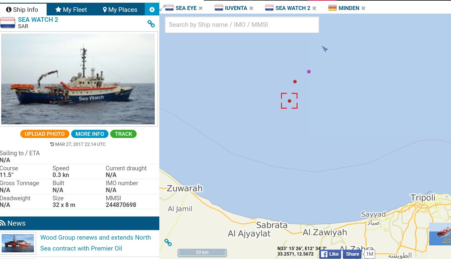
The Iuventa rescue ship operated by the German NGO Jugend Rettet reported navigational failure under the weight of the migrants and the German NGO Sea Eye also reported difficulty due to overcrowding.
"#Iuventa and @seaeyeorg are unable to move due to the high amount of people on board and nearby us in rubber boats!
We need help by #MRCC" the Jugend Rettet tweeted.
It reported having as many as seven pregnant women on board.
Italian Coast Guard confirmed that vessels were headed to the area to assist offloading some of the migrants.
MOAS also tweeted messages about its rescue ship Phoenix after spending the night watching a number of packed rubber dinghies whose passengers the ship was unable to assist because of its own overcrowding.
"Hour 40 of ongoing rescues & crisis management for #Phoenix crew.
They are still waiting for help to arrive; and we have lost all words #Med"
The voice that is often missing from the discussion is often that of the migrants themselves. On Sunday, 649 people rescued in a number of operations by the MSF Prudence arrived in Reggio Calabria.
Among them were men with gunshot wounds from traffickers and women who were tortured, according to rescuers at the scene.
At the port, a group of teenage Nigerian boys who had arrived as unaccompanied minors by way of sea rescues earlier this year waited at the shore to see if their missing family members were among the arrivals.
Alireza Pakdel, Grand Prix of the World Press Cartoon, Lisbonne, 2017
When asked if the charity boats made a difference in their decision to make the dangerous crossing, they had no idea what was meant by the question.
"The gun to my head made the difference," a young man called Caleb said after describing how he was forced onto a rubber dinghy late one night and losing sight of his father.
"We don't have a lot of choices. We are just lucky we got out of Libya alive."
Links :
- CNN : Rescuers battle rough seas to save hundreds of stranded migrants
- The Guardian : NGO rescues off Libya encourage traffickers, says EU borders chief
- The Intercept : Abandoned at sea / New evidence undermines EU report tying refugee rescue group to smugglers /
- IBTimes : More than 100 migrants feared dead crossing Mediterranean, 2,000 rescued
- RT : German boat sends out SOS after taking on too many migrants in Mediterranean
- The Economist : Merciless sea, the number of migrants crossing the Mediterranean keeps rising
- DailyMotion : Fishers of men
- GeoGarage blog :2016 deadliest year in the Mediterranean / Mediterranean migrant deaths reach record level in 2016 / Fire at sea (trailer) : shows horror of refugee crossings / A wintry sea seems a safer bet than life at home for ... / Refugee rescue app pulled from App Store after it is ... / European Union authorizes military action against people ... / Migrants can't be left to die in the seas of Europe / SAR crisis in the Mediterranean – commercial vessels ... / The millionaires who rescue people at sea / Lampedusa, the Italian Island thousands are dying to reach /
Monday, April 17, 2017
Dramatic footage of free diver and killer whales in the Arctic
During the shooting of a documentary in arctic Norway, we got up close and personal with killer whales.
Rather than ferocious killers, orcas are gentle and inquisitive, at least when it comes to human encounters.
Hundreds of orcas and humpback whales gathers in the Tromsø region in the period of November to January, to feed on the overwintering herring.
This one minute video resumes what the photographer and filmmaker David Gonzalez Buendia (buendiaphotography.com) captured in one single week, in the making of a documentary about orcas in the wild using the expedition sailing vessel Barba as a platform.
This one minute video resumes what the photographer and filmmaker David Gonzalez Buendia (buendiaphotography.com) captured in one single week, in the making of a documentary about orcas in the wild using the expedition sailing vessel Barba as a platform.
Sunday, April 16, 2017
1st European contact with Easter Isle
Jacob Roggeveen (1659 – 1729) was a Dutch explorer who was sent to find Terra Australis, but he instead came across Easter Island (called Easter Island because he landed there on Easter Day).
Jacob Roggeveen also encountered Bora Bora and Maupiti of the Society Islands and Samoa.
Jacob Roggeveen and the Easter Island
Jacob Roggeveen also encountered Bora Bora and Maupiti of the Society Islands and Samoa.
Jacob Roggeveen and the Easter Island
(see SciHi blog)
5 April, Easter Sunday, 1722 by Dutchman Roggeveen
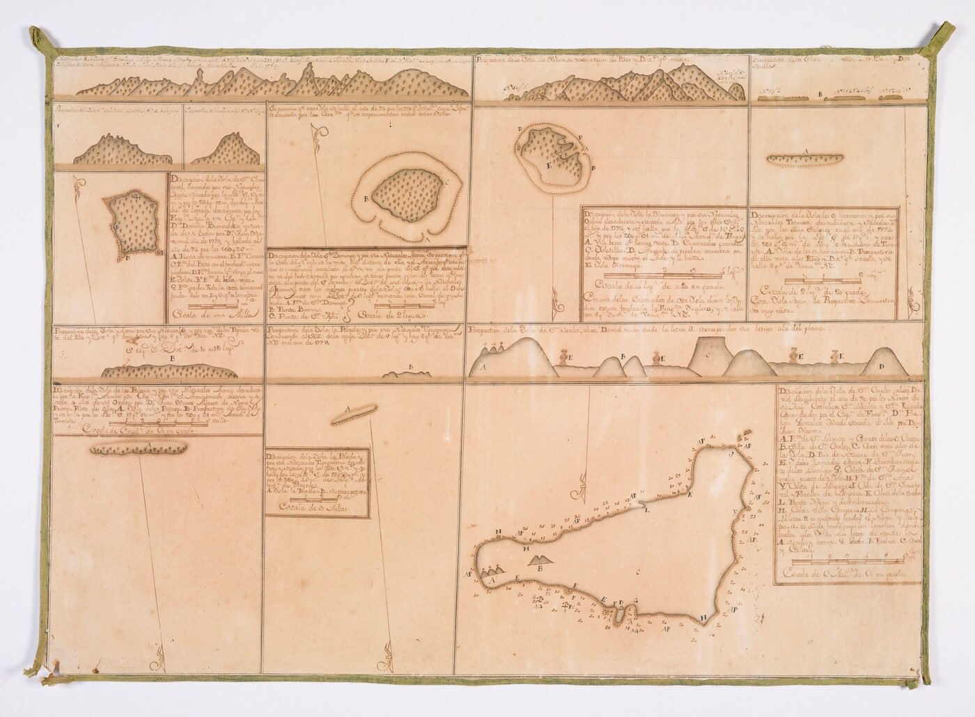
Isla de Pascua (named 'isla de San Carlos') de la expedición de González Ahedo en 1770
map from State Library of NSW
Somaglia collection of manuscript sea charts of the Pacific Ocean and South America, highlighting the Spanish expeditions to colonise Easter Island and Tahiti / [Joseph de la Somaglia, collector] ; Joseph Manuel de Moraledo, Juan de Hervé, Joseph Camacho y Brenes, Joseph Francisco Badaraco, Thomas López y Chaves [cartographers]
Plan of Isla de San Carlos, discovered on the 15th of November 1770, by el capitán de fragata Don Felipe Gonzáles de Aedo
source : Memoria Chilena
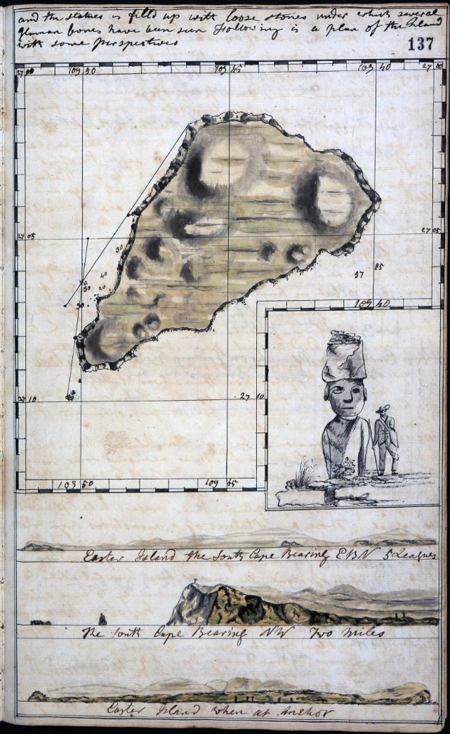
Log of the Resolution 1772-1775 Easter Island
UK National archive
Rapa Nui
The Moai of Easter Island
Log of the Resolution 1772-1775 Easter Island
UK National archive
Rapa Nui
The Moai of Easter Island
Easter island today in the GeoGarage platform (UKHO chart)
Isla de Pascua o Rapa - Nui [material cartográfico]
by el Instituto Hidrográfico de la Armada de Chile
Easter Island, captured by Sentinel-2A a few days ago, on 7 April 2017.
Easter Island, also known as Rapa Nui, is a Chilean island in the south-eastern Pacific Ocean, at the south-easternmost point of the Polynesian Triangle, and it is also one of the most remote inhabited places in the world.
Copyright: contains modified Copernicus Sentinel data (2017),
processed by ESA, CC BY-SA 3.0 IGO.
see also NASA picture
see also NASA picture
Links :
- YouTube : Expedition to Easter island / The Hidden Secret of the Statues on Easter Island
- David Rumsey collection : La Perouse, Jean-Francois, Easter Island. 1799. Exploration Book. / other (Princeton Univ)/ others / other
