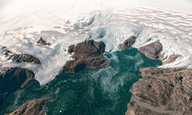
Aerial surveys show two glaciers flowing into Johan Petersen fjord in
south-eastern Greenland.
The melting of the ice sheet would cause oceans
to rise by six metres around the world if it was lost entirely.
Photograph: Jeremy Harbeck/Icebridge/NASA
From The Guardian by Damian Carrington
Ice cap is disappearing far more rapidly than previously estimated, and is part of a long-term trend, new research shows
The huge annual losses of ice from the Greenland cap are even worse than thought, according to new research which also shows that the melt is not a short-term blip but a long-term trend.
The melting Greenland ice sheet is already a major contributor to rising sea level and if it was eventually lost entirely, the oceans would rise by six metres around the world, flooding many of the world’s largest cities.
The new study reveals a more accurate estimate of the ice loss by taking better account of the gradual rise of the entire Greenland landmass.
When the ice cap was at its peak 20,000 years ago, its great weight depressed the hot, viscous rocks in the underlying mantle.
As ice has been shed since, the island has slowly rebounded upwards.
Previous satellite estimates of modern ice losses tried to take this into account, but precise new GPS data showed much of Greenland is rising far more rapidly than thought, up to 12mm a year.
This means 19 cubic kilometres more ice is falling into the sea each year, an increase of about 8% on earlier figures.
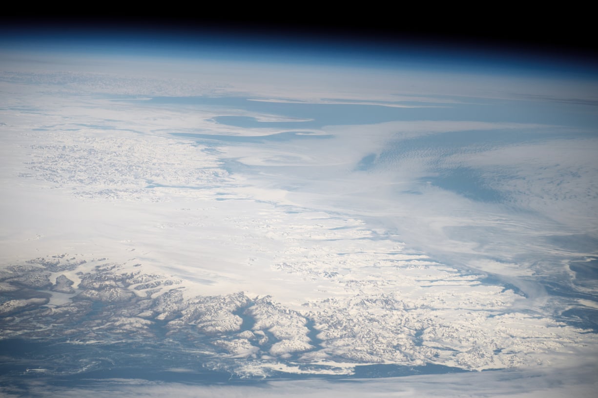
The southern tip of Greenland seen from space.
Photograph: ISS/NASA
The new work was also able to reconstruct the ice loss from Greenland over millennia and found that the same parts of Greenland - the north-west and south-east - were where most ice is being lost both in the past and today.
This means the rapid ice loss recorded by satellite measurements over the last 20 years is not likely to be a blip, but part of a long-term trend being exacerbated by climate change.
Global warming is driving major melting on the surface of Greenland’s glaciers and is speeding up their travel into the sea.
“The fact that we are seeing such a similarity of past and present behaviour suggests we could lose ice in these regions for decades into the future,” said Prof Jonathan Bamber, at the University of Bristol, UK, and one of the international team of scientists who carried out the new study, published in Science Advances.
Aerial Camera views from shore visits on the east and west coasts of Greenland, August 2016.
“The headlines of climate change and melting polar ice are not going to change,” said Dr Christopher Harig, at the University of Arizona, who was not involved in the study.
“The new research happening now really speaks to the question: ‘How fast or how much ice can or will melt by the end of the century?’ As we understand more the complexity of the ice sheets, these estimates have tended to go up. In my mind, the time for urgency about climate change [action] really arrived years ago, and it’s past time our policy reflected that urgency.”
Melt water on the surface of Greenland ice sheet 10 June, 2014 and 15
June, 2016.
Every spring or early summer, the surface of the sheet
transforms from a vast white landscape of snow and ice to one dotted
with blue meltwater streams, rivers, and lakes.
In 2016, the transition
started early and fast.
Credits: OLI/Landsat 8 and ALI/Earth
Observing-1/Nasa
Dr Pippa Whitehouse, at the University of Durham and also not involved in the new research, said: “This study highlights the powerful insight that GPS measurements can give into past and present ice loss. Using such measurements, this study demonstrates that some of the highest rates of ice loss across Greenland - both in the past and at present - are found in areas where the ice sheet flows directly into the ocean, making it dangerously susceptible to future warming in both the atmosphere and the ocean.”
This video shows images from a science flight on August 27, 2016, over a heavily crevassed portion of the Rink Glacier in western Greenland.
NASA's Operation IceBridge flies with a high-resolution camera on board, pointing straight down and taking overlapping images during the entire flight. These images represent a data product in their own right, and also provide a visual reference to help researchers better understand the data they get from other instruments.
(NASA/Rob Russell)
In April, very high temperatures led to a record-breaking early onset of glacier melting in Greenland, while another satellite study in August reaffirmed the rapid loss of ice.
Links :
- YouTube : Greenland's Glaciers on the Loose: Fiamma Straneo
- NASA : Southern Greenland
- Washington Post : Greenland may be losing ice even faster than scientists thought
- University Buffalo : What’s happening beneath Greenland?
- GeoGarage blog : Global warming is melting the Greenland ice sheet, fast / Greenland's ice layers mapped in 3D / New NASA model maps sea level rise like never before /Greenland: Like the most beautiful woman / Greenland glacier calves island four times the size of Manhattan


No comments:
Post a Comment