Aconspiracy theorists claims to have spotted this mythical Kraken swimming off the coast of Deception Island near Antarctica.
Using Google Earth, this sea monster appears to be 100 feet from head to end, with ‘the mid area of a giant squid’
From DailyMail by Stacy Liberatore
- Used Google Earth to find size of creature which showed 30m (100 feet)
- Sighting occurred on April 9, 2016 using 63° 2'56.73"S 60°57'32.38"W
- Said it must be the Kraken, but also looks like a Plesiosaur
- Another theory is this disturbance could be an underwater UFO
Nordic folklore speaks of a massive creature that haunted the icy seas of the North Sea, where it attacked passing vessels with gigantic tentacles.
And conspiracy theorists claims to have spotted this mythical Kraken swimming off the coast of Deception Island near Antarctica.
Using Google Earth, this sea monster appears to be 120m from head to end, with ‘the mid area of a giant squid’.
‘It looks like the Kraken,’ Scott C Waring shared on UFO Sightings Daily.com.
‘I used Google ruler and it says this is 30 meters (100 feet) from head to end, but the end looks like just the mid area of a giant squid, which means it could be 60+ meters long with tentacles.
'That sounds like the Kraken to me.’
The sighting occurred on April 9, 2016, when Waring looked at the coordinates 63° 2'56.73"S 60°57'32.38"W in Google Earth – although it is not clear how or where he obtained these exact coordinates.
Waring also thought of the extinct prehistoric animal Plesiosaur when he spotted the massive beast causing ‘a massive disturbance in the ocean’.
Bing imagery
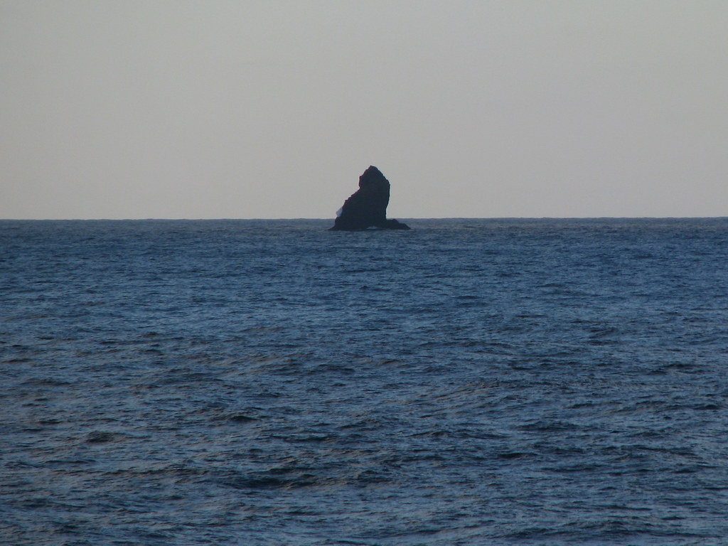
Although there is no track of land in all the available online map viewers (see above), some maps show a rock at the supposed position of the Kraken closed to Deception Island in the South Shetland Islands archipelago:
Actually, the Kraken is an small rock named 'Sail Rock'.
Insular rock, 30 m high, lying 7 mi SW of Deception Island, in the South Shetland Islands.
This name, which dates back to at least 1822, was probably given by sealers.
(source : AADC Australian Antarctic Data Center)
Sail Rock on NGA chart with the GeoGarage platform
This can be showed with detailed nautical charts overlayed on Google maps imagery:
Animated image displaying UKHO nautical maps upon Google Maps imagery
photos : Sheilanne (January 7, 2008)
photo : Margaret Simpson, (January 31, 2008)
"Heading for Deception Island, we passed Sail Rock, South Shetlands."
photos : Sheilanne (January 7, 2008)
photo : Margaret Simpson, (January 31, 2008)
"Heading for Deception Island, we passed Sail Rock, South Shetlands."
From a distance, the rock is reported to resemble a ship under sail,
but
at close range it is more like a house with a gable roof.
(courtesy of SCIelo.cl)
Links :
- GeoGarage blog : Avoiding rock bottom: How Landsat aids nautical charting / About the Null island at 0°0'0" N 0°0'0" E / How a fake island landed on Google Earth / South Pacific Sandy Island 'proven not to exist' / Improbable South Pacific reefs / Google Maps wipes out Scottish island of Jura / Mystery of the phantom islands solved: Lands that disappeared on ancient maps are revealed as mistakes, mirages and myths / Lost Islands: the story of Islands that have vanished from nautical charts / Hy-Brasil, the other Atlantis


Great analysis!
ReplyDeleteThank You. I spent half the day arguing online abbout this, not convinced either way, up until this article. It is truly uncanny how much it looks like a Colossal Squid battling a whale, likely a Sperm Whale, which is known behavior for both. I don't usually get caught up in these, but I think Cryptozoology is very important, and that insanely real creature was myth until it was found. But in this case, yeah, just a rock. My main hang up was trying to figure out why this area would be photographed in such detail in the first place, now I know why. Thanks again:)
ReplyDeleteGoogle Earth blog : The rock near Deception Island that looks like a Kraken
ReplyDelete