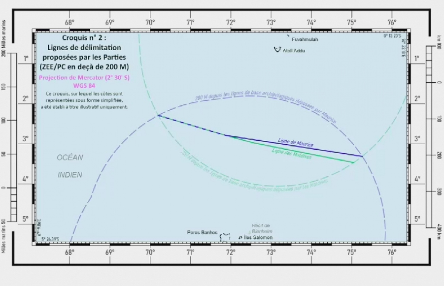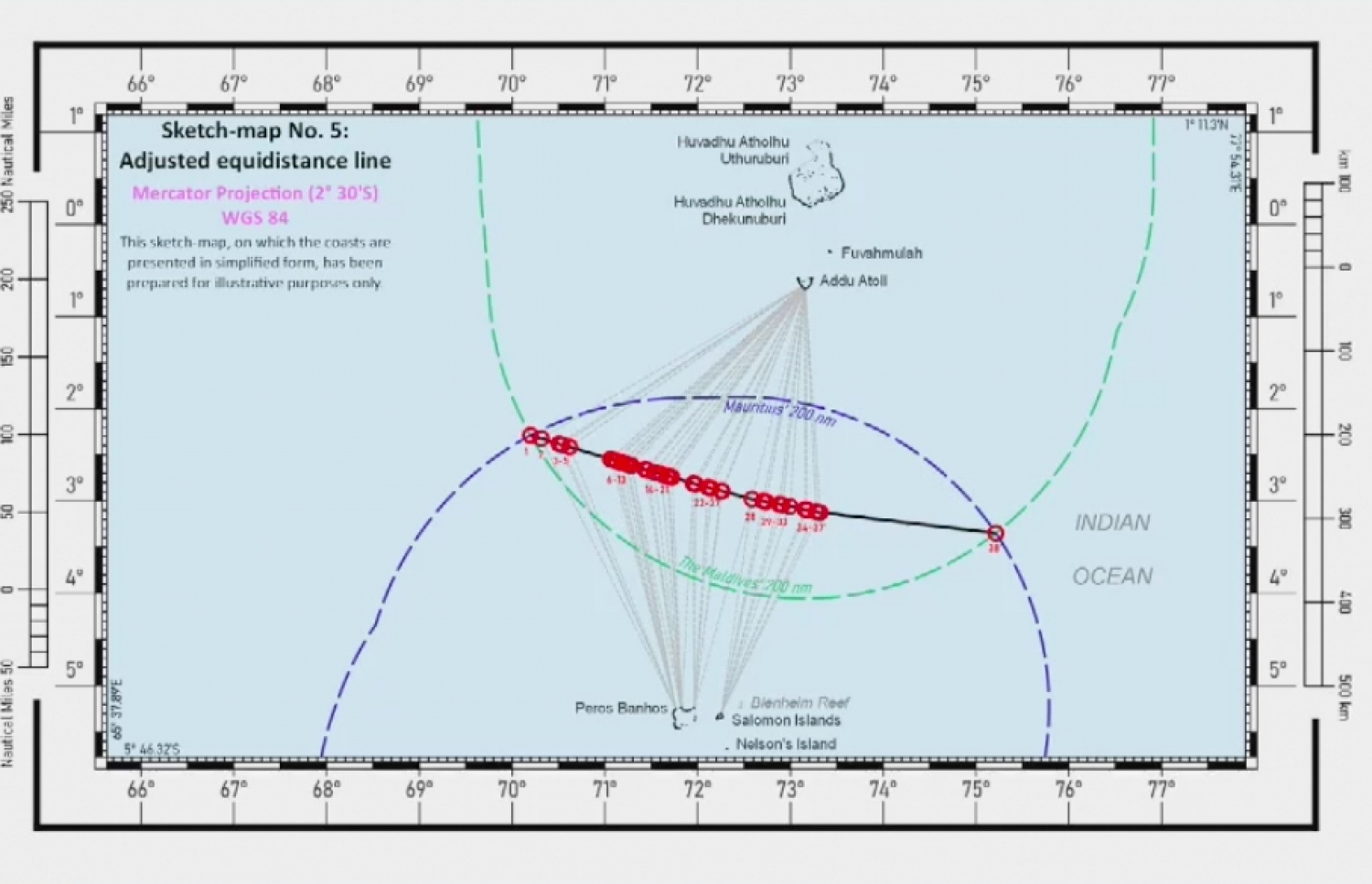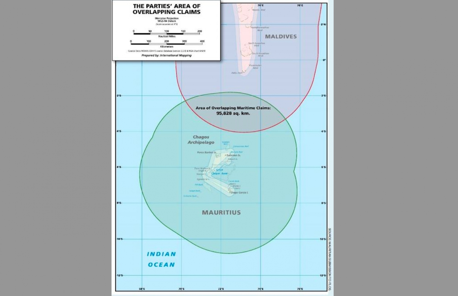
Chart on how Maldives-Mauritius'overlapping territory will be divided
From Edition by Malika Shadid
Maldives' claim for a larger share of the disputed waters with Mauritius is upheld by the International Tribunal for the Law of the Sea (ITLOS).
Utilizing the equi-distance principle, ITLOS has made a determination to divide the disputed maritime zone between Maldives and Mauritius.
Maldives' claim for a larger share of the disputed waters with Mauritius is upheld by the International Tribunal for the Law of the Sea (ITLOS).
Utilizing the equi-distance principle, ITLOS has made a determination to divide the disputed maritime zone between Maldives and Mauritius.
However, the implementation of this principle has sparked controversy, primarily due to the necessary measurements that must be taken from Blenheim Reef to Mauritius.
Maldives has presented scientific evidence and satellite images to support their argument that the Blenheim Reef is not part of the coast of Mauritius.
In response to Mauritius' proposal to utilize the reef as a base point for drawing the equi-distance line, ITLOS' special chamber ruled it as inadmissible.
Despite being visible only during dry weather, the chamber has also decided to exclude any point from the Blenheim Reef while drawing the equi-distance line.
Maldives made an argument stating that the sovereignty dispute between Mauritius and the United Kingdom over the Chagos Archipelago was unresolved and fell beyond the purview of ITLOS's jurisdiction.
Maldives made an argument stating that the sovereignty dispute between Mauritius and the United Kingdom over the Chagos Archipelago was unresolved and fell beyond the purview of ITLOS's jurisdiction.
Despite Maldives' defense, ITLOS proceeded as required by the United Nations Convention on the Law of the Sea (UNCLOS), which grants each country a 200-mile continental shelf.
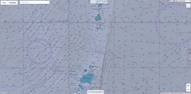
Blenheim reef with the GeoGarage platform (UKHO nauticalm raster map)
Blenheim Reef is a partly submerged atoll structure in the Chagos Archipelago, Indian Ocean.
It includes the coral reef of Baxio Predassa in its southeastern rim, plus another completely submerged part.
The disputed territory between the two countries covers an area of 95,000 square kilometers, and Mauritius proposed using the Blenheim Reef as a base point for dividing the border.
However, Maldives argued that the reef is not a dry land and thus cannot serve as a base point.
If it were considered as such, it would grant Mauritius an additional 4,687 square kilometers of territory, according to the proposed base point.
EEZ limits with the GeoGarage platform
ITLOS has allocated the disputed overlapping territory of 95,000 square kilometers between Maldives and Mauritius, providing each country with a 200-mile continental shelf.
Maldives has been granted 47,232 square kilometers while Mauritius has been given 45,331 square kilometers.
Mauritius received 0.960 square kilometers for every square kilometer received by Maldives.
Although the case has been resolved, it is worth noting that under the United Nations Convention on the Law of the Sea (UNCLOS), any natural extension of a country's continental shelf beyond 200 miles should be taken into consideration.
In 2010, the Maldives and Mauritius both approached the Commission on the Limits of the Continental Shelf (CLCS) to claim their share of the area beyond the 200-mile limit.
However, the matter remains unresolved at the CLCS.
Following the Maldives' independence in 1965, President Ibrahim Nasir entered into an agreement with Sri Lanka and India to divide the overlapping territories in the northern part of the Maldives.
Following the Maldives' independence in 1965, President Ibrahim Nasir entered into an agreement with Sri Lanka and India to divide the overlapping territories in the northern part of the Maldives.
However, the area of Chagos in the south has yet to be officially designated due to the British occupation of the islands.
On July 31, 1976, an agreement was signed between President Nasir's administration and Sri Lanka to separate the overlapping territory, and on December 28, 1976, a similar agreement was signed with India to separate the overlapping territory in the Arabian Sea.
On July 31, 1976, an agreement was signed between President Nasir's administration and Sri Lanka to separate the overlapping territory, and on December 28, 1976, a similar agreement was signed with India to separate the overlapping territory in the Arabian Sea.
However, the agreements did not come into effect until June 8, 1978. At the time of the agreements, none of the countries had a 200-mile special economic zone, so the overlapping territory was divided based on equidistance.
Links :
Links :
- The Interpreter : The curious case of Blenheim Reef / Mauritius sets sail to Chagos
- The Edition : Mauritius alleges Maldives attempting control over 99 percent of overlapping area
- The Guardian : Mauritius measures reef hoping to lay claim on Chagos Islands
- The Conversation : Chagos Islands: Mauritius’s latest challenge to UK shows row over sovereignty will not go away
- GeoGarage blog : Chagos Islands dispute: UK obliged to end control / The problem with the Chagos Islands / Fury of Chagos islanders as Britain creates world's largest ..


No comments:
Post a Comment