Overview of sea-floor landforms mapped in this study
From BBC by Jonathan Amos
South Georgia is an island of
astonishing beauty - of imposing landscapes, and bewildering numbers of
penguins, seals and seabirds.
It also has some impressive ice fields, although none it seems quite like those of the past.Some 20,000 years ago the island's glaciers pushed out 50km and more from their current positions, reaching to the edge of the continental shelf.
The British Overseas Territory was in effect covered by a giant ice cap.
This realisation is reported in the current edition of the journal Nature Communications.
South Georgia (UKHO map) in the GeoGarage platform
Located in the Southern Atlantic Ocean roughly 1,700 miles (2,735 km) due east of Argentina’s southernmost tip, South Georgia Island was a stop-over point for Sir Ernest Shackleton in November 1914.
It is the result of investigations of the seafloor by a team of scientists from the UK, Germany and Australia.
"We were able to find a tracer of this ice cap - a ridge at the outer margin of the continental shelf that's larger than all others, pretty much; and it's fairly contiguous," explained Dr Alastair Graham from Exeter University.
"You see it to the west, to the north, to the east, and even to the south where we don't have much data. It's quite a surprise because many scientists had assumed any ice cap was quite small."
Dr Graham and his colleagues conducted sonar surveys around South Georgia using the British Antarctic Survey's (BAS) research vessel, the James Clark Ross, and Germany's RV, the Polarstern.
Map of South Georgia
(a) Southern Hemisphere map showing sites where advances of
glaciers during the Antarctic Cold Reversal have been recorded.
(b)
Regional location map illustrating modern-day mean annual position of
major Southern Ocean oceanographic fronts in relation to South Georgia.
These ships mapped the long deep troughs cut by ancient glaciers.
Evident in these channels are the countless, tell-tale markings of bulldozed sediments known as moraines.
But to fill out their picture, the researchers needed also to establish when these features were produced, and so they pulled up cores of seafloor material.
Caught up in this mud and rock are the shelly remains of tiny animals that can be used to date the glacial deposits.
What emerges from all this study is a story of a rapidly changing ice-scape - one that has been incredibly sensitive to really quite small changes in temperature.
The investigation reveals that the giant ice cap was at its fullest extent at the height of the last ice age - about 19 to 26 thousand years ago.
Then, as the global climate warmed, the glaciers went into a fast retreat, pulling back to positions not far beyond the present coastline.
A pulse of cooling about 15,000 years ago saw them briefly push forward, before deglaciation took hold again.
"In the last 10,000 years the ice cap has wobbled back and forth, but never really gone out much beyond the fjords," Dr Graham told BBC News.
"And then in the 1950s, things seemed to go pear-shaped for South Georgia. The glaciers now are in a massive retreat, which could have quite serious implications for local ecosystems."
(a) Location map indicating the locations of panels b–g.
(b) Streamlined crag-and-tails and/or drumlins 0.5–1 km in length, south of Undine South Harbour;
(c) streamlined bedforms and roche moutonnée overprinted by extensive scouring in the trough feeding out of Drygalski Fjord;
(d) elongated mega-scale glacial lineations and
(e) drumlinoid bedforms that increase in elongation down-flow in the trough northwest of Church Bay;
(f)
convergence of flow patterns including a swarm of small drumlins at the
confluence of tributaries emanating from Possession Bay and Antarctic
Bay;
(g) individual drumlin imaged on flat sea-bed region south
of the central part of the island.
All multibeam data have an 8 m
grid-cell size, except for ‘f’ which is gridded at 20-m cell size. Arrows depict direction of former ice flow.
The Cumberland Trough - the seafloor scar left by a once mighty glacier
- General context map (1) for Cumberland Bay in central-north South Georgia
- Bathymetry reveals a large trough (2) spreading northeast for up to 70km
- Numerous ridges (2) of bulldozed sediment (moraines) cross the trough
- (3) Downstream of today's Nordenskjold Glacier is one large moraine
- This ridge (3) is probably the extent of a brief re-advance 15,000 years ago
(a) Compiled swath bathymetry tracks west of the island
illustrating a large outer ridge and back-stepping recessional moraines;
profile v–x through the ridge shown in ‘c’;
(b) a sub-set of the recessional moraines in detail.
(c) profile v–x through the outer ridge showing the separation of deeper, pitted sea-floor and moraine-mantled topography inshore.
(d) streamlined subglacial bedforms south of the island, resembling drumlins formed by warm-based, fast glacial flow.
(e) topographic profile y–z across the bedforms illustrating their range of amplitudes and typical wavelengths. Profile located in ‘d’. Data in ‘a’ gridded at 5 m grid cell size, and at 8 m grid-cell size in ‘d’.
This potentially could put new constraints on the bio-productivity of the region, said co-worker Prof Dominic Hodgson from BAS.
"As they erode, South Georgia and the other sub-antarctic islands put 'rock flour' in the ocean and that provides a supply of iron. Iron is the limiting nutrient," he explained.
"It gives rise to big blooms of plankton which then drive the ecosystem from the bottom up - from the plankton and zooplankton, to the krill, all the way up to the seals, birds and penguins. This is why you get this intense concentration of biota around South Georgia."
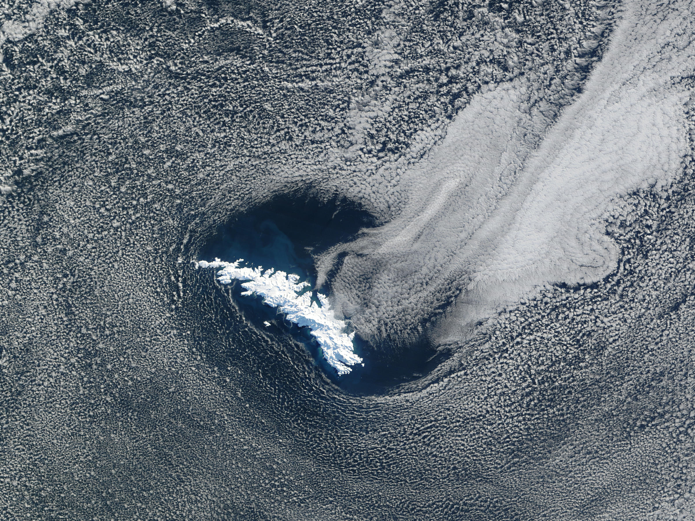
South Georgia Island
NASA (2002)
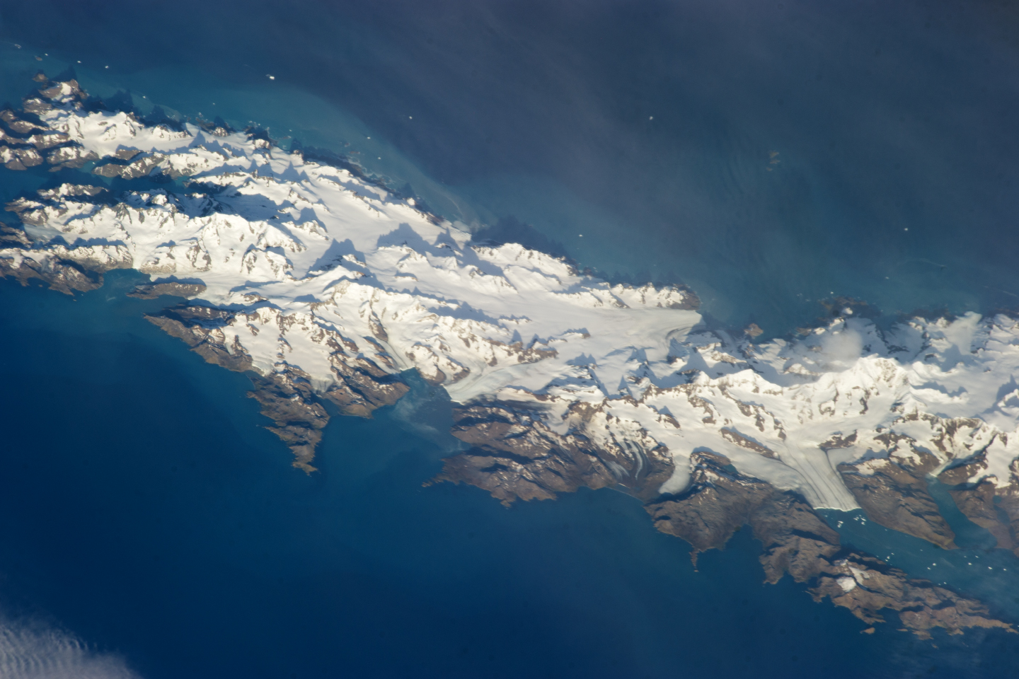
Eastern half of South Georgia Island
Today, the glaciers are in an accelerated reversal, with many pulling back up on to the land
(ISS NASA 2013)
It is an interesting question, however, as to what all this wildlife did when South Georgia was covered by a huge ice cap.
Many of its bird species, such as the albatrosses for example, nest in burrows and so need some clear, ice-free land to breed.
There are also some endemic animals - they exist nowhere else.
For these creatures to have survived through the great glaciation there must have been gaps in the ice cap.
The team is trying to establish where these refugia might have been.
Another spillover from the study is determining what the South Georgia experience tells us about higher latitudes, such as the Antarctic Peninsula.
Away from the brutal westerlies, South Georgia has some green spaces
The glaciated "finger" of land that juts up from the White Continent towards South America is already one of the fastest warming locations on Earth.
Scientists who try to model its future behaviour now have a new anchor point in their simulations thanks to this study.
"South Georgia shows us what the response is of an ice sheet to really very moderate changes in temperature, both in the ocean and the atmosphere," said Prof Hodgson.
"We can now take those responses and push them further south and get a very good idea of what might happen to the Antarctic Peninsula, and indeed any ice sheet that is close to its thermal limit."
Links :


No comments:
Post a Comment