
From Wired
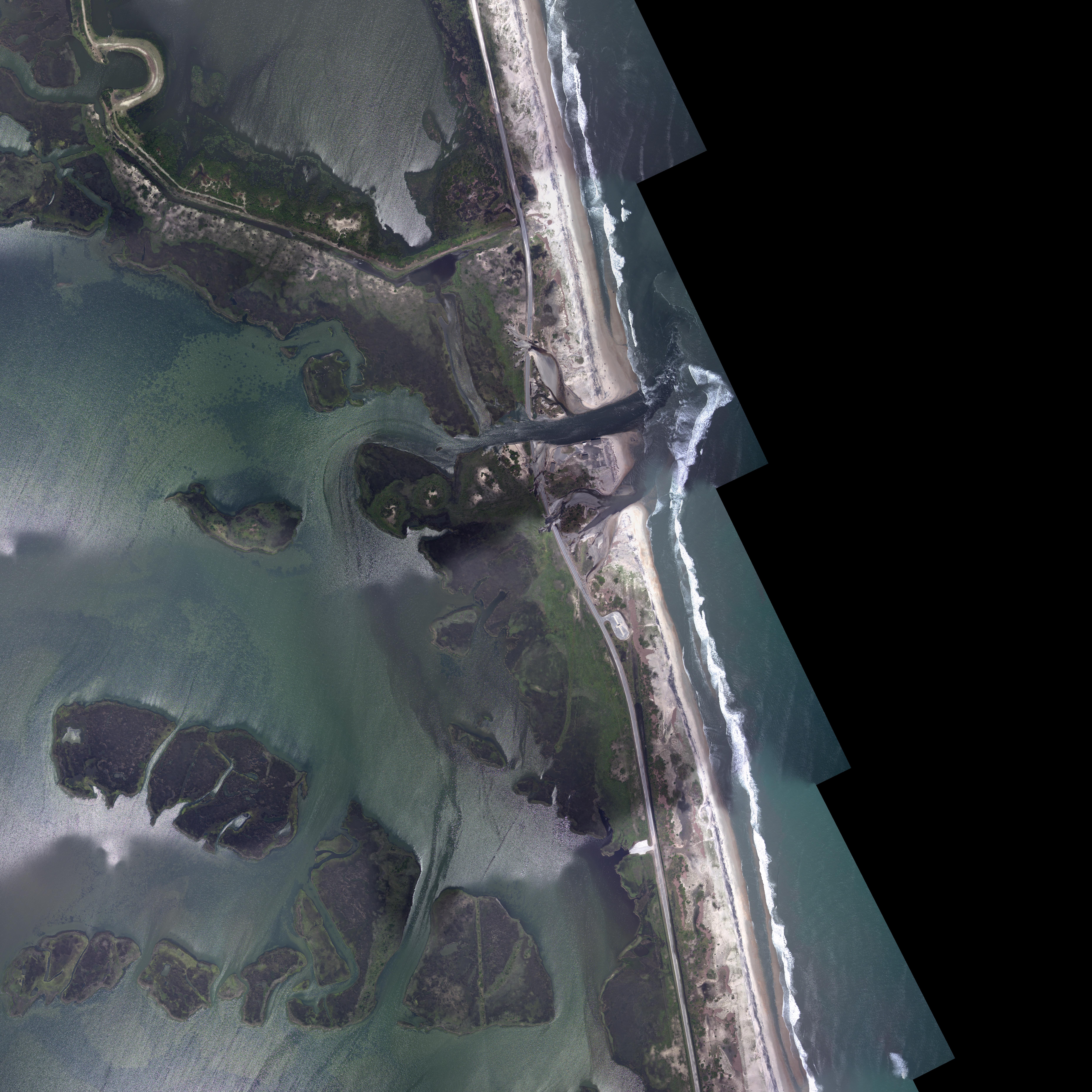
The power of Hurricane Irene was clearly apparent to people in its path, but the extent of the damage may be easier to appreciate when seen from above.
The National Oceanic and Atmospheric Administration is using aerial photographs like the one above to assess Irene’s destruction.
In this image of Hatteras Island in North Carolina taken Aug. 28, the largest breach of Highway 12, which runs along the Outer Banks, can be seen.
Water is flowing between Pamlico Sound and the Atlantic Ocean, stranding at least 2,500 residents of the island.
The local Island Free Press reported an estimate that the breach shown above is more than 100 feet wide and 8 feet deep.
More aerial photography of the damage can be seen using NOAA’s interactive index map of Irene’s path.
Links :
- YouTube : Hurricane Irene - Updated August 29, 2011 / NOAA Accurately Predicted Irene's Path 4 Days in Advance
No comments:
Post a Comment