3 charts have been removed from the previous layer :

 B233 : Eleuthera - Current Cut
- B241 : Eleuthera - Davis Channel
- B239 : Eleuthera - Rock Sound
- B228 : Central Eleuthera
- B273 : Eleuthera - Sail Rocks to Finley Cay
- B227 : Northern Eleuthera
- B229 : Southern Eleuthera
- B242 : Eleuthera - Davis Harbour
- B118 : Eleuthera - Egg Island Cut
- B60 : Eleuthera - Fleeming Channel
- B236 : Eleuthera - Governor's Harbour
- B231 : Eleuthera - Harbour Island
- B232 : Eleuthera - Harbour Mouth
- B225 : Eleuthera - Spanish Wells & Devil's Backbone
- B276 : Eleuthera - Tarpon Bay
Note : you will note some shifts between the nautical maps and Google imagery in some positions.
After checking the two maps B229 and B228, it seems the land geo-referencing is fairly accurate (the map creator WLP frequently takes positions of docks or rocky coastline and then adjusts the land imagery if need be).
So it would seem that the Google system is incorrect in this general area.
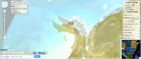
See the overlay of B229 on Bing Maps aerial pictures :
In the same way, if we display the historical imagery of this area in Google Earth we can see that the imagery from 2002 seems to be correctly georeferenced.
We feedback Google about this issue.
If you navigate in these areas, it would be interesting to find where the error is, checking places on different Islands to see if there is a discrepancy to the GPS readings taken to georeference the map.


Google Follow Your World : 3 years after submission, Google updates imagery and corrects its georeferencing
ReplyDeleteOK for Google aerial imagery
ReplyDeletebut still shifting problems with Google maps