
The Marine GeoGarage is glad to announce a first license agreement with some private nautical map publisher Wavey Line Publishing to display nautical charts for :
- Bahamas,
- Turks & Caicos Islands,
- Hispaniola
- and Caribbean.
(some iPhone/iPad application will be available soon).Note : for ordering any of these maps seen in the viewer, please go to the American Nautical Services website.
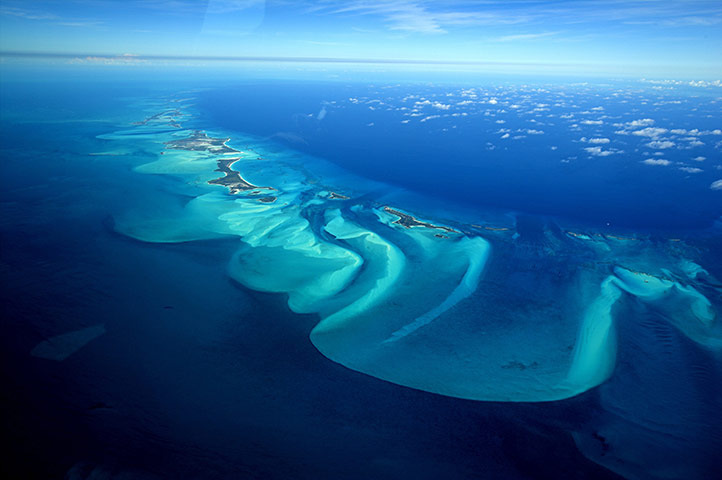 An aerial view of Exuma, part of the chain of 365 islands that form the Bahamas
Photograph: Onne van der Wal/Bluegreen/Rex Features
Explorers and Surveyors (extract from Wavey Line Publishing website)
The Dark Ages!
Wavey Line charts have origins way back in the days before GPS completely revolutionized navigation and marine surveying.
After his first Atlantic crossing in the late 1970's, Bob Gascoine started cruising the Antilles and Bahamas Chain.
Bob found great inadequacy in the government chart publications as did many cruisers of that period, and he started to compile his own sketch charts and pilotage notes.
These were first published in 1983 as a Yachtsman's Guide for the Turks & Caicos Islands.
Escape from City Life
Bob's background includes experience in the London printing and graphic arts industry.
This knowledge was bolstered when Jane Minty teamed up with him in the early 1990's and contributed artistic and computer graphic skills.
Soon after, they began exploring and surveying using a sophisticated GPS receiver as their main tool.
Milt the Mentor
Milt Baker, founder of the well-known Blue Water Books & Charts store, encouraged Bob and Jane to publish their data and TC001, their first chart, was printed in December 1993.
It had the distinction of being the first navigation sea chart designed primarily for use with GPS and featured new innovations such as 'one mile grid' (note : removed in the Marine GeoGarage as the map is georeferenced) and 'waypoint list'.
This first edition sold out in six months, so Bob and Jane quit their day job - which had been sailing and scuba diving charters - and took up hydrography as a full time occupation.

Socially Acceptable to Nature
In addition to work on private publications, Bob and Jane have been engaged by the Turks & Caicos Islands National Parks Service and Harbour Authority to conduct various marine projects.
They have also checked and advised the UK Hydrographic Office on new British Admiralty publications for the region.
Being conservation activists, Bob and Jane include advice on environmental issues and local etiquette in their publications in the hope that visiting cruisers will respect local ways and go easy on the environment - this should help reduce the need for restrictive legislation in the future.
Out Islands 'R' Us
Bob and Jane are now finishing surveys for two new Bahamas charts and will be updating and re-surveying areas of the Turks & Caicos Islands so that all chart publications have up-to-date information and 'WAAS' accuracy.
But don't expect to see them giving presentations or 'Volleyball Beach' talks, for they prefer to keep a low profile and moor away from the crowd.
Still, if you notice their catamaran 'Mage Magic' (yes, the one with the barking "potcake") and decide to stop by and visit, you'll be warmly received.
No comments:
Post a Comment