David Rumsey began collecting maps back in 1980, and since then has amassed more than 150,000 maps spanning from the 16th to the 21st century. Nearly 90,000 of those maps have been carefully digitized and made available online, making it easier for students, researchers and enthusiasts around the world to experience the history of the world in maps.
Finally, get a look behind the scenes at the David Rumsey Map Center at Stanford University.
From Medium by Kristian Appenbrink
Today we’re bringing back a layer that has long been a favorite of ours on Google Earth — the Historical Map Collection from David Rumsey.
Long-time users might recognize some of these maps from a previous collection, but they’ve never been easier to explore on the web or on your phone or tablet.
View a collection of these maps in Google Earth: https://g.co/earth/rumseymaps
David Rumsey has been collecting maps for nearly 40 years, and in that time, he has amassed more than 150,000 maps. He hand selected this collection specifically for Google Earth.
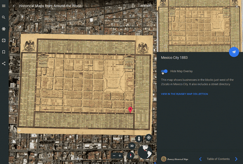
Each of the 100 plus maps has been georeferenced so you can easily compare the historic interpretation of the world with the world as it is today.
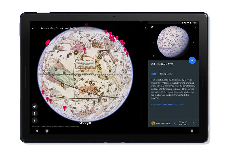
I especially love the early maps that include detailed illustrations and map things beyond the known world, like this Celestial Globe from 1792.
So take a few minutes to explore today, and see just how much the world and our perception of it has changed in the past 400 years.
Not only can maps show us where we are going, but they can help us to better understand where we’ve been.
You can also use the mashup created and hosted by the GeoGarage platform :

Links :
No comments:
Post a Comment