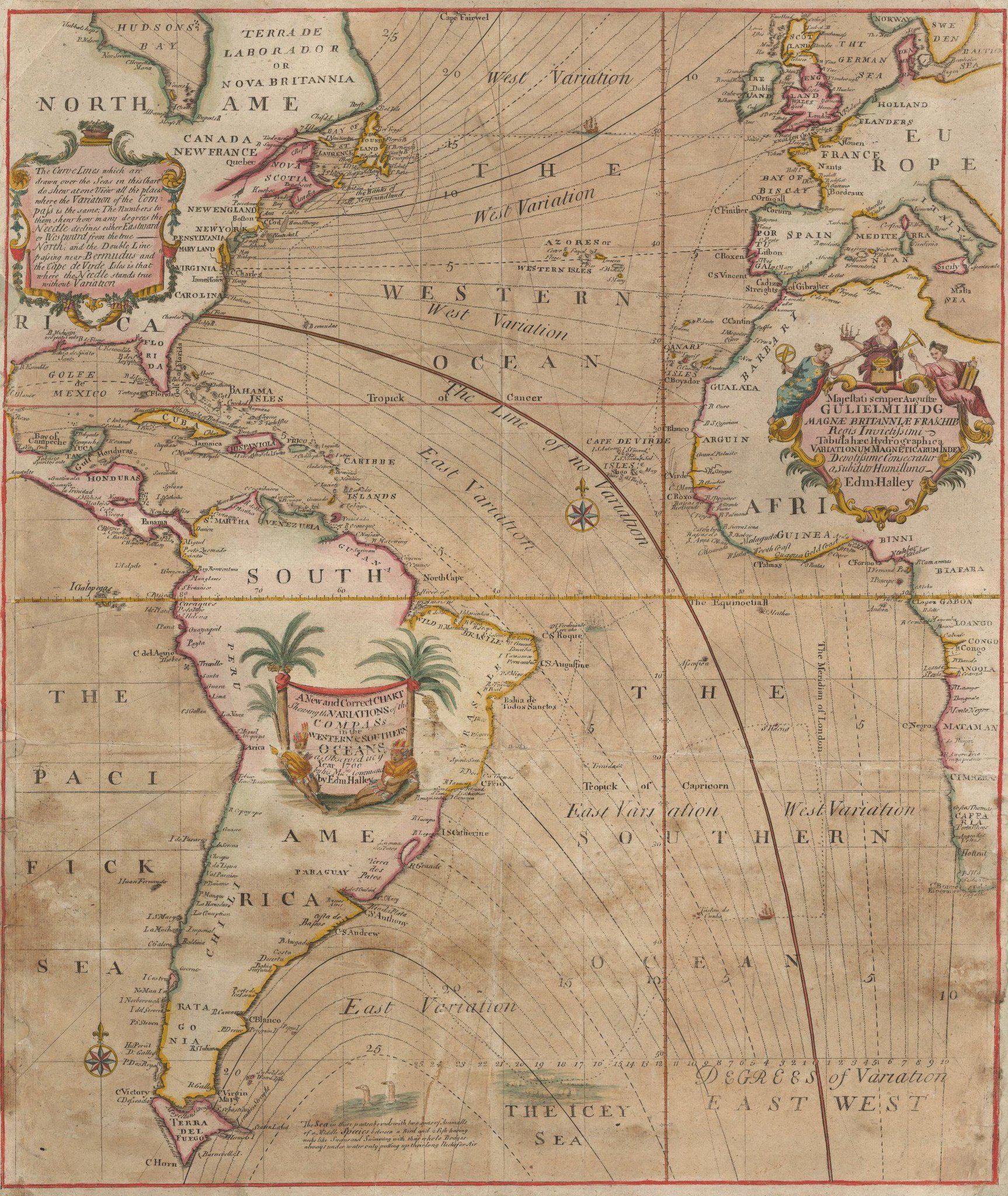
The magnetic declination varies with time due to changes of the Earth's magnetic field.
Since the 1970's the Magnetic North Pole has accelerated from less than 10 to more than 30 miles per year
From NOAA
Earth is like a giant magnet with a North and South Pole.
However, the magnetic North and South Pole are not aligned with the Geographic North and South Pole.
The Geographic North Pole is defined by the latitude 90° N and is the axis of the Earth's rotation.
The Magnetic North Pole is where the Earth's magnetic field points vertically downward.
The Earth creates its own magnetic field from the electric currents created in the liquid iron-nickel core.
Compass needles point in the direction of the magnetic field lines, which is generally different from the direction to the Geographic North Pole.
The compass pointing direction can also differ from the direction to the Magnetic North Pole since the magnetic field lines are not just circles connecting the magnetic poles.
This dataset shows lines of equal magnetic declination (isogonic lines) measured in degrees east (positive) or west (negative) of True North.
The green line is where the declination equals zero and the direction of True North and Magnetic North are equal (agonic line).
The Magnetic North and South Poles are indicated by the green circles.
It is important to know the magnetic declination when using a compass to navigate so that the direction of True North can be determined.
Since the 1970's, the movement of the Magnetic North Pole has accelerated, which is noticeable in this dataset.
In this figure and animation, the magnetic field from 1590 to 1890 is given by the GUFM-1 model of Jackson et al. (2000), while the field from 1900 to 2015 is given by the 11th generation of the International Geomagnetic Reference Field.
Between 1890 and 1900, a smooth transition was imposed between the models.
This visualization uses a transverse aspect of the Plate Carrée projection to minimize distortion near the poles.
Links :
No comments:
Post a Comment